

Quick Look at Alabama Weather Situation – 9:45 a.m.
Here is a quick look at the Alabama Weather Situation on this Sunday morning.
A dynamic weather system is affecting the Deep South and will bring widespread rain and thunderstorms to Alabama today, including a severe weather threat for parts of the area.
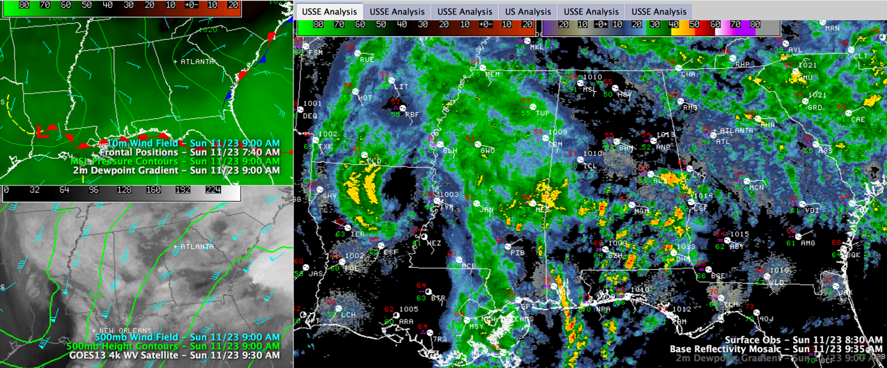
The upper level disturbance responsible for the active weather is west of Vicksburg MS this morning. You can clearly see it in the water vapor image in the lower left corner of the graphic. Click the graphic to enlarge it. I have shown the winds at 18,000 feet on that smaller panel as well. They are screaming at 70-90 knots over southern Mississippi and southern Louisiana.
The top left panel shows the surface low over western Louisiana with a warm front stretched along the Gulf Coast. It is onshore in South Alabama now, a little further north than the graphic indicates. It will continue to push north all day. The low will track northeast along with the upper level disturbance.
Showers and storms were continuing over southern Mississippi and were breaking out over South Alabama. These storms will spread north through the day. They will have lots of heavy rain and lightning and gusty winds. A few of them could become severe with damaging winds the main threat.
Here is the radar at 9:45. You can see lots of lightning already with these storms that are ahead of the warm front.
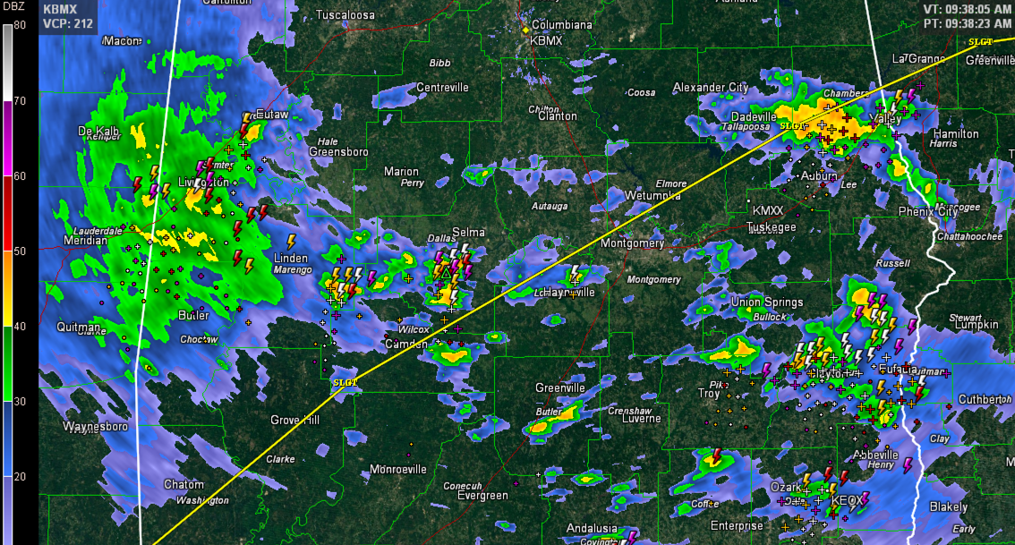
There is a small chance of a tornado south of a line from Jackson AL to Camden to Wetumpka to Lafayette. This line is the northward extent of the SPC Day One Severe Weather Outlook “slight” risk area, their standard severe weather forecast category. The best chance of a tornado is further southeast over Southeast Alabama, southwestern Georgia and the Florida Panhandle. Dothan is in this “enhanced” risk category, which is between slight and moderate in the SPC nomenclature.
Further north, for places like Demopolis, Tuscaloosa, Jasper, Birmingham, Clanton, Cullman, Talladega, Anniston and Gadsden, the storms will be loud with lots of lightning and thunder, heavy rain and gusty winds and there is chance a few of them could become severe with damaging winds being the main threat, but that chance is small. Can’t rule out a rogue tornado warning during the day in these areas though since helicity values showing low level spin in the atmosphere will be high by early afternoon across much of Central Alabama. But the storms don’t look like they will have much to work with in the way of instability, which makes severe weather way less likely.
We will track the warm front all day to see it’s progress. Storms along the warm front and any that develop behind it will have the best chances to become severe.
PAY ATTENTION TO THE WEATHER TODAY: Have a reliable source for receiving warnings, like a Weatheradio or Smartphone app like MyWARN. Review your personal severe weather safety rules. There is a link at the top of the blog to a compendium of safety rules. Know where you will go quickly in case a severe thunderstorm or tornado warning is issued.
We will have frequent updates throughout the day on the blog.
Category: Alabama's Weather, Severe Weather
About the Author (Author Profile)
Bill Murray is the President of The Weather Factory. He is the site's official weather historian and a weekend forecaster. He also anchors the site's severe weather coverage. Bill Murray is the proud holder of National Weather Association Digital Seal #0001 @wxhistorianSubscribe
If you enjoyed this article, subscribe to receive more just like it.


