

Storms Lifting into Birmingham Metro
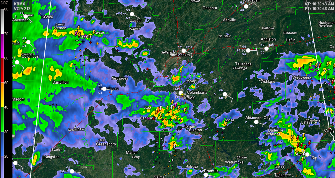
Thunderstorms over Bibb and western Chilton County are lifting north northeastward toward the Birmingham Metro at this hour. They will affect Shelby County between 10:40 – 11 a.m. and then move across Jefferson County between 11 – 11:45 a.m.
These storms are elevated, meaning their instability source is above the surface. That makes it hard for these storms to produce severe weather. But they will produce loud booming thunder that will shake the windows and very heavy rain as well as gusty winds.
Other storms are over Fayette County and over East Alabama over parts of Randolph, Tallapoosa, Lee and Chambers Counties.
There is a tremendous amount of wind shear over the area, but no surface based instability. The warm front, marking the edge of that instability is pushing northward through South Alabama It is north of Evergreen now, as evidenced by the 71F degree dewpoint there.
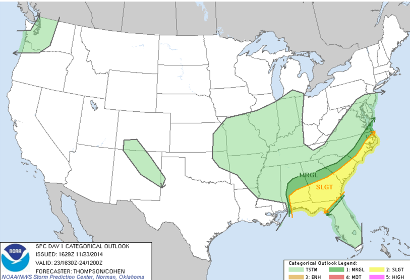
The new SPC Day One Outlook is out. It is basically unchanged with the slight risk in Alabama trimmed down slightly on its northern and western borders.
Category: Alabama's Weather, Severe Weather
About the Author (Author Profile)
Bill Murray is the President of The Weather Factory. He is the site's official weather historian and a weekend forecaster. He also anchors the site's severe weather coverage. Bill Murray is the proud holder of National Weather Association Digital Seal #0001 @wxhistorianSubscribe
If you enjoyed this article, subscribe to receive more just like it.


