

Severe Weather Potential Tuesday
This is a preliminary look at the severe weather potential across Alabama Tuesday, December 23. With so many people traveling that day, we all need to pay attention to the situation, although this early in the game there are more questions than answers.
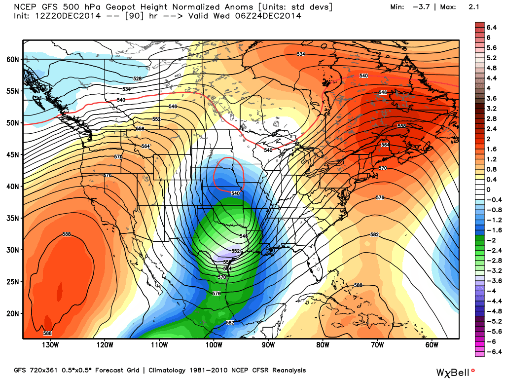
LARGE SCALE SETUP: A vigorous, 500 mb upper trough will form west of Alabama early in the week, providing excellent support for showers and thunderstorms Tuesday.
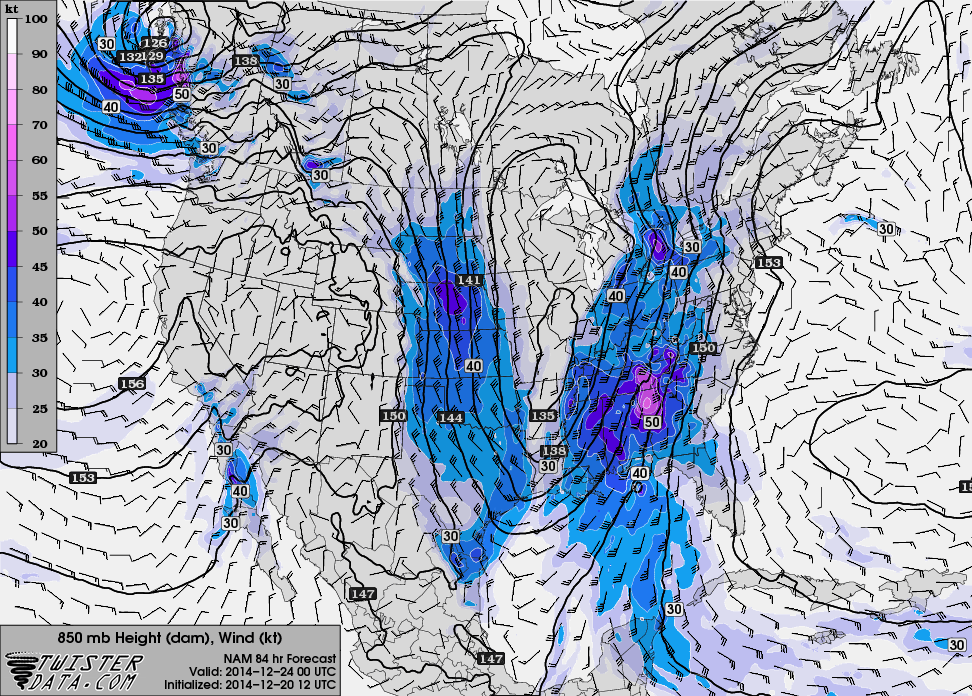
A low level jet (about 5,000 feet off the ground) will develop, in the 40-50 knot range, by Tuesday afternoon.
So, the dynamic setup is impressive, but as always in the cold season, the big question is the instability, or the ability of air parcels to freely rise and become buoyant. A narrow tongue of higher instability will form ahead of a rapidly deepening surface low across Alabama Tuesday evening…
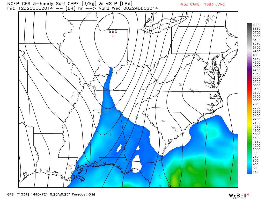
It doesn’t take much CAPE (convective available potential energy) for severe weather issues in December, and even with CAPE values of 500 j/kg we will need to watch the situation closely. The 12Z GFS model is printing a high of 71 degrees for Birmingham Tuesday, with potential for dewpoints to rise into the 60 degree range.
TIMING: The highest risk for severe weather across Alabama will come, most likely, during the afternoon and evening hours Tuesday, when the air is most unstable. I would say now the prime window is from 12:00 noon to 12:00 midnight. But, understand this could easily change for an event three days away.
PLACEMENT: The SPC Day Four convective outlook suggests the primary risk of severe weather will come over Southwest Alabama…
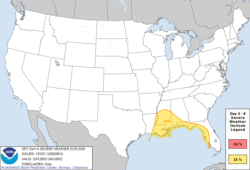
However, based on the forecast parameters, I would say most of the state will have some risk of severe storms, especially along and south of U.S. 278 (Hamilton to Cullman to Gadsden). I expect the SPC outlook to expand northward and eastward in future updates.
MODES OF SEVERE WEATHER: This is what has happened with similar surface and upper air conditions, using the top 15 analogs (from CIPS analog guidance)…
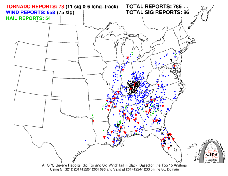
You can clearly see that all modes of severe weather will be possible with a setup like this, including a few tornadoes. Remember, this graphic is showing total severe weather output from 15 events, so it won’t be this active Tuesday… just a way of looking at what has happened in the past with a similar setup.
IMPORTANT: While the overall synoptic scale looks favorable for some severe weather Tuesday, we really won’t see how the mesoscale features will play out until tomorrow night and Monday. So, determining the overall threat level this far out is very difficult to do. Don’t let the social media kings of hype bother you, this doesn’t look like some “historic” event with “millions in the path”… just a situation that we have fairly often this time of the year. This is still the core of the late fall/early winter severe weather season in Alabama. Not unusual at all.
We will post frequent updates here as we get closer to the event.
CHRISTMAS EVE: The social media hype guys will also probably push a chance of snow on Wednesday under a very cold upper trough moving over the state.

Could there be a few a few flurries over extreme North Alabama Wednesday? Yes, but the deeper moisture will be long gone, and temperatures will be well above freezing. The bigger issues will be north of here with a very deep surface low just north of the Great Lakes…
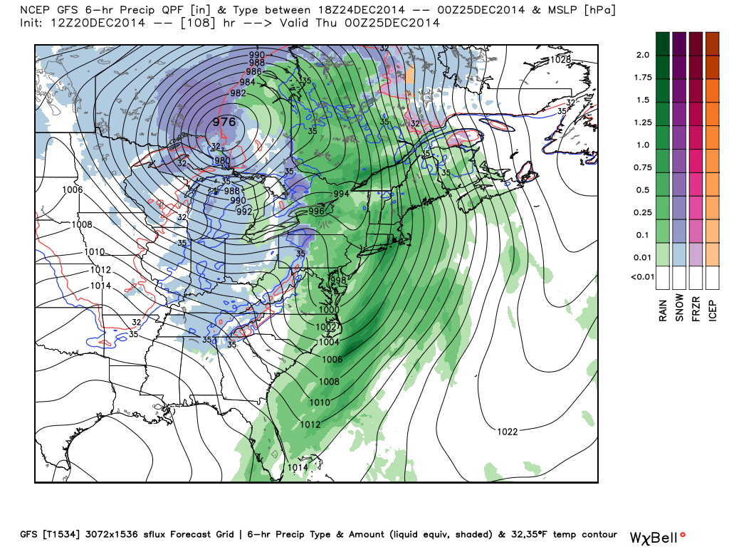
This will bring lots of wind and snow to the Great Lakes region Wednesday, and lots of rain for the eastern seaboard.
CHRISTMAS DAY: Looks like beautiful day for Alabama, with a sunny sky and a high in the 50s.
Again, stay tuned to the blog and we will keep you advised. If you are traveling, stay safe!
Category: Alabama's Weather
About the Author (Author Profile)
James Spann is one of the most recognized and trusted television meteorologists in the industry. He holds the AMS CCM designation and television seals from the AMS and NWA. He is a past winner of the Broadcast Meteorologist of the Year from both professional organizations.Subscribe
If you enjoyed this article, subscribe to receive more just like it.


