

Tuesday’s Severe Weather Threat
Brian will be along shortly with a new Weather Xtreme video and a forecast discussion. These notes concern the potential for severe weather in Alabama Tuesday. With so many people traveling this time of the year, there is great interest in the expected weather.
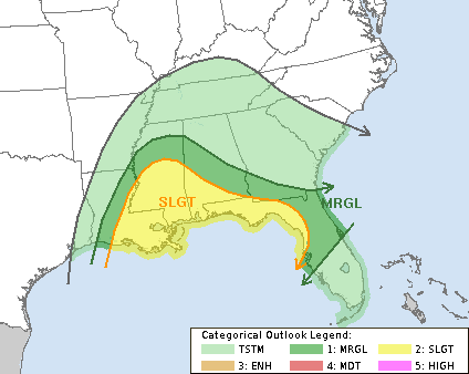
SPC OUTLOOK: On the day three convective outlook from the Storm Prediction Center, which covers the period from 6:00 a.m. Tuesday through 6:00 a.m. Wednesday, they have the standard “slight risk” of severe weather identified along and south of a line from Livingston to Greenville to Geneva. A “marginal risk” extends northward to a line from Hamilton to Birmingham to Auburn…
Let’s first point out this is nothing unusual; we are in the core of the late fall/early winter tornado season in Alabama. Having thunderstorms at Christmas time has always been common here.
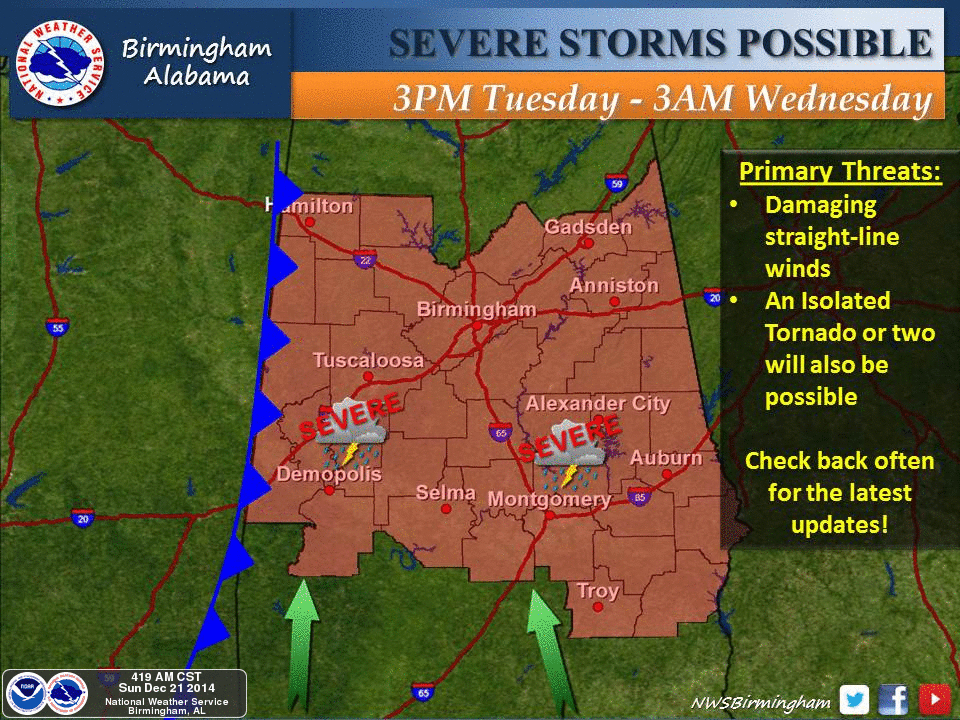
TIMING: The core severe weather threat will come from about 3:00 p.m. Tuesday through 3:00 a.m. Wednesday.
Understand showers and storms are possible Tuesday morning as well, but those storms should remain below severe limits.
HIGH SHEAR, LOW CAPE: Another thing common with cold season severe weather threats in Alabama is this kind of setup; strong shear in the atmosphere, but marginal instability. CAPE stands for Convective Available Potential Energy, and is a measure of instability. Low level (0-1 km) storm relative helicity values are impressive…

But it remains to be seen if sufficient instability can develop over the northern half of Alabama. Thunderstorms near the Gulf Coast could cut off the inflow of deep moisture into our part of the state, and clouds and morning showers could also limit the instability. Because of this the SPC guys have kept the core severe weather risk over the southern part of the state.
But, model data hints Birmingham could approach 70 degrees Tuesday afternoon, with dewpoints rising to near 60, which will help to create low level instability.
Keep an eye on blog updates for potential changes.
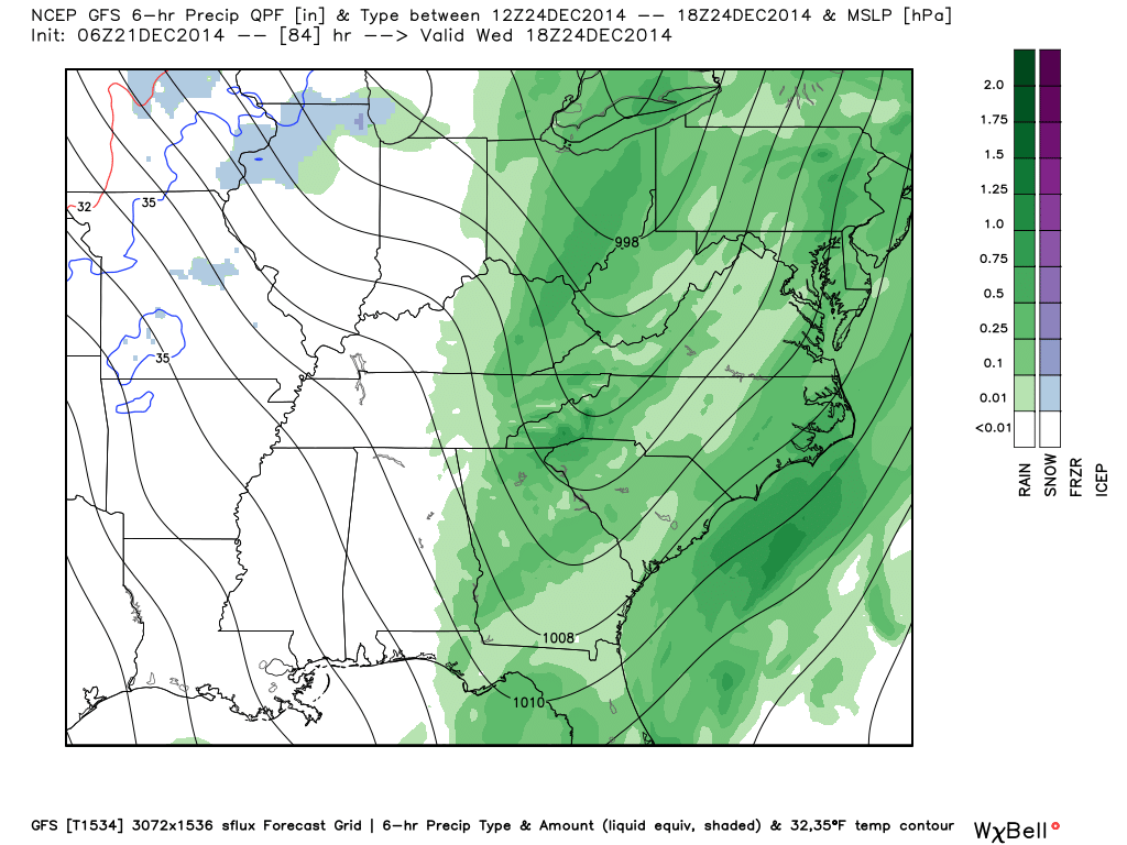
CHRISTMAS EVE: Rain will push out of the state Wednesday morning… the map below is valid at 12:00 noon CT Wednesday (from the new high resolution parallel GFS model)…
Wednesday will be mostly cloudy, windy, and colder with temperatures falling through the 50s. There might be a snow flake or two over the far northern part of the state under the cold core upper trough passing overhead, but it won’t amount to anything with surface temperatures far above freezing, and the deeper moisture long gone. And, the latest model data suggests no risk of flurries over far North Alabama… just too warm.
CHRISTMAS DAY: Looks very nice with ample sunshine and a high in the 50s.
ONE MORE THING: We live in a world of weather hype thanks to national news media and the clickbait guys using outrageous headlines on social media. This is not a “monster storm”, “unprecedented”, with “millions in the path” that “stuck without warning”. And, Alabama will not have a White Christmas with big Christmas Eve snow storm. Seems like we spend most of our time these days putting down the insanity that is floating around.
On our blog, we are not always right, but we use sound science, level heads, and do our best to simply communicate the truth.
Stay tuned for updates later today….
Category: Alabama's Weather
About the Author (Author Profile)
James Spann is one of the most recognized and trusted television meteorologists in the industry. He holds the AMS CCM designation and television seals from the AMS and NWA. He is a past winner of the Broadcast Meteorologist of the Year from both professional organizations.Subscribe
If you enjoyed this article, subscribe to receive more just like it.


