

Active Day Ahead
Parts of Central, West and Southwest Alabama are under the standard “slight risk” of severe weather today and tonight, with a lower end “marginal risk” farther north and east…
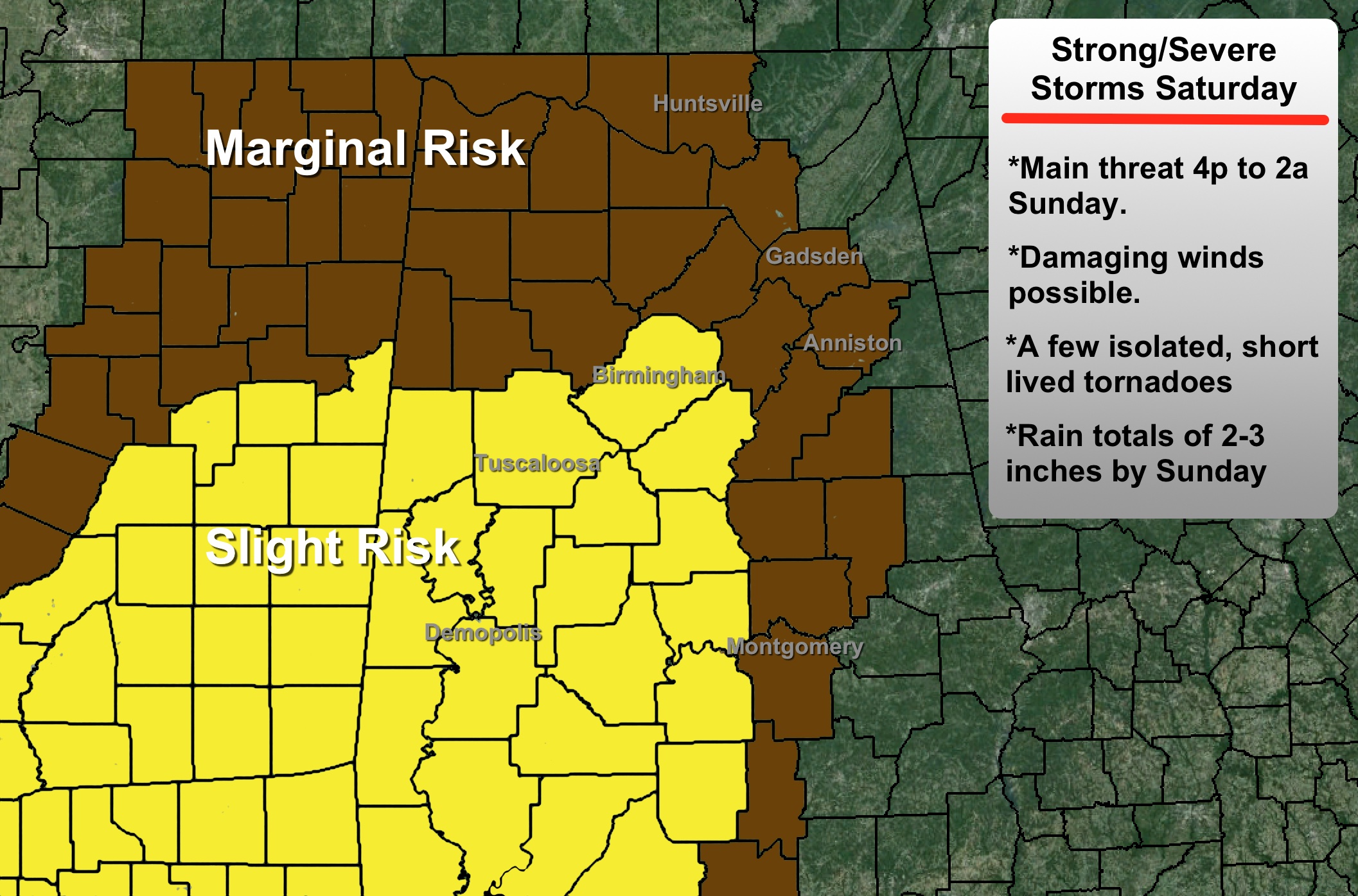
A dynamic storm system will bring a push of warm, moist air up into Alabama today, and we expect a high close to 70 degrees this afternoon. While a few passing showers are possible during the morning and early afternoon hours, the most active weather comes after 4:00 p.m….
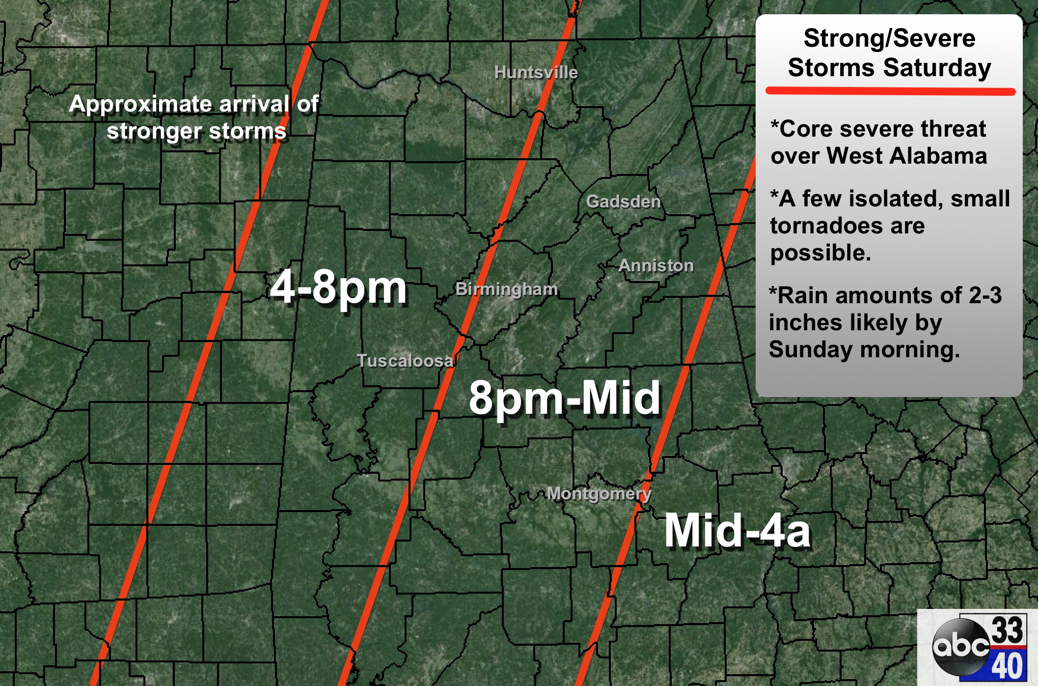
Storms will be capable of producing strong, perhaps damaging winds, some small hail, and maybe even an isolated short lived tornado or two.
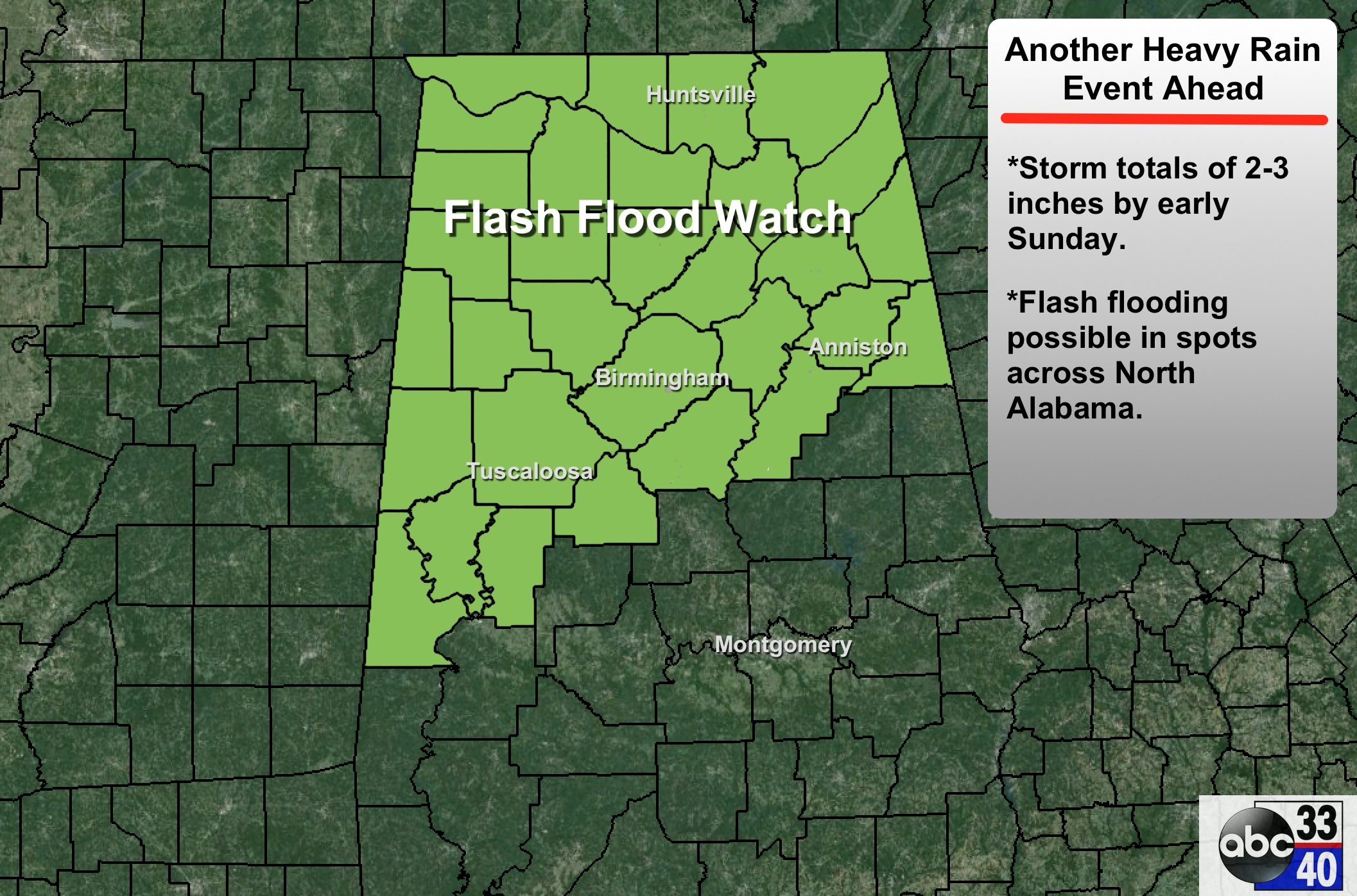
Additional rain amounts of 2 inches are expected, and some localized flooding issues are certainly possible. A flash flood watch has been issued for parts of North Alabama…
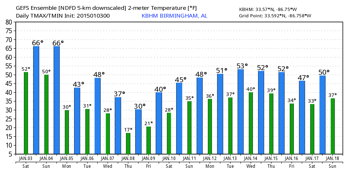
ARCTIC BLAST: One quick note about next week… new guidance is suggesting much of North Alabama will stay below freezing all day Thursday of the coming week as Arctic air rolls into Alabama. Thankfully, it doesn’t look like it will stay for a long period of time, and we do not expect any wintry precipitation issues. The low early Thursday will be in the teens.
Brian will be along in a bit with a new meteorological discussion… and we will have frequent updates on the situation throughout the day.
Category: Alabama's Weather
About the Author (Author Profile)
James Spann is one of the most recognized and trusted television meteorologists in the industry. He holds the AMS CCM designation and television seals from the AMS and NWA. He is a past winner of the Broadcast Meteorologist of the Year from both professional organizations.Subscribe
If you enjoyed this article, subscribe to receive more just like it.


