

Storms Weaken Somewhat, But Still Packing a Punch
Our line of storms has weakened a bit, as expected, as he are losing the heating of the day.
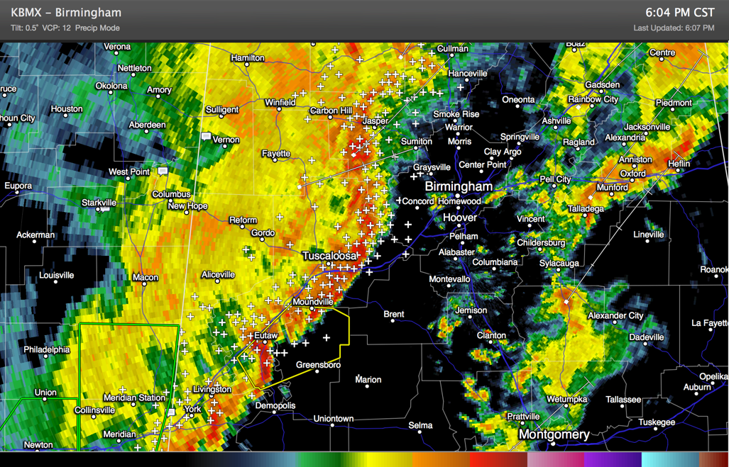
It not extends along I-65 south from Dodge City to Birmingham, then curving down I-59/20 to near Lake View. It then extends on south of the interstate to near Greensboro and Demopolis.
The storms are still packing a punch with gusty winds and torrential rains as well as intense lightning. Be in a safe place as they approach. Try to avoid driving during the peak of the storms.
There is still a chance that the storms could flare up and become severe, especially the further south you go.
A tornado watch continues until 8 p.m. for areas ahead of the storms. We will be monitoring whether the watch will be extended or not.
Category: Alabama's Weather, Severe Weather
About the Author (Author Profile)
Bill Murray is the President of The Weather Factory. He is the site's official weather historian and a weekend forecaster. He also anchors the site's severe weather coverage. Bill Murray is the proud holder of National Weather Association Digital Seal #0001 @wxhistorianSubscribe
If you enjoyed this article, subscribe to receive more just like it.


