

The Big Chill Arrives Today
An all new edition of the ABC 33/40 Weather Xtreme video is available in the player on the right sidebar of the blog. You can subscribe to the Weather Xtreme video on iTunes by clicking here.
INTO THE DEEP FREEZE: Strong north winds will develop across Alabama later today; averaging 15-30 mph, with gusts to 35 mph by mid afternoon. This is the result of a tight pressure gradient across the state, with a very cold 1059 mb high to the northwest over the Great Plains. Temperatures will hold in the 30s, and the wind chill index will approach zero this evening as far south as Birmingham.
TO THE NORTH: We note a few snow flurries on radar this morning over Tennessee…
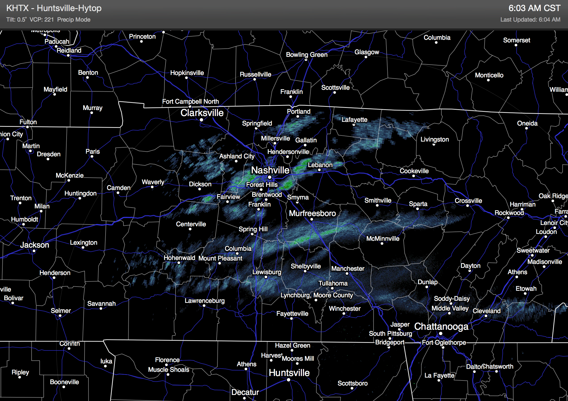
Could there be a few snow flurries over North Alabama later today? Yes. Will they amount to anything? No. The air is very dry across Alabama, and most of you won’t see a flake; better chance of flurries will be over Northeast Alabama. The cold air is the big deal, not snow flurries.
HARD FREEZE TOMORROW MORNING: We are still projecting lows between 10 and 15 degrees for North/Central Alabama tomorrow morning, with single digit lows for many places north of Birmingham.
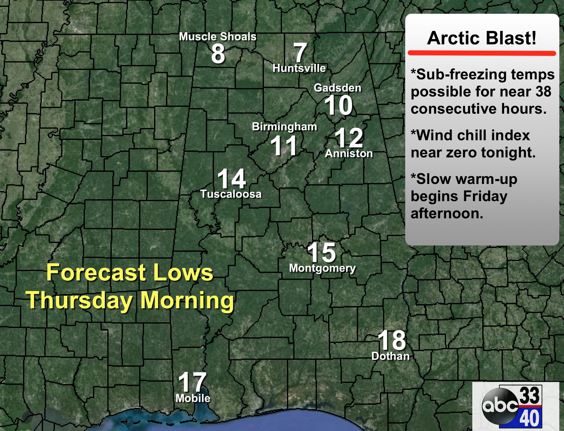
We stay below freezing all day tomorrow, but at least the wind will be much lighter, and the sky will be sunny. The low early Friday will be in the upper teens. In all, places like Birmingham, Tuscaloosa, Anniston, and Gadsden can expect about 38 consecutive hours of sub-freezing weather (tonight through Friday morning). To the north, Huntsville and Muscle Shoals will be below freezing for 54-60 consecutive hours (now through Friday morning).
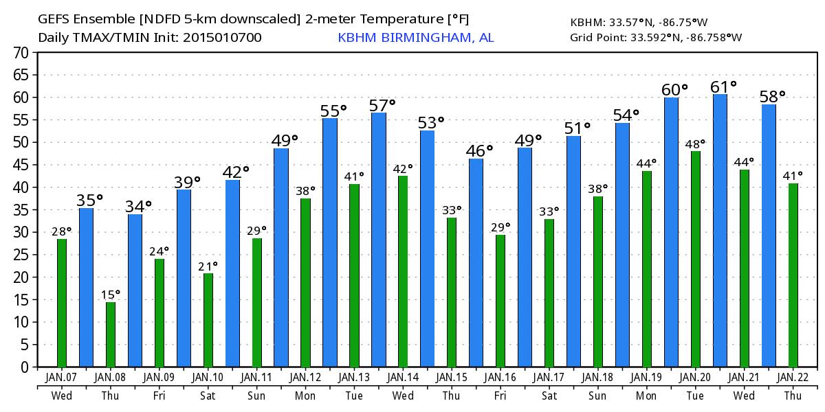
FRIDAY AND THE WEEKEND: Friday will be dry with a partly sunny and a high at or just over 40 degrees. Saturday will be cold and dry; the low early in the day will be in the upper teens, followed by a high Saturday afternoon in the low 40s.
Models continue to trend drier for Sunday, and it looks like most of the day will be dry for Alabama. We will just mention the chance of a little scattered light rain Sunday afternoon; the high Sunday will be pretty close to 50 degrees. The idea of light freezing rain early Sunday morning for Northwest Alabama is pretty much off the table at this point.
Expect a better chance of rain at times on Monday, but it doesn’t look especially heavy. Then, the weather for Tuesday and Wednesday (Jan 13-14) looks rain-free with highs in the 50s, and lows in the 30s, right at seasonal averages. See the Weather Xtreme video for maps, graphics, and more details.
WEATHER BRAINS: Don’t forget you can listen to our weekly 90 minute netcast anytime on the web, or on iTunes. This is the show all about weather featuring many familiar voices, including our meteorologists here at ABC 33/40.
CONNECT: You can find me on all of the major social networks…
Facebook
Twitter
Google Plus
Instagram
Look for the next Weather Xtreme video here by 4:00 this afternoon… enjoy the day!
Category: Alabama's Weather
About the Author (Author Profile)
James Spann is one of the most recognized and trusted television meteorologists in the industry. He holds the AMS CCM designation and television seals from the AMS and NWA. He is a past winner of the Broadcast Meteorologist of the Year from both professional organizations.Subscribe
If you enjoyed this article, subscribe to receive more just like it.


