

Here Comes The Rain
An all new edition of the ABC 33/40 Weather Xtreme video is available in the player on the right sidebar of the blog. You can subscribe to the Weather Xtreme video on iTunes by clicking here.
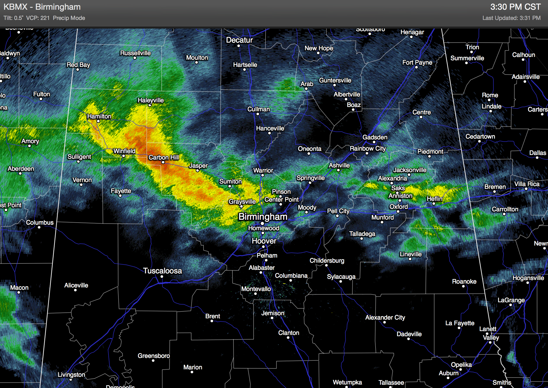
RADAR CHECK: Rain is increasing over West Alabama this afternoon; even a few reports of sleet mixed in with the rain over Northeast Alabama. The sleet goes away soon, and the rain should be widespread across the state tonight and tomorrow as a surface low moves across the northern Gulf of Mexico, with good upper support. Not much change in the forecast thinking; rain totals of around one inch for places like Birmingham, Tuscaloosa, Anniston, and Gadsden, with potential for two inches along the Gulf Coast at Mobile and Pensacola. No thunder, no flooding… just rain. It will be a cold rain with temperatures in the 40s all day tomorrow.
SNOW FLAKES LATE TOMORROW NIGHT/EARLY SATURDAY? As the surface low moves northeast, there is a decent chance the rain will taper off to light snow over North Alabama before ending. The best chance of light snow is between 2:00 and 7:00 a.m. Saturday, and mostly north of a line from Vernon to Jasper to Oneonta to Gadsden. This will be a low impact situation, with surface temperatures generally above freezing, and roads just wet.
The possible exception is over far North Alabama, where temperatures could slip into the low 30s around daybreak Saturday. A touch of bridge icing is possible in places like Muscle Shoals, Athens, Huntsville, and Scottsboro, and maybe even a small amount of accumulation could be found there in grassy areas.But again, this is a low impact event.
THE ALABAMA WEEKEND: The sky becomes partly sunny Saturday afternoon as drier air works into the state; the day will be cool with a high between 47 and 50 degrees. Then, Sunday looks pretty nice with ample sunshine and a high in the upper 50s.
NEXT WEEK: The Alberta Clipper will pass northeast of Alabama, and we have dropped any mention of light rain on Monday. We stay dry with a mix of sun and clouds; in fact much of the week looks cool and dry with highs mostly in the 50s, and lows mostly in the 30s. See the Weather Xtreme video for maps, graphics, and more long range details.
WEATHER BRAINS: Don’t forget you can listen to our weekly 90 minute netcast anytime on the web, or on iTunes. This is the show all about weather featuring many familiar voices, including our meteorologists here at ABC 33/40.
CONNECT: You can find me on all of the major social networks…
Facebook
Twitter
Google Plus
Instagram
I had a great time today visiting with the kids at Snow Rogers Elementary School near Gardendale… be looking for them on the Pepsi KIDCAM on ABC 33/40 News at 5:00! The next Weather Xtreme video will be posted here by 7:00 a.m. tomorrow…
Category: Alabama's Weather
About the Author (Author Profile)
James Spann is one of the most recognized and trusted television meteorologists in the industry. He holds the AMS CCM designation and television seals from the AMS and NWA. He is a past winner of the Broadcast Meteorologist of the Year from both professional organizations.Subscribe
If you enjoyed this article, subscribe to receive more just like it.


