

Some Snow Late Tonight; A Brighter Weekend
An all new edition of the ABC 33/40 Weather Xtreme video is available in the player on the right sidebar of the blog. You can subscribe to the Weather Xtreme video on iTunes by clicking here.
GLOOMY, COLD, WET: Low clouds, fog, and drizzle can be found across most of North and Central Alabama this afternoon; temperatures are holding in the 40s. The bulk of the heavier rain has moved east of the state, for now, into Georgia.
SNOW FLAKES? As the surface low moves northeast tonight, and a deep upper trough moves overhead, light rain will change to light snow over North Alabama after midnight. The morning data set suggests no need to change our forecast thinking; it will generally be a low impact event.
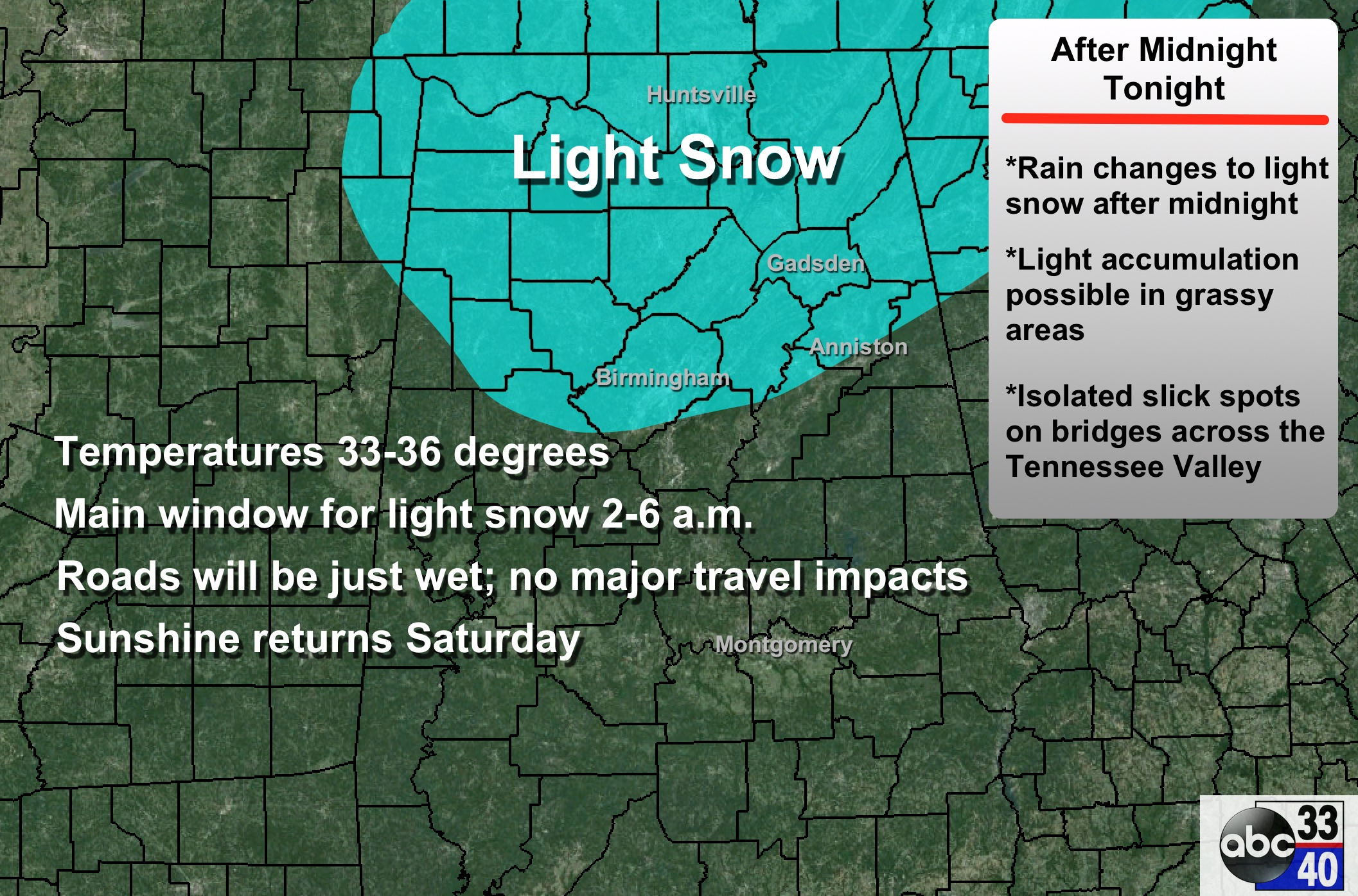
A little accumulation is possible on grassy areas overnight, mainly north of U.S. 278 (north of a line from Hamilton to Cullman to Gadsden), and no travel impacts are expected other than the chance of a few slick spots on bridges over far North Alabama. Most of this happens between 2 and 6 a.m., so most of you will simply sleep through it.
IMPROVING WEEKEND WEATHER: The sky will become mostly sunny tomorrow as dry air works into the state; the high will be close to 50 degrees. Sunday looks very nice, with ample sunshine and a high in the upper 50s.
NEXT WEEK: An Alberta Clipper will pass northeast of Alabama Monday. I guess a raindrop or snow flake is possible over the northeast corner of Alabama (DeKalb/Jackson Counties), but most of the state will be dry with a high between 47 and 50. Then, the rest of the week looks cool and dry, with highs mostly in the 50s and lows mostly in the 30s.
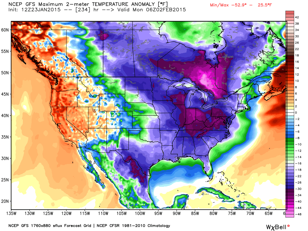
ARCTIC BLAST AS FEBRUARY BEGINS? We are seeing increasing evidence of a shot of very cold air down into the eastern half of the U.S. in about 8-9 days. The Arctic Oscillation (AO) and North Atlantic Oscillation (NAO) both go negative, and a deep upper trough is forecast to form over the eastern part of North America. This could set up a cross polar flow, and it could be very cold around here in the Feb 1-3 time frame. Too early to be specific, but confidence is increasing in this possibility.
See the Weather Xtreme video for maps, graphics, and more details.
WEATHER BRAINS: Don’t forget you can listen to our weekly 90 minute netcast anytime on the web, or on iTunes. This is the show all about weather featuring many familiar voices, including our meteorologists here at ABC 33/40.
CONNECT: You can find me on all of the major social networks…
Facebook
Twitter
Google Plus
Instagram
I had a great time today visiting with the kids at Stemley Road Elementary School in Talladega County… be looking for them on the Pepsi KIDCAM today at 5:00 on ABC 33/40 News! My next Weather Xtreme video will be posted here Monday morning by 7:00 a.m…. Brian Peters will have the video updates tomorrow and Sunday. Enjoy the weekend!
Category: Alabama's Weather
About the Author (Author Profile)
James Spann is one of the most recognized and trusted television meteorologists in the industry. He holds the AMS CCM designation and television seals from the AMS and NWA. He is a past winner of the Broadcast Meteorologist of the Year from both professional organizations.Subscribe
If you enjoyed this article, subscribe to receive more just like it.


