

Severe Thunderstorm Warning for Jefferson/Tuscaloosa Counties

A line of strong thunderstorms moving across Central Alabama is producing strong wind gusts that have caused damage. There are reports of trees down and power outages along the line.
Trees have been reported down in Brookwood and Duncanville.
Winds gusted to 59 mph at the Tuscaloosa Airport.
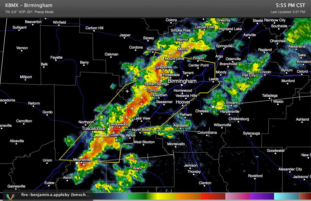
The storms are tapping strong winds aloft and a very cold airmass to produce the strong winds.
THE NATIONAL WEATHER SERVICE IN BIRMINGHAM HAS ISSUED A
* SEVERE THUNDERSTORM WARNING FOR…
JEFFERSON COUNTY IN ALABAMA…
EASTERN TUSCALOOSA COUNTY IN WEST CENTRAL ALABAMA…
* UNTIL 630 PM CST
* AT 548 PM CST…THE NATIONAL WEATHER SERVICE INDICATED A LINE OF
SEVERE THUNDERSTORMS CAPABLE OF PRODUCING DAMAGING WINDS IN EXCESS
OF 60 MPH. THESE STORMS WERE LOCATED ALONG A LINE EXTENDING FROM 6
MILES NORTHWEST OF SYLVAN SPRINGS TO MCFARLAND MALL…AND MOVING
EAST AT 45 MPH.
* LOCATIONS IMPACTED INCLUDE…
HUEYTOWN…FAIRFIELD…FULTONDALE…GARDENDALE…BESSEMER…
BIRMINGHAM…HOMEWOOD AND VESTAVIA HILLS.
THIS INCLUDES…
INTERSTATE 65 EXIT NUMBERS 250 THROUGH 272…
INTERSTATE 459 EXIT NUMBERS 1 THROUGH 33…
US 78 EXIT NUMBERS 81 THROUGH 91…
INTERSTATE 20 EXIT NUMBERS 62 THROUGH 140…
INTERSTATE 59 EXIT NUMBERS 130 THROUGH 143…
Category: Alabama's Weather, Severe Weather
About the Author (Author Profile)
Subscribe
If you enjoyed this article, subscribe to receive more just like it.


