Sunny Mid-Winter Day
An all new edition of the ABC 33/40 Weather Xtreme video is available in the player on the right sidebar of the blog. You can subscribe to the Weather Xtreme video on iTunes by clicking here.
COLD START: Temperatures are in the 28-32 degree range across the great state of Alabama early this morning; with a dry airmass we expect a good supply of sunshine today with a high in the mid 50s this afternoon.
TOMORROW: Clouds return to the state tomorrow as a clipper passes well to the north; it will drag a cold front through here tomorrow night, and this could bring a few scattered showers to the northern counties during the afternoon and evening hours. Rain amounts will be light and spotty, and before the showers temperatures will rise up into the low 60s… it will be warmest day of the week.
FRIDAY/SATURDAY: Friday will be mostly sunny and cooler with a high in the low 50s; some places north of Birmingham could hold in the 40s through the afternoon. Then, on Saturday as the weekend begins, the weather stays dry, but clouds begin to increase during the afternoon hours ahead of an approaching storm system. The high Saturday will be in the mid 50s.
RAIN RETURNS SUNDAY: A deepening surface low, supported by an upper trough, will pass northwest of Alabama, setting the stage for widespread rain. Looks now like there will be enough dynamic forcing for some thunderstorms to be involved, although severe weather isn’t expected. Rain amounts of around one inch look likely through Sunday night.
NEXT WEEK: Much colder air blows into Alabama Monday, and there is the risk of a few snow flurries over the northern counties of the state during the morning hours, but with little or no impact. Look like we won’t get past the mid 40s Monday afternoon with a strong north wind to make it feel colder. And, significant freeze is likely by early Tuesday with a low down in the mid 20s.
Another weather system will bring more rain to the state by Wednesday and Thursday… see the Weather Xtreme video for maps, details, and graphics. Looks like temperatures will be generally below average for the first 7-10 days of February.
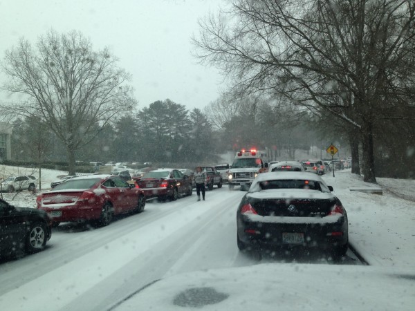
ONE YEAR AGO: Snow Jam, Snowmageddon, Snowpocalypse, whatever you want to call it. Two inches of snow (which we forecast to be a dusting) turned into a winter weather nightmare for much of North/Central Alabama, and Birmingham was especially hard hit.
Read my detailed review event here…. and a sincere apology for a bad forecast here.
Needless to say, I feel the pain my colleagues are experiencing this week in New York City and Boston.
WEATHER BRAINS: Don’t forget you can listen to our weekly 90 minute netcast anytime on the web, or on iTunes. This is the show all about weather featuring many familiar voices, including our meteorologists here at ABC 33/40.
CONNECT: You can find me on all of the major social networks…
Facebook
Twitter
Google Plus
Instagram
I have weather programs today at Gwin Elementary in Hoover, and the University of Alabama Center in Gadsden. Look for the next Weather Xtreme video here by 4:00 this afternoon…. enjoy the day!
Category: Alabama's Weather


