

Saturday Afternoon Update
Much of Central Alabama continues to see more sun than clouds, but looking at the latest visible satellite imagery, clouds are increasing to the west and making their way east. By late this evening, and especially overnight, the sky will become mostly cloudy across the state. Before then, we continue to see seasonal temps as many locations in and throughout Alabama are into the mid and upper 50s this afternoon. With the increasing clouds, we should see some very nice colors this evening as the sun sets.
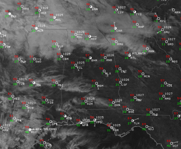
Not much showing up currently in Alabama. There are a few radar returns stretching from Cullman County up into the Tennessee Valley, moving northward. As we expand out across the Southeast, showers are developing in the Mississippi Valley and there is a larger expanse of rain across Texas and Oklahoma, and that is heading our way. Rain will begin across Alabama on Sunday by mid to late morning. Grab the rain gear heading out the door in the morning. The rain will continue through the afternoon and nighttime hours. Some thunder is possible in a few spots, but no severe weather. Most of us will see a soaking rain as rain amounts of 1/2 to 1 inch are likely. The rain will taper off late Sunday night.

Category: Alabama's Weather
About the Author (Author Profile)
Macon, Georgia Television Chief Meteorologist, Birmingham native, and long time Contributor on AlabamaWX. Stormchaser. I did not choose Weather, it chose Me. College Football Fanatic. @Ryan_StinnetSubscribe
If you enjoyed this article, subscribe to receive more just like it.


