

Showers End Early; Some Sun Later Today
An all new edition of the ABC 33/40 Weather Xtreme video is available in the player on the right sidebar of the blog. You can subscribe to the Weather Xtreme video on iTunes by clicking here.
RADAR CHECK: We have rain falling over parts of Central Alabama early this morning… mostly south and east of Birmingham.
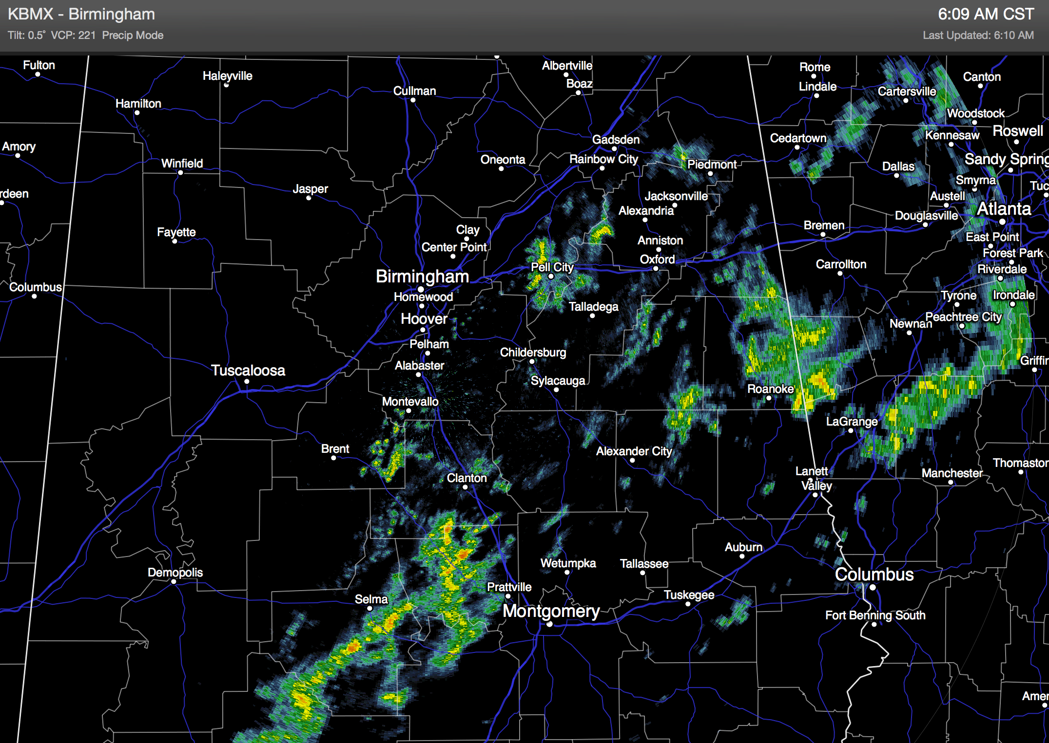
These rain showers will be into Georgia by mid-morning, and some parts of the state could see a little sunshine this afternoon as drier air enters the state. Temperatures won’t change much today; we will stay in the mid to upper 50s through the afternoon… some spots could reach the low 60s, not quite as mild as recent days.
TOMORROW/WEDNESDAY: Expect a good supply of sunshine on these two days; tomorrow will be cooler with a high in the low to mid 50s… then we rise into the low 60s Wednesday afternoon, which should be the nicest day of the week.
COLD FRONT ARRIVES THURSDAY: A cold front will blow through early Thursday morning, and the day will be windy and colder with a high in the mid 40s along with a chilly north wind. The wind dies down Thursday night, and we project a low between 18 and 23 degrees early Friday morning. Then, Friday will be cold and dry with a good supply of sunshine and a high in the mid 40s.
THE ALABAMA WEEKEND: Saturday will be another cold and dry day; we begin with a low in the 20s, and the high Saturday afternoon will be in the mid 40s. Then, an Arctic front will move through in dry fashion Saturday night, and Sunday will be even colder. The GFS is printing a low of 13 degrees for Birmingham at daybreak Sunday, followed by a high only in the upper 30s.
NEXT WEEK: Monday morning will feature another very significant freeze, then we warm into the low 50s Monday afternoon with a good supply of sunshine. The GFS hints that our next chance of rain will come on Tuesday… see the Weather Xtrme video for maps, graphics, and more details.
FIRST ALERT STORM TEAM TOUR: Our annual severe weather awareness tour across Alabama rolls along; we will be in Winfield tomorrow evening. Just drop by anytime from 4:00 until 6:30… you can watch me do weather live on ABC 33/40, get some free stuff to take home, and have a chance to win several NOAA Weather Radios we will be giving away. If you need your weather radio programmed or checked, bring it by and we will be glad to help.

WEATHER BRAINS: Don’t forget you can listen to our weekly 90 minute netcast anytime on the web, or on iTunes. This is the show all about weather featuring many familiar voices, including our meteorologists here at ABC 33/40. We will produce this week’s show tonight at 8:30 CT… you can watch it on “James Spann 24/7” on cable systems around the state, or on the web here.
CONNECT: You can find me on all of the major social networks…
Facebook
Twitter
Google Plus
Instagram
Busy day ahead with weather programs at Helena Middle School in Shelby County, and Rock Quarry Elementary in Tuscaloosa. Look for the next Weather Xtreme video here by 4:00 this afternoon… enjoy the day!
Category: Alabama's Weather
About the Author (Author Profile)
James Spann is one of the most recognized and trusted television meteorologists in the industry. He holds the AMS CCM designation and television seals from the AMS and NWA. He is a past winner of the Broadcast Meteorologist of the Year from both professional organizations.Subscribe
If you enjoyed this article, subscribe to receive more just like it.


