

Much Colder Tomorrow
An all new edition of the ABC 33/40 Weather Xtreme video is available in the player on the right sidebar of the blog. You can subscribe to the Weather Xtreme video on iTunes by clicking here.
WONDERFUL WINTER DAY: It has been a day of blue sky and sunshine across the great state of Alabama, and temperatures are in the 59-63 degree range at most places this afternoon. I hope you are enjoying it, because much colder air blows in here tomorrow.
WINDY/COLDER: The high tomorrow will be only in the low 40s despite a mostly sunny sky, and a brisk north wind of 15-25 mph will make it feel colder. The wind will calm down tomorrow night, and by early Friday we will be in the 17-21 degree range. Friday will be cold and dry with a good supply of sunshine and a high in the mid 40s.
THE ALABAMA WEEKEND: A one day warm-up is likely Saturday; with sunshine in full supply we will rise into the mid 50s by afternoon, but another dry Arctic front will pass through Saturday night, and Sunday will be one of the coldest days so far this winter. The latest GFS run (12Z) is printing a high of only 33 for Birmingham Sunday afternoon… many communities to the north won’t get out of the 20s. The wind chill index early Sunday morning will drop into the sub-zero range over Northeast Alabama, and will be close to zero at Birmingham. But at least the air will be dry and the day will be mostly sunny, despite the Arctic cold.
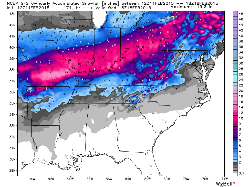
TRICKY FORECAST NEXT WEEK: As discussed here this morning, next week’s forecast is a challenge. Monday will be dry with a high in the upper 40s, and a wave in the southern branch of the jet stream will bring clouds in here Monday night. Confidence is high in a rain event Tuesday as a surface low passes just north of Alabama. Then, Tuesday night and early Wednesday, as colder air flows into the state, the rain could change to a “wintry mix” of sleet, freezing rain, or snow over the northern half of the state before it ends.
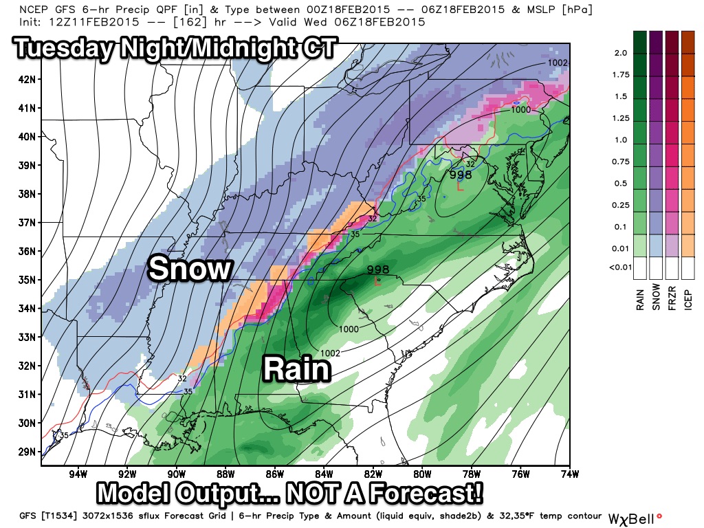
The idea of a second wave coming in during the day Wednesday is “off the table” for now… so at the moment it looks like the main risk of winter weather mischief for North Alabama will come Tuesday night into Wednesday morning. There is no skill in a specific impact forecast this far in advance, just something to watch. We could see nothing more than a few flurries, or there could be some light accumulation. For now, the highest risk of accumulation is north of Alabama…
Take some time to watch the Weather Xtreme video for the maps, graphics, and more details.
FIRST ALERT STORM TEAM TOUR: Our annual severe weather awareness tour across Alabama rolls along; we will be in Reform tomorrow evening. Just drop by anytime from 4:00 until 6:30… you can watch me do weather live on ABC 33/40, get some free stuff to take home, and have a chance to win several NOAA Weather Radios we will be giving away. If you need your weather radio programmed or checked, bring it by and we will be glad to help.
WEATHER BRAINS: Don’t forget you can listen to our weekly 90 minute netcast anytime on the web, or on iTunes. This is the show all about weather featuring many familiar voices, including our meteorologists here at ABC 33/40.
CONNECT: You can find me on all of the major social networks…
Facebook
Twitter
Google Plus
Instagram
I enjoyed seeing everyone today at the ALAGASCO service center in Pell City… look for the next Weather Xtreme video here by 7:00 a.m. tomorrow…
Category: Alabama's Weather
About the Author (Author Profile)
James Spann is one of the most recognized and trusted television meteorologists in the industry. He holds the AMS CCM designation and television seals from the AMS and NWA. He is a past winner of the Broadcast Meteorologist of the Year from both professional organizations.Subscribe
If you enjoyed this article, subscribe to receive more just like it.


