

Evening Forecast Notes
We really had a great time and a huge crowd this evening over at Reform in Pickens County… thanks to everyone for their hospitality!
Let’s look ahead to the potential wintry weather situation for Alabama early next week….
ICY MONDAY: Confidence is increasing in the idea of a “wintry mix” over North and Central Alabama Monday morning. The new 00Z NAM model just in suggests the onset of the precipitation will come between 4 and 6 a.m., when surface temperatures will be below freezing.
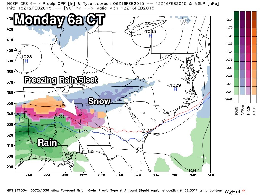
It is impossible at this early stage of the game to try and identify the precipitation type and their locations, but one way or another this sure looks like it will impact travel for at least the first half of the day Monday with potential for ice on bridges, and perhaps some secondary roads. Icy travel problems seem likely from about 4:00 a.m. through 12:00 p.m. Monday, and mainly north of a line from Livingston to Eutaw to Marion to Clanton to Alexander City.
The precipitation should change to mainly rain over Alabama Monday afternoon, continuing Monday night and into Tuesday morning, although the are hints that freezing or frozen precipitation could continue across the Tennessee Valley of far North Alabama.
Then, during the day Tuesday as a surface low moves northeast and more cold air drops into the state, the rain could change to freezing rain, sleet, or snow on the back side of the departing system.
This could lead to more icy travel problems Tuesday afternoon, Tuesday night, and possibly into Wednesday morning.
The GFS model hints of some snow accumulation over North/Central Alabama…
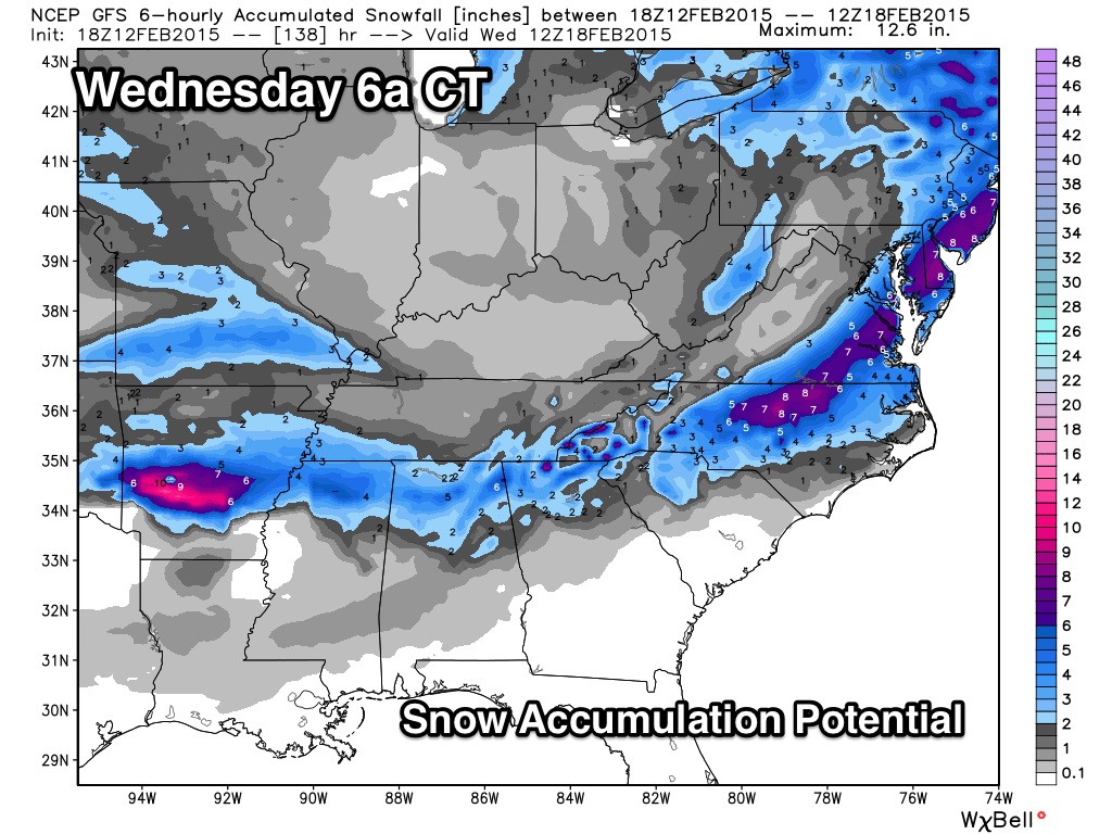
That is model output, NOT a forecast… just an idea for now.
BOTTOM LINE: We have potential for hazardous winter driving conditions Monday morning, and then again Tuesday, Tuesday night, and possibly into Wednesday. We have a limited skill set in dealing with winter storms in Alabama five days in advance, so understand this forecast will probably change. We are just giving you a heads up to potential issues….
I will have a new Weather Xtreme video posted here by 7:00 a.m. tomorrow.
Category: Alabama's Weather
About the Author (Author Profile)
James Spann is one of the most recognized and trusted television meteorologists in the industry. He holds the AMS CCM designation and television seals from the AMS and NWA. He is a past winner of the Broadcast Meteorologist of the Year from both professional organizations.Subscribe
If you enjoyed this article, subscribe to receive more just like it.


