

Sunday Night Notes
I will be on ABC 33/40 News tonight at 10:00… hope you can join us.
Not much change in the overall thinking for tomorrow (since this morning)…
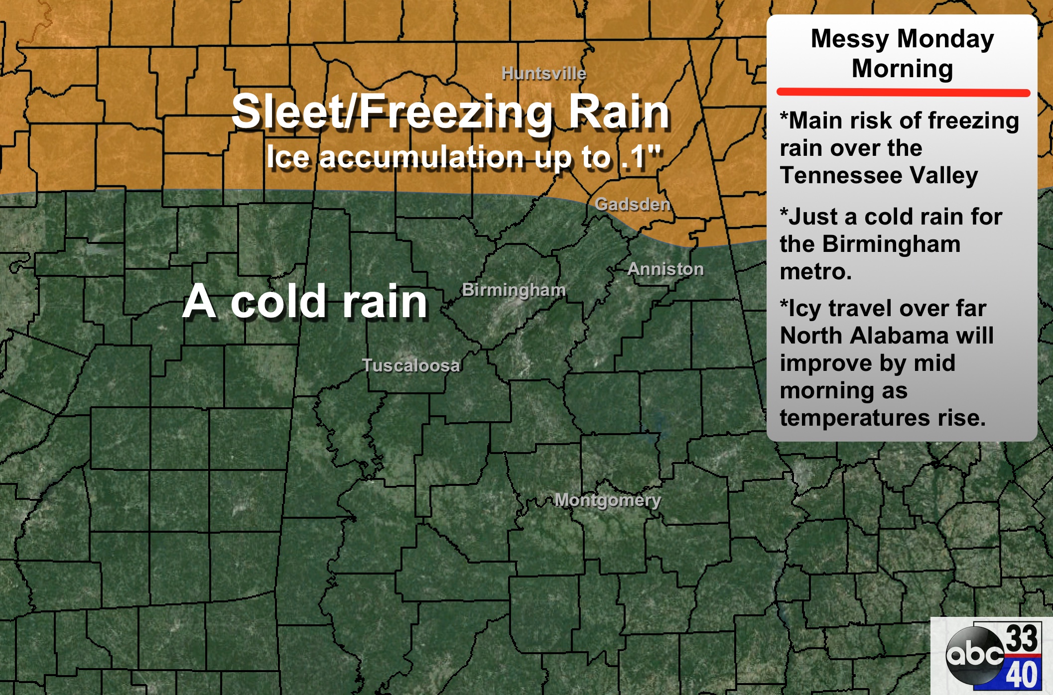
New guidance rolling still suggests the main threat of icy travel will be well to the north of Birmingham, mainly over the Tennessee Valley. We can’t rule out isolated freezing rain areas as far south as U.S. 278 (Hamilton to Cullman to Gadsden). Warm air advection will push us well above freezing by mid morning, and statewide we expect a soaking rain tomorrow afternoon.
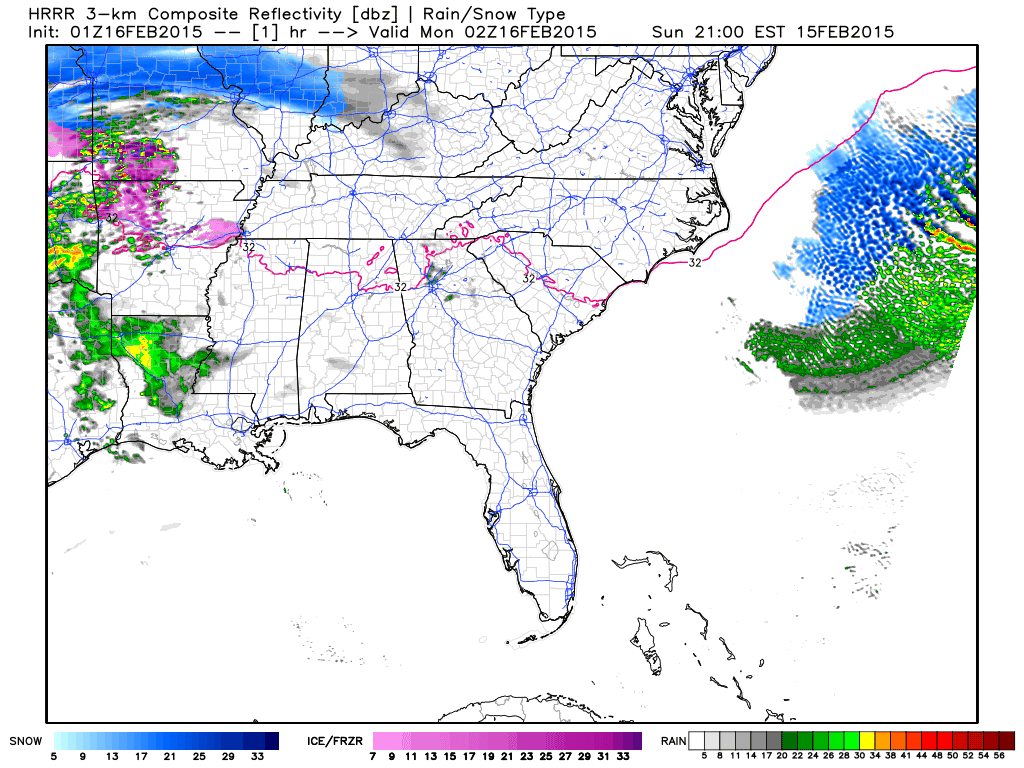
This 15 hour HRRR model loop tells the story nicely.
As the rain ends tomorrow night, there is a chance of some light snow or snow flurries in the colder air, but the chance of any precipitation looks low. A few icy patches are possible early Tuesday morning where there is standing water.
ARCTIC BLAST: One of the headlines for the week is the Arctic air blowing in here Wednesday and Thursday; the GFS is printing a low of 15 in Birmingham early Thursday, with a high of only 33. These two days look dry for now.
ALABAMA POWER IS READY, ARE YOU? Our friends at Alabama Power are monitoring the forecast closely, ready to deploy people and assets to quickly address any outages that might occur. Read a special message from Ike Piggot about their commitment to their customers.
I will have a new discussion and a Weather Xtreme video posted very early tomorrow morning…
Category: Alabama's Weather
About the Author (Author Profile)
James Spann is one of the most recognized and trusted television meteorologists in the industry. He holds the AMS CCM designation and television seals from the AMS and NWA. He is a past winner of the Broadcast Meteorologist of the Year from both professional organizations.Subscribe
If you enjoyed this article, subscribe to receive more just like it.


