

Concerning Tonight
This post is primarily concerned with the weather tonight across North and Central Alabama. First I should mention we have many reports of ice on exposed objects over counties like Blount and St. Clair…
This is ice accumulation in Springville… Photo from Steven Skinner…

The good news is that roads are just wet; we have heard of no ice on bridges or roads anywhere south of the Tennessee River in Alabama. Temperatures at most “official” observation stations are well above freezing.
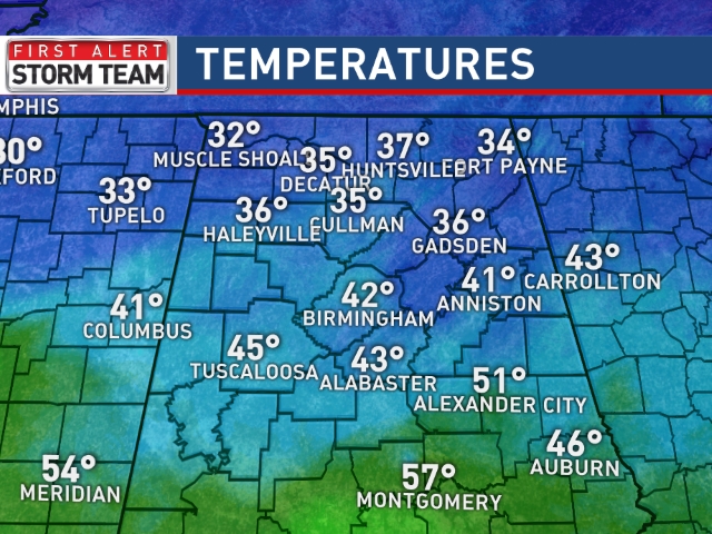
Some spots could reach 50 degrees this afternoon, but the colder pockets of Northeast Alabama will see a high closer to 40.
REST OF THE AFTERNOON: Rain continues; we might even hear some thunder this afternoon as a cold front moves through. Rain totals of around one inch are likely.
ICE ISSUES TONIGHT? That is what we will address here. Below is an animation of what we expect tonight via the high resolution HRRR model…
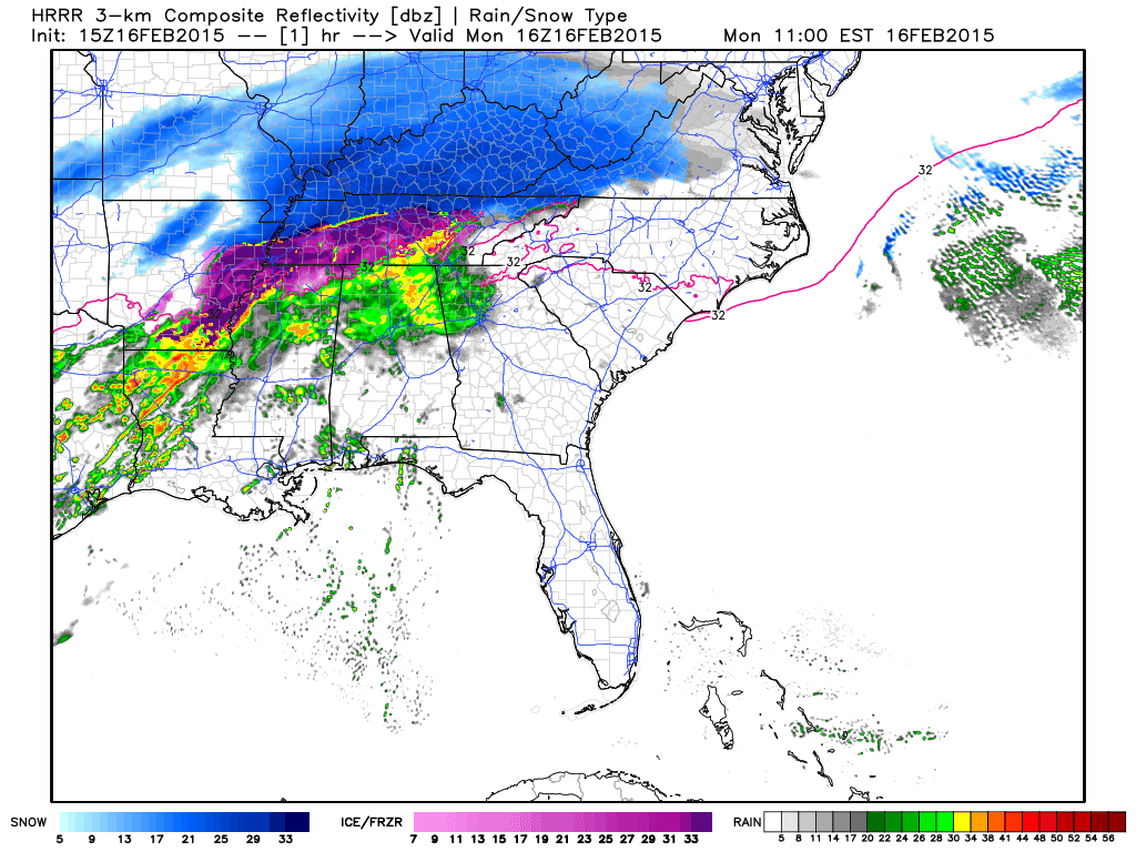
Note on the back end the potential for some freezing rain as temperatures drop below freezing.
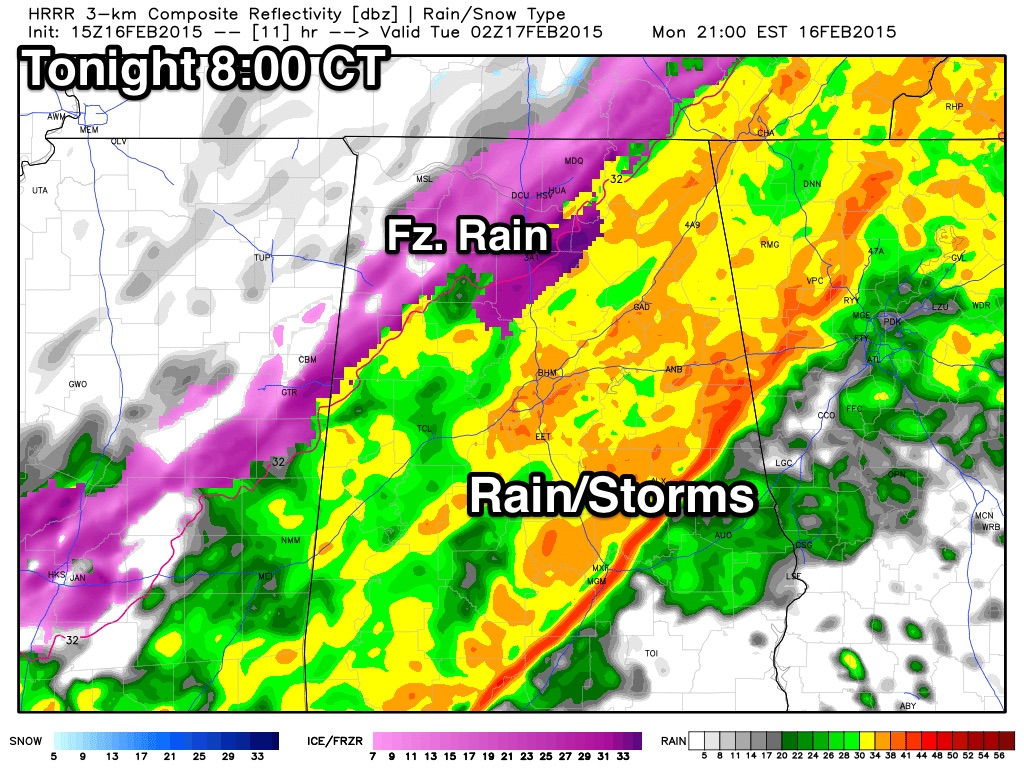
With temperatures falling below freezing, and the potential for a brief period of freezing rain and maybe even a few snow flakes, it certainly opens the door for some icy spots tonight (mainly on bridges). I am not convinced this will be a widespread issue, but if you are driving tonight or early tomorrow morning, just be aware of the potential of some “black ice” and icy patches on bridges.
TIMING: Temperatures should drop below freezing tonight between 9:00 and 12:00 midnight in most places, and that is when some ice could begin to show up on bridges, which will be the primary issue. While the precipitation will end quickly late tonight, lingering water from today’s rain, and any freezing rain that falls could lead to some travel impact through 8:00 a.m. tomorrow.
Will it be enough to bring school delays? I think it will vary greatly from county to county; areas north of Birmingham will be subject to the most impact since they are colder. Travel impact from the Birmingham metro south should be rather isolated and limited.
We should mention tomorrow looks dry with a high around 40.
More details on the afternoon discussion coming up a bit later this afternoon. Stay tuned…
ALABAMA POWER IS READY, ARE YOU? Our friends at Alabama Power are monitoring the forecast closely, ready to deploy people and assets to quickly address any outages that might occur. Read a special message from Ike Piggot about their commitment to their customers.
Category: Alabama's Weather
About the Author (Author Profile)
James Spann is one of the most recognized and trusted television meteorologists in the industry. He holds the AMS CCM designation and television seals from the AMS and NWA. He is a past winner of the Broadcast Meteorologist of the Year from both professional organizations.Subscribe
If you enjoyed this article, subscribe to receive more just like it.


