

North Alabama Notes
Snow showers across North Alabama are leaving light accumulations and slippery roads in spots.
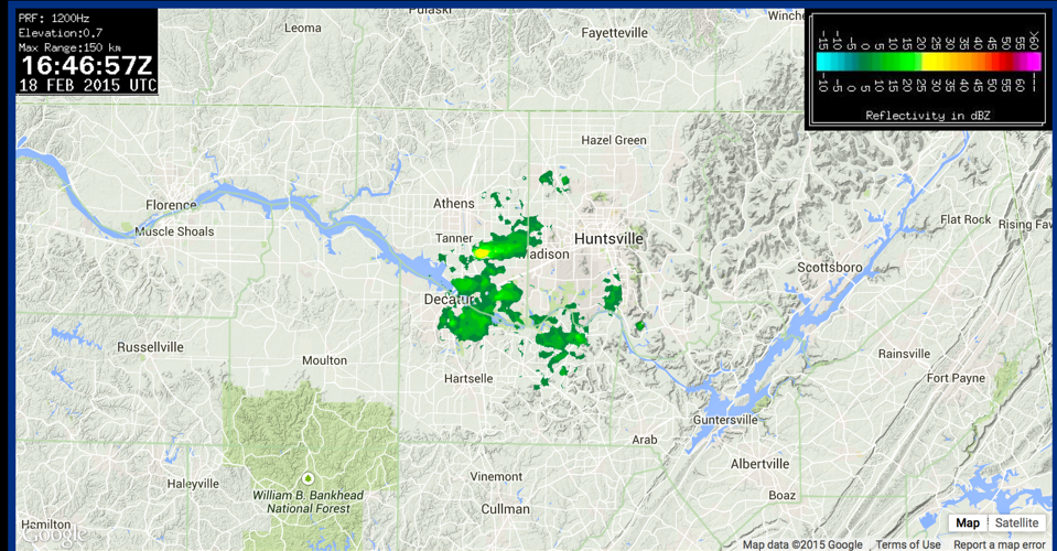
Looking at the Hytop radar won’t do you any good though because it is down waiting on a part. Here is the UAH ARMOR radar:
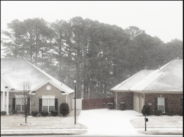
Here is an image from Terri Clark in Madison via Twitter.
SOME REPORTS
…0.25 inches on roadways around Cloverdale in Lauderdale County with up to one half inch on CR-8.
…Up to 1/2 of an inch of snow reported causing some icing conditions to occur near the intersection of CE 61 and CR 306 near Zip City in Lauderdale County.
…One tenth of an inch of snow and some icing in the Hinegar and Ider areas of DeKalb County.
…Secondary roads completely covered in snow…major roads mostly covered around Rainville in DeKalb County. Temperature 26 degrees.
…Secondary roads in eastern Lauderdale County reported to be “impassable”.
…Snow flurries around Decatur
Across the border in Moore County TN, 2.5 inches of snow has accumulated on grassy areas.
The worst of the snow will be over by noon with a few snow showers could persist into the afternoon.
Category: Alabama's Weather, Winter Weather
About the Author (Author Profile)
Bill Murray is the President of The Weather Factory. He is the site's official weather historian and a weekend forecaster. He also anchors the site's severe weather coverage. Bill Murray is the proud holder of National Weather Association Digital Seal #0001 @wxhistorianSubscribe
If you enjoyed this article, subscribe to receive more just like it.


