

Concerning Monday
The new GFS run still shows good potential for yet another “wintry mix” across Central Alabama late tomorrow night into Monday morning.
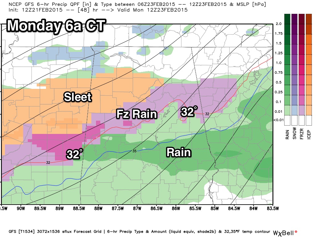
Highest risk of ice accumulation will be near the I-20 corridor, and this could have a significant impact on travel Monday morning. We will have a more specific update later today, but this is just to give you a “heads up” on the situation.
Precipitation looks to be light, but we all know it doesn’t take much freezing rain to bring big travel headaches. Seems like the highest risk of sleet/freezing rain will come from about midnight Sunday night through 9:00 a.m. Monday.
ALABAMA POWER IS READY, ARE YOU? Our friends at Alabama Power are monitoring the forecast closely, ready to deploy people and assets to quickly address any outages that might occur. Read a special message from Ike Piggot about their commitment to their customers.
Category: Alabama's Weather
About the Author (Author Profile)
James Spann is one of the most recognized and trusted television meteorologists in the industry. He holds the AMS CCM designation and television seals from the AMS and NWA. He is a past winner of the Broadcast Meteorologist of the Year from both professional organizations.Subscribe
If you enjoyed this article, subscribe to receive more just like it.


