

Winter Weather Potential Update
Let me say up front this is a low confidence forecast, with bit questions involving the placement of the deepest moisture and the timing of the cold air moving in from the north. Some of you will simply have a cold rain tomorrow, while others will have freezing rain with icy travel. Defining the line is a big challenge, but for now we won’t make too many changes in our ongoing forecast.
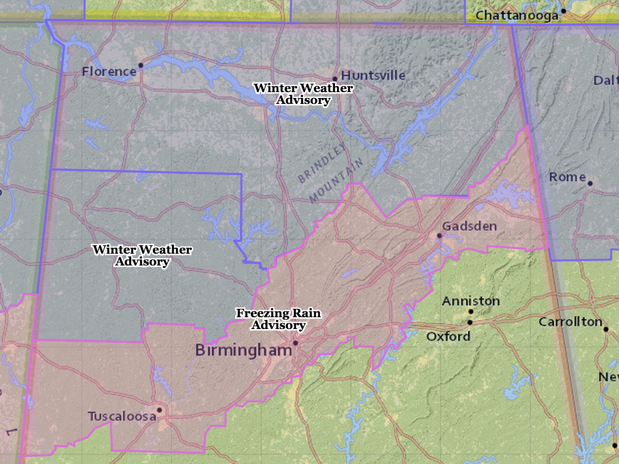
No change in the NWS advisories…
This is a 15 hour loop of the HRRR model, which shows the wintry mix potential across the northern third of Alabama late tonight and early tomorrow…
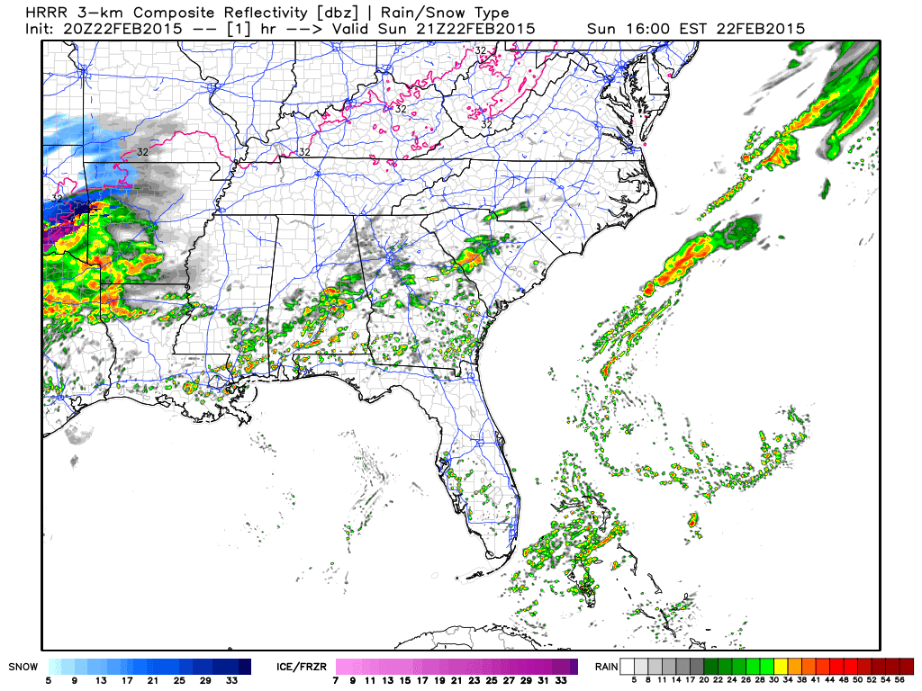
We note the HRRR, which is generally a very reliable short term high resolution model, keeps the freeze line north of Tuscaloosa, Birmingham, and Anniston, hinting these cities could stay in the mid 30s with the freezing rain issues generally north of U.S. 278. But, this is a very shallow layer of cold air, and even high resolution models can struggle with low level thermal fields (as was the case last Friday).
But this is our ongoing forecast….
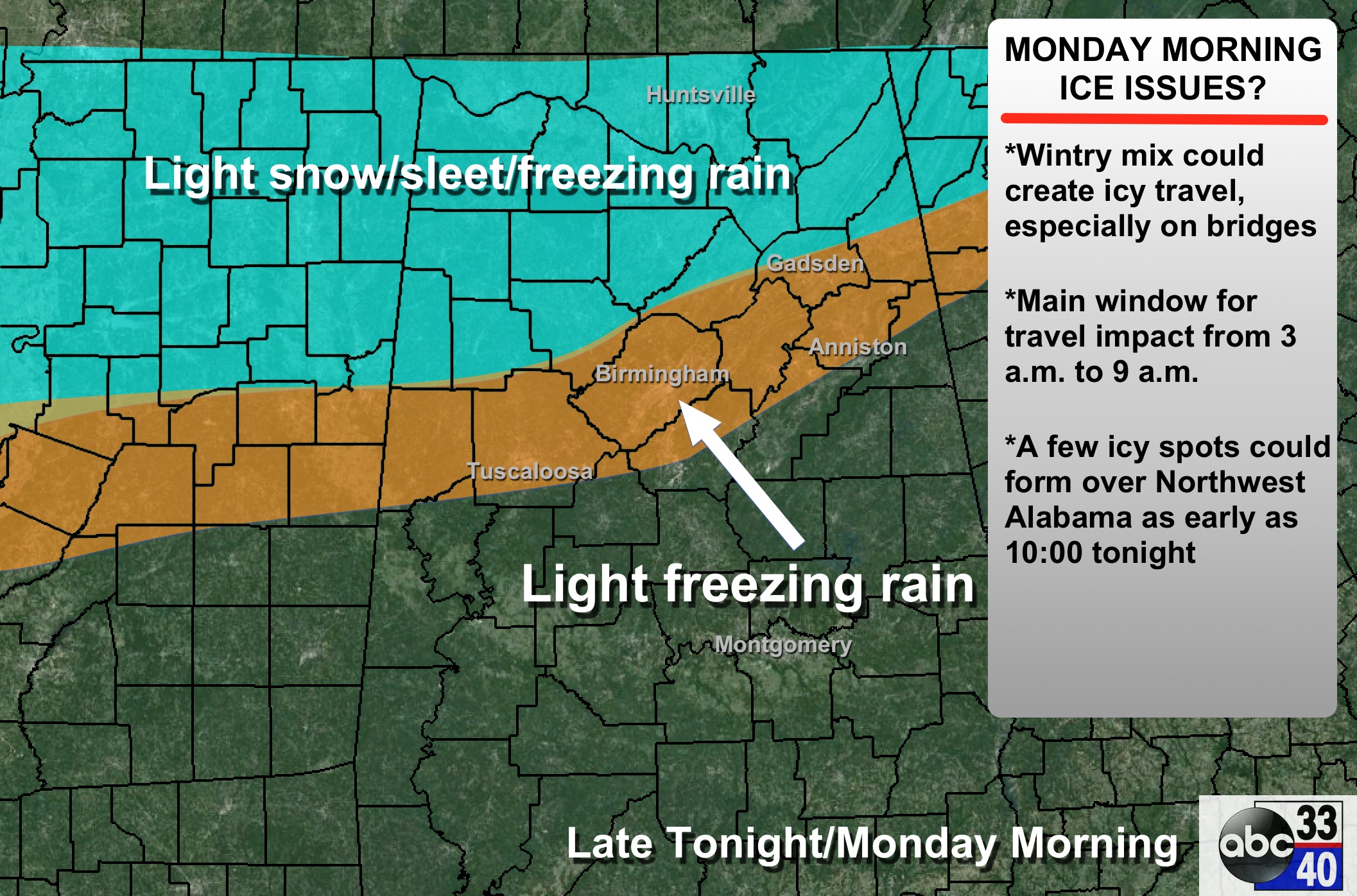
TIMING: Freezing rain/sleet/snow is possible over Northwest Alabama as early as 10:00 tonight. Main threat of the wintry mix, however, will come for most between midnight tonight and 9:00 a.m. tomorrow.
PLACEMENT: The southern extent of the potential icy travel will be roughly along I-20. The northern extent will be close to the Tennessee River.
ACCUMULATION: There won’t be too much snow involved, but some spots in Northwest Alabama could see 1/4″. Most will see freezing rain; amounts to 0.10″ are possible. Precipitation will be light, but we all know it doesn’t take much to create icy travel.
IMPACT: Not enough ice for any power outages, but enough ice is certainly possible for travel difficulties.
Again we stress changes remain possible in this forecast. See our “ten things people need to know about winter weather forecasts”.
Stay tuned to the blog for updates through the night….
ALABAMA POWER IS READY, ARE YOU? Our friends at Alabama Power are monitoring the forecast closely, ready to deploy people and assets to quickly address any outages that might occur. Read a special message from Ike Piggot about their commitment to their customers.
Category: Alabama's Weather
About the Author (Author Profile)
James Spann is one of the most recognized and trusted television meteorologists in the industry. He holds the AMS CCM designation and television seals from the AMS and NWA. He is a past winner of the Broadcast Meteorologist of the Year from both professional organizations.Subscribe
If you enjoyed this article, subscribe to receive more just like it.


