

Late Night Look at Alabama’s Weather
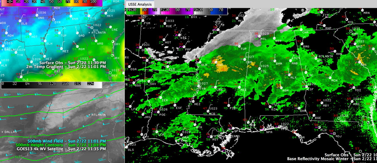
Mixed precipitation is spreading across North and North Central Alabama tonight ahead of an approaching upper level disturbance even as colder air is slowly filtering into the state from the north.
North of a line from Russellville to Moulton to Athens, the precipitation is mixed freezing rain and rain. South of the line, the precip is all rain.
Temperatures are falling however, and through the overnight hours, Fayette, Lamar, Marion, Walker, Winston, Colbert, Cullman, De Kalb, Franklin, Jackson, Lauderdale, Lawrence, Limestone, Madison, Marshall and Morgan Counties will see the best opportunities for the precip to produce accumulating ice. Icing amounts should be about 0.10 inches in the winter weather advisory area.
To the south, across Fayette, Lamar, Marion, Walker and Winston Counties, there will be mostly rain, but some patches of freezing rain will be mixed in.
Remember, it only takes a small amount of freezing rain to cause big travel problems. Please check the latest conditions early in the morning before venturing out. Most area school systems have delayed their openings.
The precip will quickly switch over to all rain in all areas by 9-10 a.m.
There is lots of uncertainty in the forecast moving forward, but there could be more wintry precip tonight and early Tuesday and don’t look now, but the NAM shows a decent accumulating snow for North Central Alabama Wednesday night.
Category: Alabama's Weather, Winter Weather
About the Author (Author Profile)
Bill Murray is the President of The Weather Factory. He is the site's official weather historian and a weekend forecaster. He also anchors the site's severe weather coverage. Bill Murray is the proud holder of National Weather Association Digital Seal #0001 @wxhistorianSubscribe
If you enjoyed this article, subscribe to receive more just like it.


