

Mid Morning Update
New model data is coming in this morning; it will all be evaluated and a winter storm warning will be needed for much of North, and parts of Central Alabama later today concerning the event tomorrow.
Here is the new run (12Z) of the NAM model… showing the axis of heavier snow generally between I-20 on the southern periphery, and US 278 to the north.
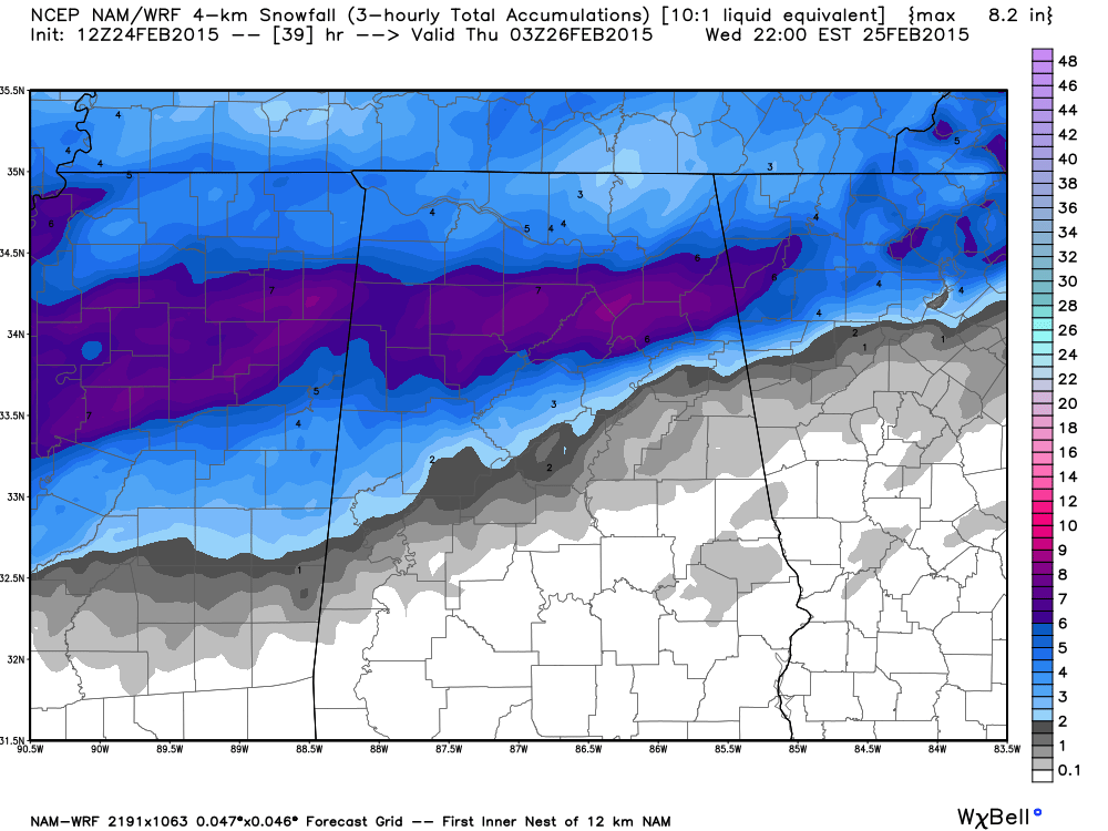
You can see the “bullseye” on this run is near Cullman and Gadsden with 5-7 inches (the US 278 corridor)… but remember, this is raw model output, not a forecast. But, it is certainly possible considering we are 24 hours away from the event. The model suggests around 2-3 inches of snow for Birmingham, Tuscaloosa, and Anniston.
As stated here many times, the most difficult part of this forecast is defining the rain/snow line to the south, and the northern edge of the accumulating snow to the north. And, another challenge is where the heavy snow axis sets up… this is usually only about 30 miles wide, and can’t really be defined until the event begins.
Here is a summary of what we expect….
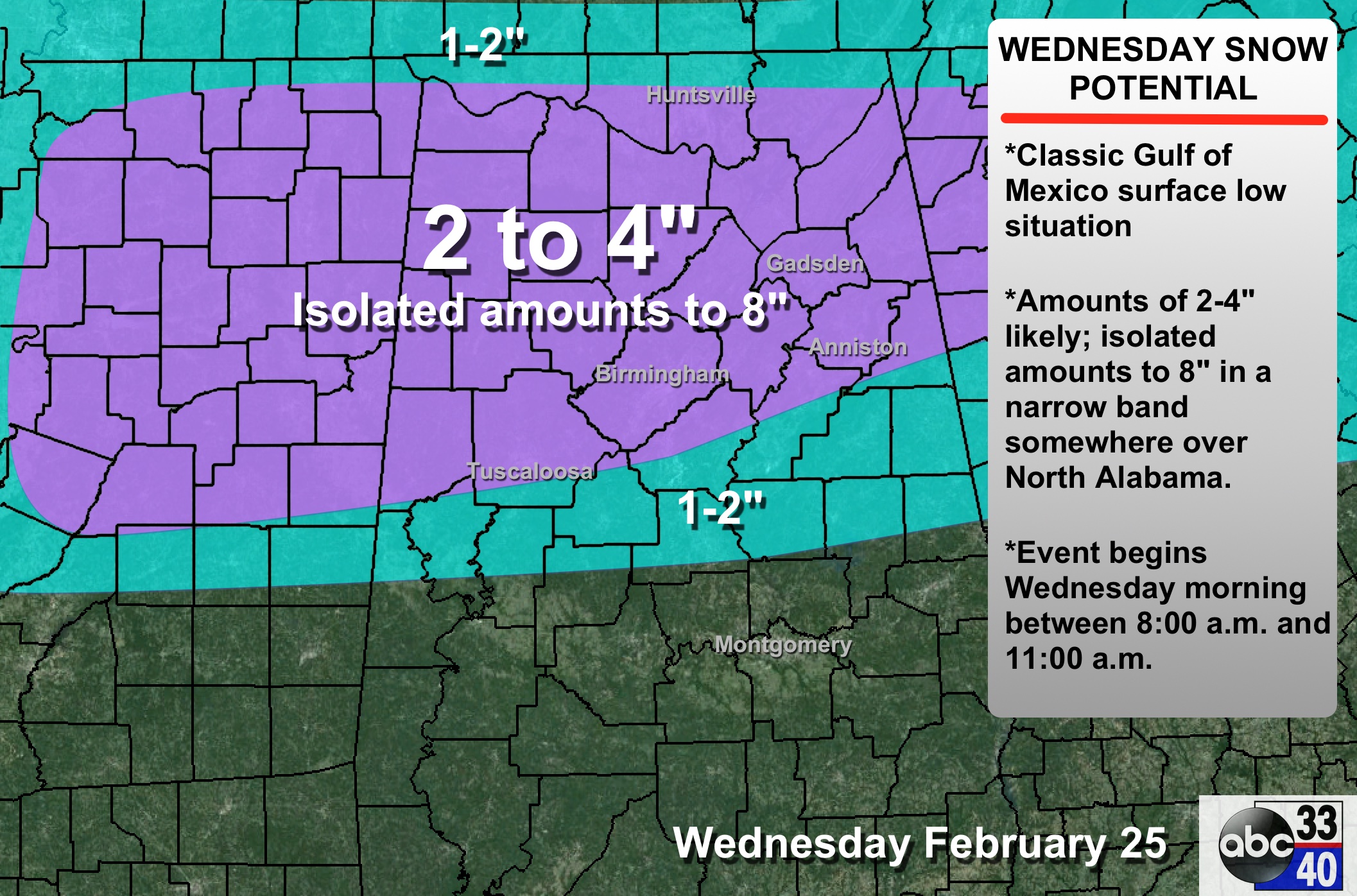
TIMING: We have pushed back the onset of the precipitation to 8:00 to 11:00 a.m. The heavier snow will come tomorrow afternoon, then winding down tomorrow night.
AS IT BEGINS: Understand there could be some rain involved at the beginning of the event with warmer temperatures below 2,000 feet, but it will change to all snow quickly with dynamic cooling.
PLACEMENT: One of the hard parts of this forecast is defining the rain-snow line. It should be close to a line from Forkland to Clanton To Wedowee. Below this line, all rain. And, understand this is a “fuzzy” line subject to change later today and tonight. The northern edge of the good accumulating snow should be near the Alabama/Tennessee border.
ACCUMULATION POTENTIAL: We will maintain potential, on an average basis, of 2-4 inches across much of North/Central Alabama. We note the SREF mean for Birmingham has dropped into the 1-2 inch range, but that will probably change again. And, understand, there will be a narrow axis of heavy snow (as discussed above) where a few spots could see 8″ on the high end.
IMPACT: In that narrow heavy snow band, there could be some scattered power outages due to the heavy, wet snow. Travel will also be impacted greatly; issues could linger into Thursday morning due to the potential for the snow to morph into ice on roads and bridges. Travel will improve during the day Thursday as temperatures climb above freezing.
REMEMBER: Some will be delighted with the amount of snow they get, others will be very disappointed. That is just the way it works.
ALABAMA POWER IS READY, ARE YOU? Our friends at Alabama Power are monitoring the forecast closely, ready to deploy people and assets to quickly address any outages that might occur. Read a special message from Ike Pigott about their commitment to their customers.
Stay tuned for more updates!
Category: Alabama's Weather
About the Author (Author Profile)
James Spann is one of the most recognized and trusted television meteorologists in the industry. He holds the AMS CCM designation and television seals from the AMS and NWA. He is a past winner of the Broadcast Meteorologist of the Year from both professional organizations.Subscribe
If you enjoyed this article, subscribe to receive more just like it.


