

Snow Will Begin in Birmingham Soon
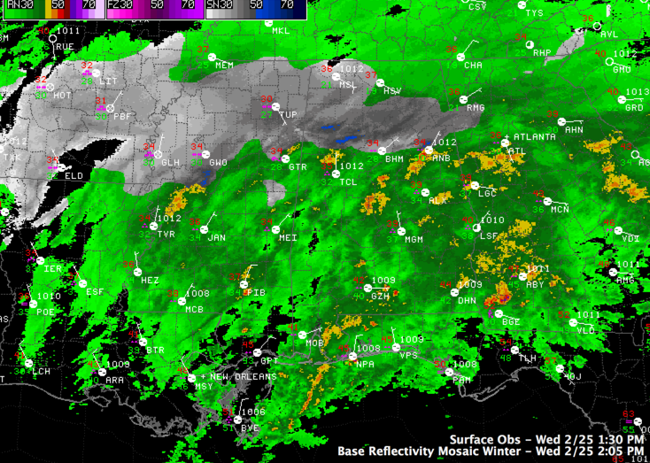
The snow line is working its way south and east at this hour and is into western and northern Jefferson County.
You will notice a change to a slushy rain/snow mix then to all snow. It will not take long for the changeover to occur, probably over the next hour.
It is now time to be home in the Greater Birmingham area.
Travel is now reportedly very hazardous in the snow areas, including Cherokee, Etowah, Blount, northern St. Clair, northern Jefferson, Walker and Fayette Counties. Do not travel unless it is an emergency.
ALABAMA POWER IS READY, ARE YOU? Our friends at Alabama Power are monitoring the forecast closely, ready to deploy people and assets to quickly address any outages that might occur. Read a special message from Ike Pigott about their commitment to their customers.
Stay tuned for more updates…
Category: Alabama's Weather, Met 101/Weather History
About the Author (Author Profile)
Bill Murray is the President of The Weather Factory. He is the site's official weather historian and a weekend forecaster. He also anchors the site's severe weather coverage. Bill Murray is the proud holder of National Weather Association Digital Seal #0001 @wxhistorianSubscribe
If you enjoyed this article, subscribe to receive more just like it.


