

Evaluating The Forecast
This is the final forecast graphic I put together for yesterday’s snow event Tuesday night at 9:00 p.m.
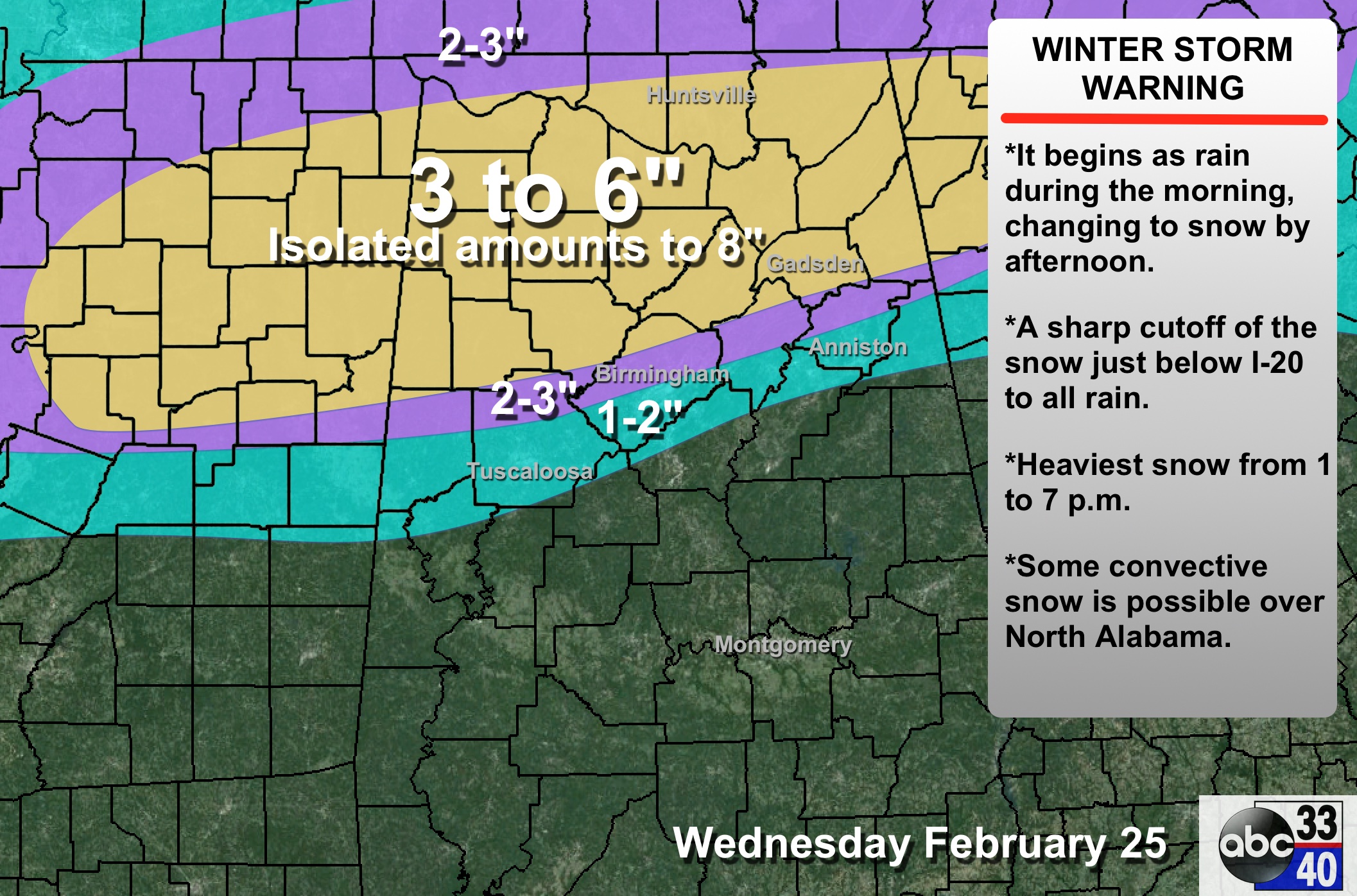
GRADE: A-
The biggest forecast miss was the amount of snow in the heavy snow zone along the US 278 corridor. Instead of 3-6″ with isolated amounts to 8″, it turned out to be 6-9″, with isolated amounts to one foot. There was some objective guidance that did have it correct; guess I just didn’t have the guts to go that high.
As discussed for days, the rain-snow line near I-20 was the biggest challenge in the forecast. The change to snow did indeed to come to Tuscaloosa, Birmingham, and Anniston… just a little later in the event (after dark).
The NWS will put together a map of accurate snow observations later today and you can overlay that on the forecast.
BOTTOM LINE: We honestly can’t do much better with a winter storm. People that kept up with blog discussions and forecasts on a timely basis knew what to expect, and were prepared. And, those that experienced a rainy day knew it was going to be all rain for them.
I will spend some time looking back at model output, our forecast, and actual observations in coming days. You learn something from every winter event in the Deep South…
Category: Alabama's Weather
About the Author (Author Profile)
James Spann is one of the most recognized and trusted television meteorologists in the industry. He holds the AMS CCM designation and television seals from the AMS and NWA. He is a past winner of the Broadcast Meteorologist of the Year from both professional organizations.Subscribe
If you enjoyed this article, subscribe to receive more just like it.


