

Warmer Days Ahead
An all new edition of the ABC 33/40 Weather Xtreme video is available in the player on the right sidebar of the blog. You can subscribe to the Weather Xtreme video on iTunes by clicking here.
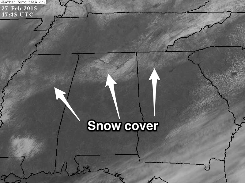
THIS AFTERNOON: The sky has become sunny across the great state of Alabama; temperatures are mostly in the low 40s. The snow cover over North Alabama, while fading under the February sun, still shows nicely on visible satellite imagery this afternoon…
OUR WEEKEND: Tomorrow will be dry with a mix of sun and clouds; the high will be in the 52-55 degree range. Then, clouds increase Sunday, and we could see a little scattered light rain. Any rain Sunday should be light and spotty; a decent part of the day will be dry. The “wedge” could bring colder air into far East Alabama; communities near the Georgia border could hold in the 40s all day, but for the rest of the state the high will be in the 50s.
ACTIVE WEATHER NEXT WEEK: A cold front will be just north of the state Monday, and we will forecast occasional showers with a high at or just over 60 degrees. Then, on Tuesday, a deep surface low passes northwest of Alabama, and we will mention a chance of showers and storms for the northern half of the state. It will be a warm day with a high up in the low 70s… it still looks like the better risk of any severe thunderstorms will be north and west of Alabama.
WINTER WEATHER MISCHIEF? The 12Z GFS shows the cold front passing through Alabama Wednesday morning; the day will feature falling temperatures and periods of rain. And, like we really need this, it continues to hint at some potential for a “wintry mix” Wednesday night.
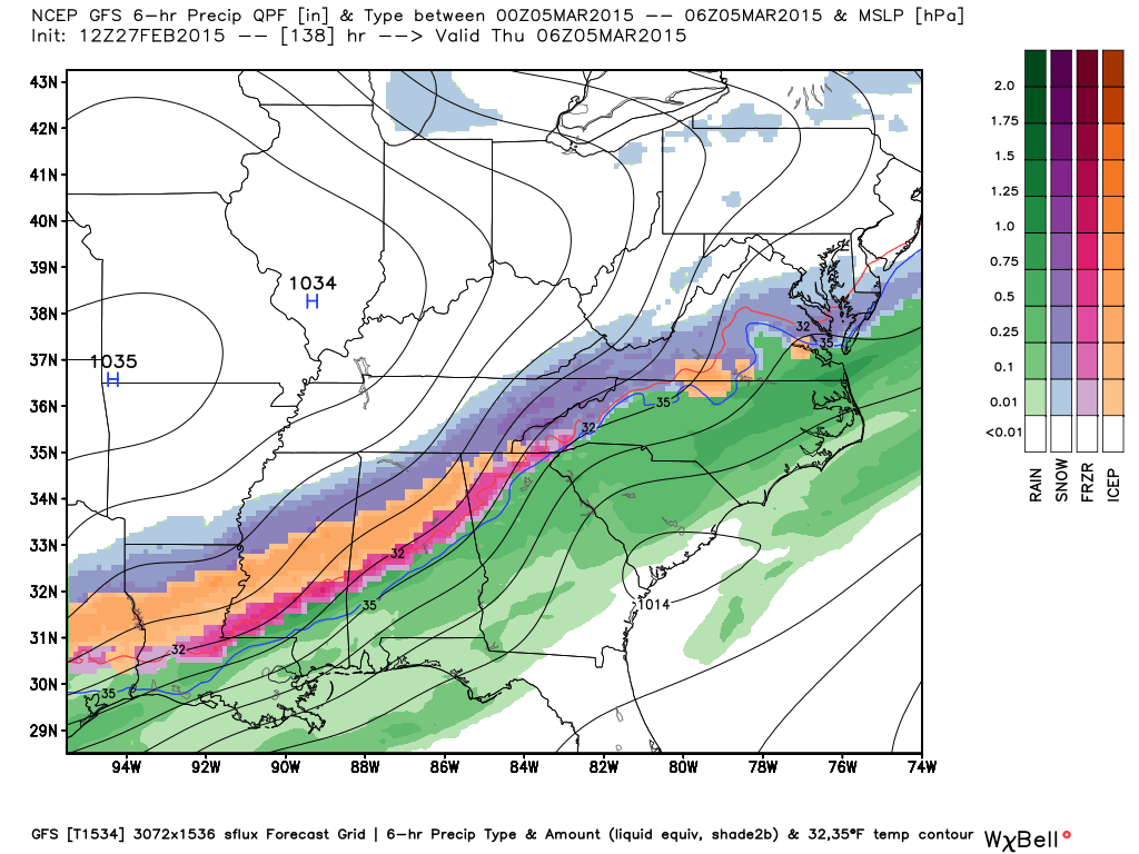
While this is not exactly “voodoo”, there is no way to resolve details of this potential so far in advance, and we might escape with no winter precipitation at all. We will keep a close eye on it over the weekend. See the Weather Xtreme video for maps, graphics, and more details.
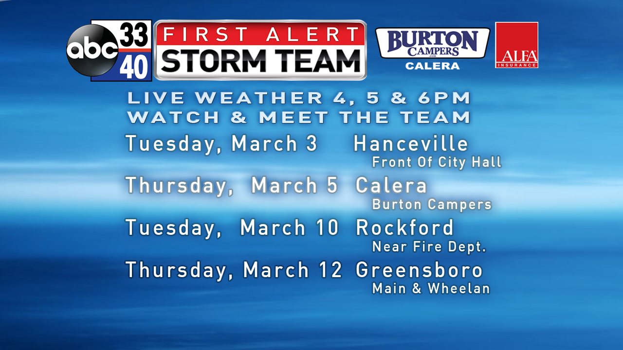
FIRST ALERT STORM TEAM TOUR: Our annual severe weather awareness tour across Alabama rolls along; we will be in Hanceville next Tuesday evening. Just drop by anytime from 4:00 until 6:30… you can watch me do weather live on ABC 33/40, get some free stuff to take home, and have a chance to win several NOAA Weather Radios we will be giving away. If you need your weather radio programmed or checked, bring it by and we will be glad to help.
WEATHER BRAINS: Don’t forget you can listen to our weekly 90 minute netcast anytime on the web, or on iTunes. This is the show all about weather featuring many familiar voices, including our meteorologists here at ABC 33/40.
CONNECT: You can find me on all of the major social networks…
Facebook
Twitter
Google Plus
Instagram
I had great visits today at Oak Grove Elementary in Jefferson County, and West Blocton Elementary in Bibb County… be looking for those kids on the Pepsi KIDCAM today at 5:00 and 6:00 on ABC 33/40 News! My next Weather Xtreme video will be posted early Monday morning by 7:00… Brian Peters will have the video updates here tomorrow and Sunday. Enjoy the weekend!
Category: Alabama's Weather
About the Author (Author Profile)
James Spann is one of the most recognized and trusted television meteorologists in the industry. He holds the AMS CCM designation and television seals from the AMS and NWA. He is a past winner of the Broadcast Meteorologist of the Year from both professional organizations.Subscribe
If you enjoyed this article, subscribe to receive more just like it.


