

Mid-Week Winter Storm Update
This is an update of the potential for a winter storm across North Alabama Wednesday night and Thursday… please understand this far out the forecast is subject to big changes, but model consistency has been very good and confidence is growing in this forecast. As always, I encourage you to read the “ten things people need to know about winter weather forecasts.
TIMING: After a good rain/thunderstorm event and a cold front passage, cold air advection will bring Arctic air into Alabama Wednesday with falling temperatures during the day. The high will be reached Wednesday morning, and we should be in the 30s by late afternoon. Temperatures will go below freezing across North/Central Alabama in the 4:00 to 7:00 p.m. time frame, and winter weather issues are likely from then through Wednesday night into Thursday morning.
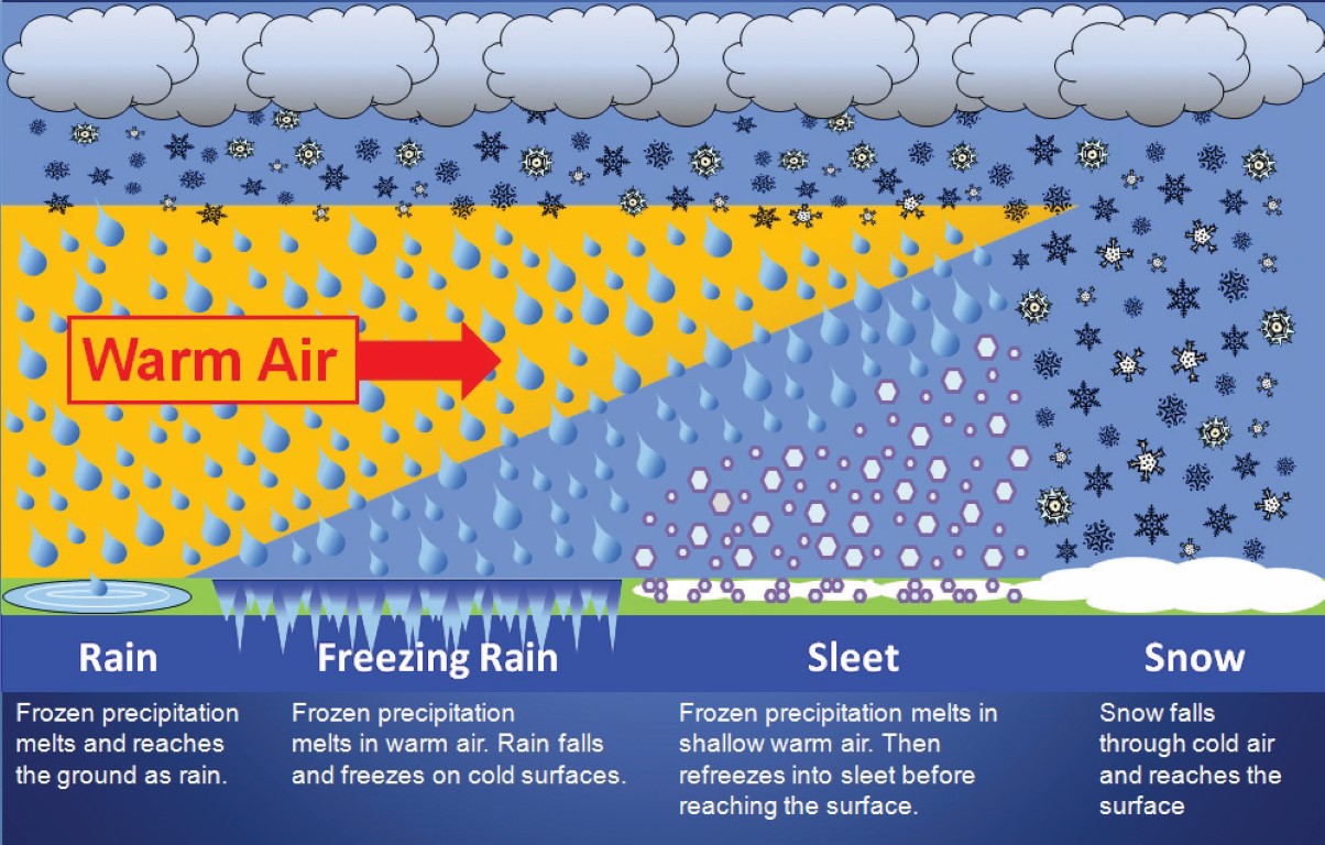
PRECIPITATION TYPE: Unfortunately, the cold air will be shallow, and a layer of warmer air aloft between 5,000 and 10,000 feet will most likely set the stage for freezing rain, followed by a change to sleet and snow as the event winds down Thursday morning as the cold air deepens. Below is a forecast sounding for Birmingham for late Wednesday night.
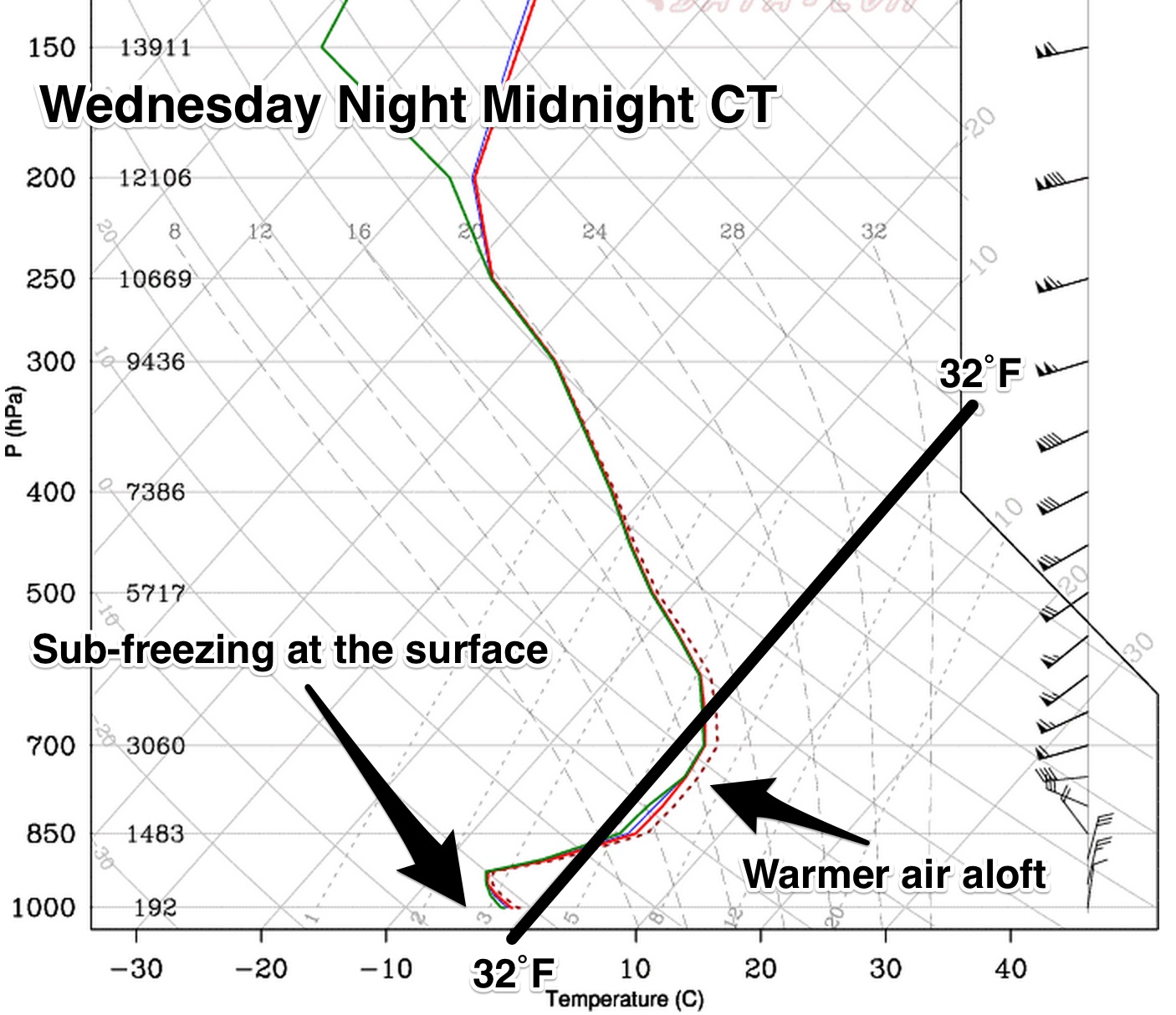
Freezing rain is the worst kind of winter precipitation; that is simply rain in liquid form that falls when temperatures are below freezing.
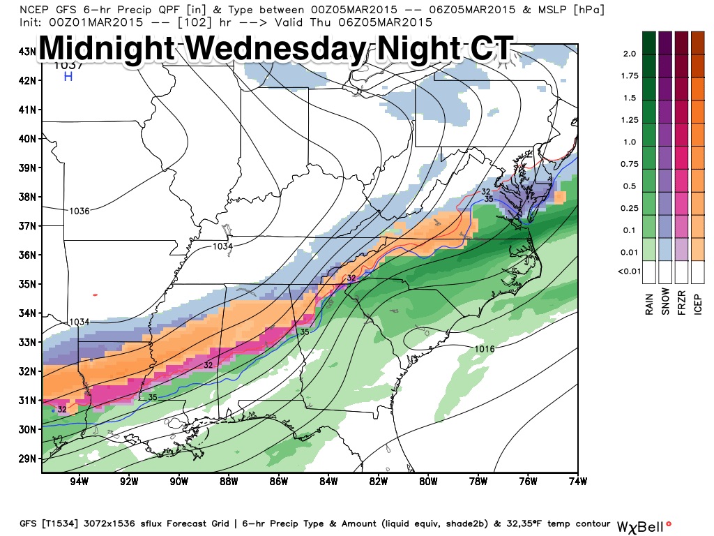
PLACEMENT: Current model data suggests the highest threat of freezing rain and icing issues will be along and north of I-20, but some impact is possible down to a line from Livingston to Clanton to Roanoke by Thursday morning.
IMPACT: Where the freezing rain falls for a long duration (5-6 hours), this has the potential to be a high impact event. Even higher than the huge snow event that just happened last night (some had up to one foot of snow).Freezing rain coats exposed objects with ice, and the weight of the ice can bring down trees and power lines if the accumulation is great enough. At this early stage, we can’t forecast specific impact, but a significant ice storm is not out of the question with potential for power outages.
UNDERSTAND: This forecast can, and will change. Let’s hope we just have a cold rain, followed by a quick change to sleet and light snow and it ends with little impact. But, on the other hand, this could be a very high impact event for North, and maybe even parts of Central Alabama, Wednesday night and Thursday morning. Please check the blog often for updates as we get closer.
AND: Strong storms are possible before the cold air arrives Tuesday night and Wednesday morning, but poor lapse rates will limit instability and it doesn’t look like a major threat for now.
Brian will be along shortly with a new discussion and a Weather Xtreme video.
Category: Alabama's Weather
About the Author (Author Profile)
James Spann is one of the most recognized and trusted television meteorologists in the industry. He holds the AMS CCM designation and television seals from the AMS and NWA. He is a past winner of the Broadcast Meteorologist of the Year from both professional organizations.Subscribe
If you enjoyed this article, subscribe to receive more just like it.


