

Potential Winter Storm Wed Night/Thursday
An all new edition of the ABC 33/40 Weather Xtreme video is available in the player on the right sidebar of the blog. You can subscribe to the Weather Xtreme video on iTunes by clicking here.
ANOTHER WILD WEEK: Strap in for yet another weather roller coaster ride this week, with potential for a high impact winter storm before the week is over.
TODAY: Wet is the word; we will forecast occasional showers today and tonight; temperatures will hold steady in the 50s much of the day. We should note we have dense fog advisory for much of Central and South Alabama as the day begins; visibilities are very restricted in spots.
WARM DAY TOMORROW: A warm front pushes northward tomorrow morning, and we should soar into the low to mid 70s tomorrow afternoon; much of South Alabama can expect low 80s. A shower or two is certainly possible during the day, but I sure get the idea much of the day will be dry, and the sun might even peek out at times. Walk outside tomorrow afternoon and you will think we are a lunatic for forecasting a winter storm Wednesday night into Thursday.
STRONG STORMS? There is no formal risk of severe weather defined by SPC for Alabama, and severe weather parameters are not impressive for tomorrow night. A strong storm is certainly possible, but for now the chance of severe weather is not great.
WRONG WAY WEDNESDAY: A very sharp cold front will move through Alabama Wednesday, making it a nightmare temperature forecast. Temperatures will begin to fall across the Tennessee Valley of far North Alabama early in the day. For Birmingham, Tuscaloosa, Anniston, and Gadsden, temperatures will most likely reach the 60s by midday, then falling through the afternoon, with 30s by evening. Rain will fall much of the day; it will be a good soaking for the state.
WINTER STORM THREAT: Post frontal precipitation will bring the threat of a high impact winter storm to North and parts of Central Alabama Wednesday night and Thursday. Understand we are still a few days away from this, but confidence in the forecast is growing.
TIMING: Freezing rain and sleet could begin over the northwest corner of Alabama as early as 6:00 p.m. Wednesday, when temperatures are expected to go below freezing. For Birmingham, Tuscaloosa, Anniston, and Gadsden, the core threat of freezing rain/sleet will come from roughly midnight Wednesday night through 10:00 a.m. Thursday.
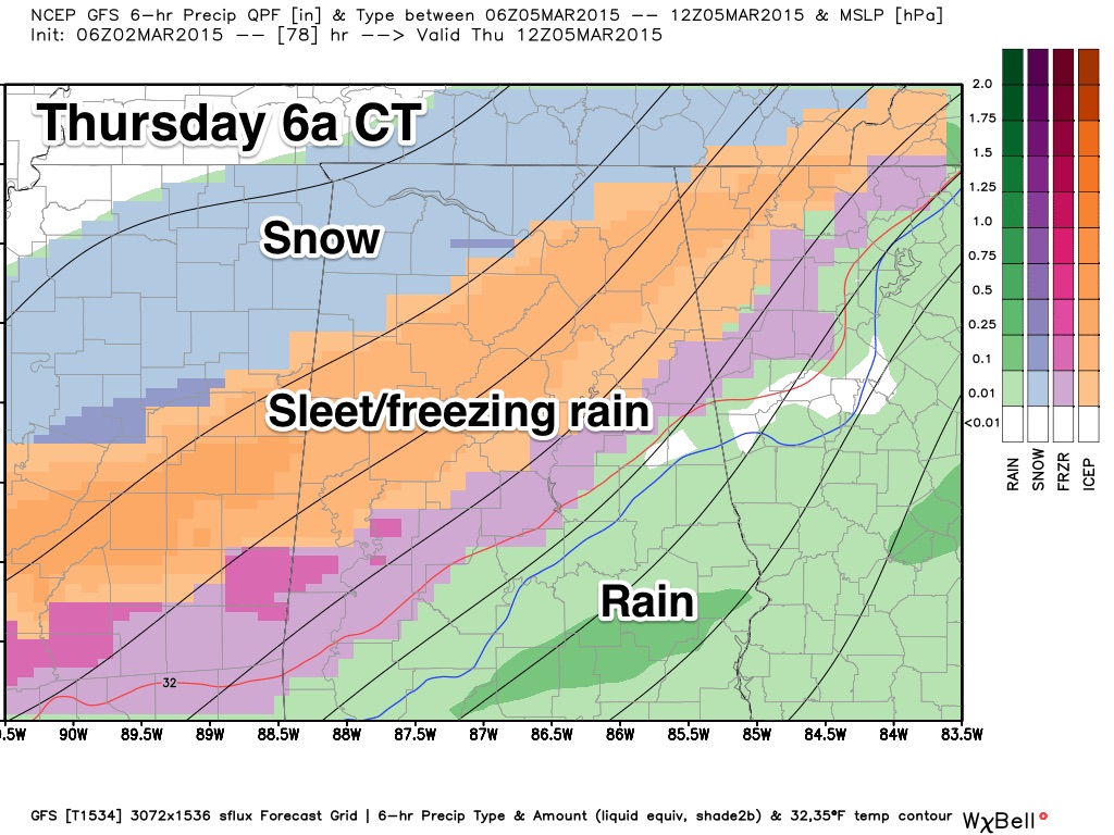
PLACEMENT: Ice accumulation will be possible along and north of a line from Livingston to Clanton to Roanoke. Isolated issues are possible even south of that line.
PRECIPITATION TYPE AND AMOUNT: The cold air initially will be very shallow; warmer air between 5,000 and 10,000 feet will mean the initial precipitation will fall as sleet (ice pellets) and freezing rain (liquid). Then, as the cold air deepens, it changes to snow before ending.
Ice accumulation to 0.25″ is likely; some spots could get more. On top of that, snow totals of 1-3″ are possible, mainly along and west of a line from Sulligent to Cullman to Scottsboro (we do note the GFS is more aggressive with snow totals). Snow amounts to the west and south will be lighter. The greatest concern is the ice accumulation; a long period of freezing rain leads to an ice storm.
IMPACT: This winter storm should severely impact travel Wednesday night and Thursday morning, and there could be enough ice accumulation for power outages. We expect a north wind of 10-20 mph during the event, which will add to the possibility of tree branches and power lines being impacted by the ice.
TEMPERATURES: Most North Alabama communities stay below freezing all day Thursday, and where there is snow and ice accumulation, temperatures early Friday morning will drop into the 10-15 degree range, with even potential for isolated single digit lows. We then warm above freezing by mid-morning Friday.
IMPORTANT: This forecast can, and will change. The event Wednesday night/Thursday could be a minor situation with mostly a cold rain, and brief change to wintry precipitation on the back side, or it could be a high impact ice storm. The truth is probably somewhere in between.
Check the blog often for updates. And, see the “ten things people need to know about winter weather forecasts”.
FRIDAY AND THE WEEKEND: These three days will be dry with a warming trend. We reach the upper 40s Friday, mid 50s Saturday, and upper 50s Sunday. Each day should feature a good supply of sunshine.
See the Weather Xtreme video for maps, graphics, and more details.
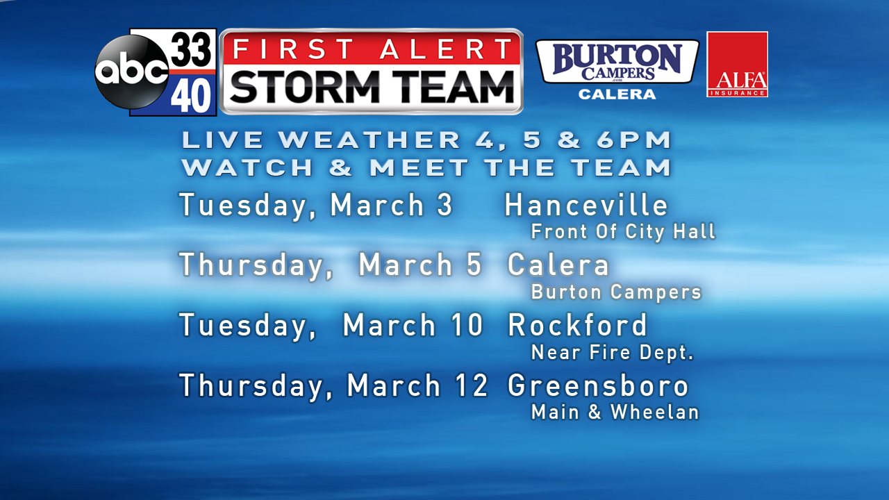
FIRST ALERT STORM TEAM TOUR: Our annual severe weather awareness tour across Alabama rolls along; we will be in Hanceville tomorrow evening. Just drop by anytime from 4:00 until 6:30… you can watch me do weather live on ABC 33/40, get some free stuff to take home, and have a chance to win several NOAA Weather Radios we will be giving away. If you need your weather radio programmed or checked, bring it by and we will be glad to help.
WEATHER BRAINS: Don’t forget you can listen to our weekly 90 minute netcast anytime on the web, or on iTunes. This is the show all about weather featuring many familiar voices, including our meteorologists here at ABC 33/40. We will produce this week’s show tonight at 8:30 CT… you can watch it on “James Spann 24/7” on cable systems around the state, or on the web here.
CONNECT: You can find me on all of the major social networks…
Facebook
Twitter
Google Plus
Instagram
I have a weather program this morning at Calera Elementary School… and this afternoon I will be reading at Irondale Community School. Look for the next Weather Xtreme video here by 4:00 this afternoon… enjoy the day…
Category: Alabama's Weather
About the Author (Author Profile)
James Spann is one of the most recognized and trusted television meteorologists in the industry. He holds the AMS CCM designation and television seals from the AMS and NWA. He is a past winner of the Broadcast Meteorologist of the Year from both professional organizations.Subscribe
If you enjoyed this article, subscribe to receive more just like it.


