

Winter Storm Potential Update
A good bit of the new model data is in tonight (the 00Z runs), but not all of the data.
Bottom line is that I don’t see any need to change our ongoing forecast.
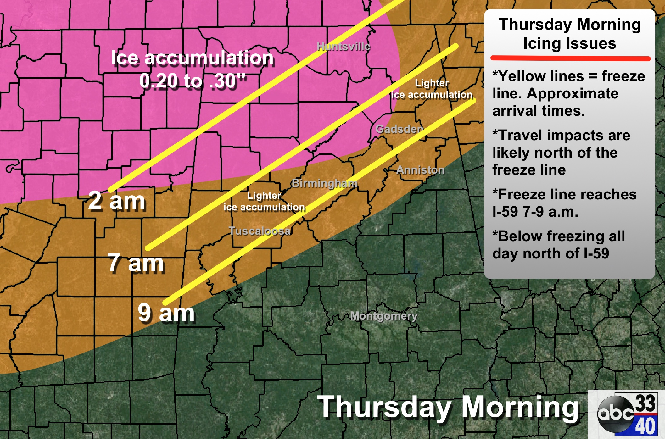
TIMING: Icy travel could begin up around Florence and Muscle Shoals as early as midnight to 2 a.m…. then freeze line will move steadily southward during the morning, reaching Birmingham/Tuscaloosa/Anniston in the 7-9 am time frame.
It is important to note that computer models struggle with shallow layers of cold air like this, and if anything the cold air might arrive slightly ahead of time.
PLACEMENT: The southern edge of the ice accumulation will be roughly along a line from Forkland to Brent to Alabaster to Oxford. South of this line, it will be just a cold, rainy day. Understand it won’t be a clean, straight line like we are showing on the map, it is just a guideline.
It is very possible for the cities of Birmingham, Tuscaloosa, and Anniston the northern sections of these cities could have 30 degrees and icy travel, while the southern sections have 33 degrees and a cold rain.
IMPACT: Over Northwest Alabama, where the ice accumulation will be heavier (up to 0.30″)… scattered power outages are possible due to the weight of the ice on trees and power lines, and a north wind of 10-20 mph.
Concerning travel, bridges and overpasses will become icy quickly where temperatures are below 32 degrees. Even some black top surfaces could become icy, even with the warm temperatures we had today. We are seeing many ice covered roads tonight across Arkansas and West Tennessee.
DURATION: Temperatures will stay below freezing north of I-59 all day tomorrow, and it will be mid morning Friday before readings climb above 32 degrees. This means icy travel is possible over a decent part of North Alabama through tomorrow night into Friday morning.
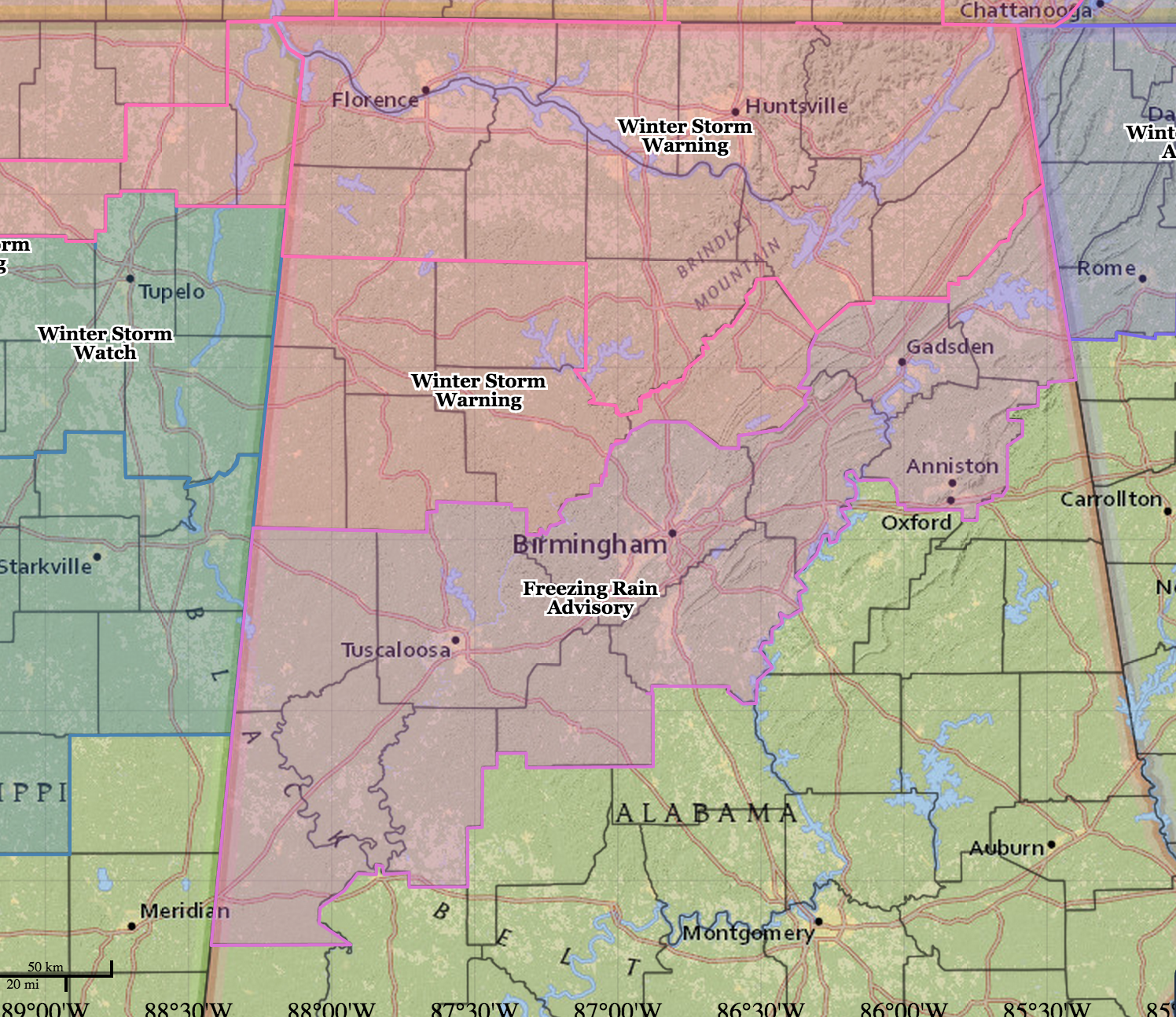
WATCHES/ADVISORIES: No change…
Be ready for surprises tomorrow; we have a limited skill set in dealing with freezing rain events like this.
ALABAMA POWER IS READY, ARE YOU? Our friends at Alabama Power are monitoring the forecast closely, ready to deploy people and assets to quickly address any outages that might occur. Read a special message from Ike Piggot about their commitment to their customers.
I will have a new discussion very early tomorrow morning… stay tuned…
Category: Alabama's Weather
About the Author (Author Profile)
James Spann is one of the most recognized and trusted television meteorologists in the industry. He holds the AMS CCM designation and television seals from the AMS and NWA. He is a past winner of the Broadcast Meteorologist of the Year from both professional organizations.Subscribe
If you enjoyed this article, subscribe to receive more just like it.


