

Quick Radar Check
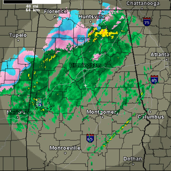
Another day with quite the mess across the area. A quick look at the radar shows a mix of wintery precip across Northwest and North Alabama, with rain, sleet, and freezing rain falling. The freezing line continues to sink towards the southeast and is approaching the Interstate 59 corridor.
Already getting reports of sleet mixed with the rain in the Birmingham metro, and once temps fall below freezing, travel issues are going to develop. Temps will continue to drop today, so do not look for conditions to improve.
The next few hours we will see a transition to freezing rain and sleet, and yes, there will be snow as the even winds down. A winter storm warning remains in effect for areas along and north of Interstate 59 until 3PM. This includes areas north of Birmingham and Tuscaloosa, such as Jasper, Fayette, Hamilton, and Cullman.
Category: Alabama's Weather, Winter Weather
About the Author (Author Profile)
Macon, Georgia Television Chief Meteorologist, Birmingham native, and long time Contributor on AlabamaWX. Stormchaser. I did not choose Weather, it chose Me. College Football Fanatic. @Ryan_StinnetSubscribe
If you enjoyed this article, subscribe to receive more just like it.


