

Band of Heavy Sleet Affecting I-59 Corridor
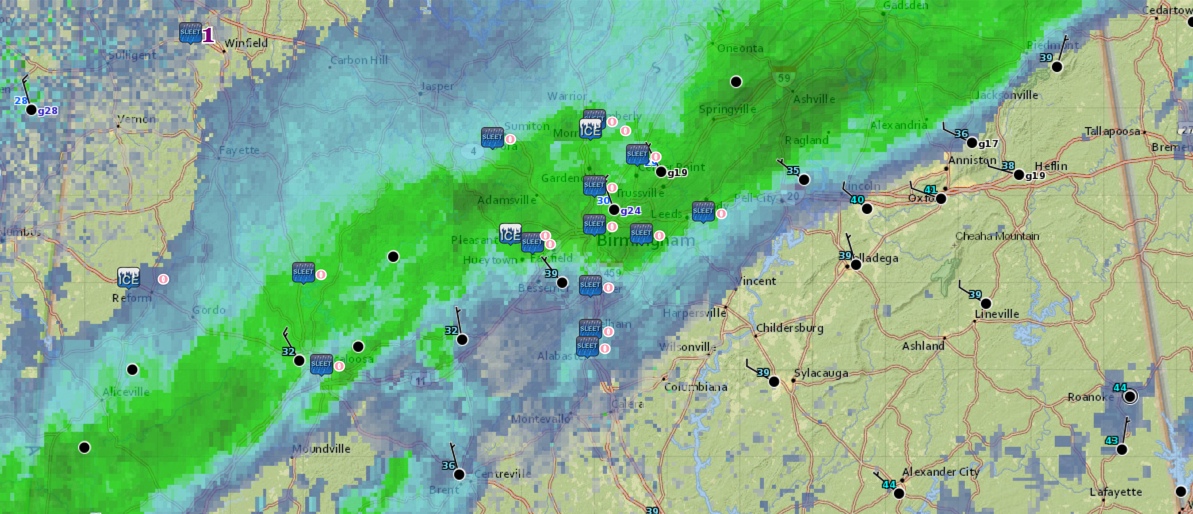
A band of moderate to heavy sleet is affecting many communities in a southwest to Northeast line from Sumter and Greene Counties through Tuscaloosa, Jefferson, Shelby, southern Blount, southern Etowah, St. Clair and Cherokee Counties.
It is sleeting like crazy now in places like Hoover, Bessemer, Helena and Mountain Brook.
It is 32F at the Tuscaloosa Airport, 30F at the Birmingham Airport. In fact, most of the stations in the Tuscaloosa/Birmingham areas are now at or below freezing.
Roads are just wet for now in the Birmingham/Tuscaloosa metro areas but it is beginning to accumulate on raised and exposed objects like decks.
Travel is not recommended now in the affected areas.
Category: Alabama's Weather, Winter Weather
About the Author (Author Profile)
Bill Murray is the President of The Weather Factory. He is the site's official weather historian and a weekend forecaster. He also anchors the site's severe weather coverage. Bill Murray is the proud holder of National Weather Association Digital Seal #0001 @wxhistorianSubscribe
If you enjoyed this article, subscribe to receive more just like it.


