

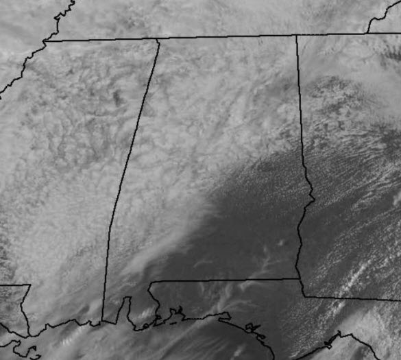
Clouds Hanging Tough
After a rather week of weather, we are finally seeing the rain come to an end for much of the state. There remains a few very light showers this afternoon, and many of these are not even showing up on the radar. There are also a few areas of fog, with misty conditions. The clouds continue to hang tough across much of Central Alabama this afternoon, but we do note some peeks of sunshine in the area, while a mainly sunny sky is in place across southeastern portions of the state. Though parts of Alabama are seeing the sun today, I think a vast majority of the state will see the sun return tomorrow.
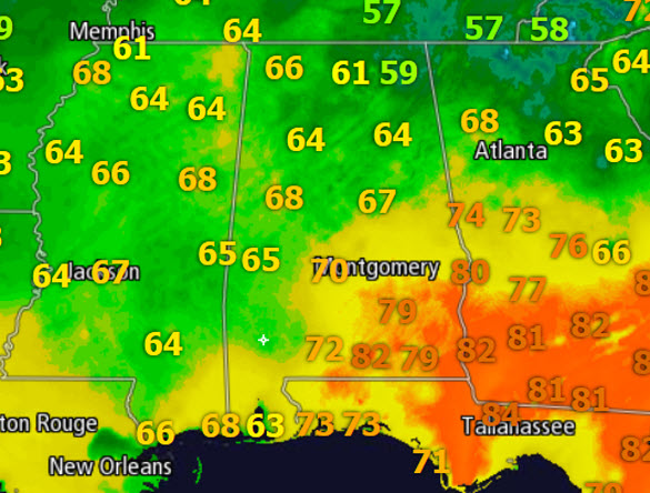
After the cold air damming/wedge provided cold easterly flow into the state yesterday, our winds have shifted out of the southwest and we are seeing warmer temps throughout the state today. Much of Central Alabama has temps in the mid to upper 60s this afternoon, while in South Alabama 70s and even some 80s are showing up. Warmer temps down south are a result of a sunny sky in those areas.
Heading into the overnight hours, we should slowly see the clouds decrease in coverage, but it does appear we will start our Sunday off with mainly cloudy conditions and areas of fog. We are expecting the sky to be clearing through the day, and by tomorrow afternoon, it appears that big orange ball of fire will finally show itself to all of us. We will start tomorrow off in the mid-50s for most locations, but we should rebound into the 70s for most locations in Central Alabama. It will certainly be a very nice end to the weekend!
Category: Alabama's Weather
About the Author (Author Profile)
Macon, Georgia Television Chief Meteorologist, Birmingham native, and long time Contributor on AlabamaWX. Stormchaser. I did not choose Weather, it chose Me. College Football Fanatic. @Ryan_StinnetSubscribe
If you enjoyed this article, subscribe to receive more just like it.


