

Cold Front Arrives Tomorrow Night
An all new edition of the ABC 33/40 Weather Xtreme video is available in the player on the right sidebar of the blog. You can subscribe to the Weather Xtreme video on iTunes by clicking here.
ACTIVE WEATHER TO THE WEST: Rather benign weather continues across Alabama today with a mix of sun and clouds and afternoon highs in the 70s. An isolated shower is not completely out of the question, but most places stay dry.
Severe storms are possible west of Alabama later today and tonight; SPC has an “enhanced” severe weather risk of parts of Oklahoma and Arkansas…
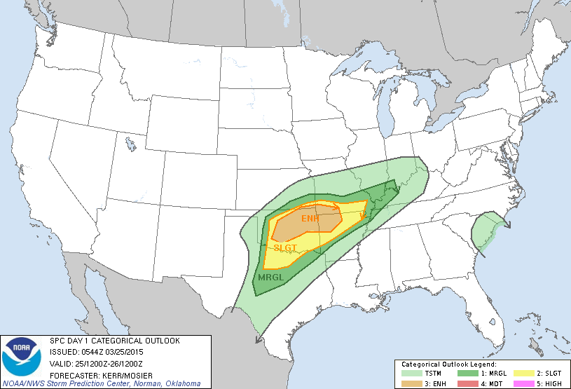
This is one of the new severe weather risk categories; it is between a “slight” and “moderate” risk.
COLD FRONT ARRIVES TOMORROW NIGHT: Clouds increase tomorrow, and showers are likely late in the day and tomorrow night as the cold front passes through. There could be some thunder, but there is no risk of organized severe weather. The main window for showers will come from about 5:00 p.m. tomorrow through 3:00 a.m. Sunday, and rain amounts will be under 1/2 inch.
COLDER AIR FRIDAY: Friday will be dry, but colder and blustery with a north wind of 12-22 mph. Temperatures won’t get past the mid 50s despite a decent amount of sunshine. And, by Saturday morning, temperatures will drop into the low 30s setting up the potential for a late season freeze.
Saturday will be dry but pretty chilly for late March; the GFS is printing a high of only 52 degrees for Birmingham… some North Alabama communities won’t get out of the 40s. Another freeze is possible early Sunday with a low back down in the low 30s.
Then, a warming trend begins Sunday afternoon with a good supply of sunshine and a high in the mid 60s.
NEXT WEEK: We warm into the low 70s Monday and Tuesday; a few isolated showers are possible on these days, but the weather will be generally dry. Then, a potent system could bring strong storms and heavy rain to Alabama at mid-week on Wednesday, and possibly into Thursday. Way too early to define a specific severe weather threat… see the Weather Xtreme video for maps, graphics, and more details.
WEATHER BRAINS: Don’t forget you can listen to our weekly 90 minute netcast anytime on the web, or on iTunes. This is the show all about weather featuring many familiar voices, including our meteorologists here at ABC 33/40.
CONNECT: You can find me on all of the major social networks…
Facebook
Twitter
Google Plus
Instagram
I have a weather program this morning at Hamilton Elementary School in Marion County… be looking for the next Weather Xtreme video here by 4:00 this afternoon. Enjoy the day!
Category: Alabama's Weather
About the Author (Author Profile)
James Spann is one of the most recognized and trusted television meteorologists in the industry. He holds the AMS CCM designation and television seals from the AMS and NWA. He is a past winner of the Broadcast Meteorologist of the Year from both professional organizations.Subscribe
If you enjoyed this article, subscribe to receive more just like it.


