Cold Front Moves In Tonight
An all new edition of the ABC 33/40 Weather Xtreme video is available in the player on the right sidebar of the blog. You can subscribe to the Weather Xtreme video on iTunes by clicking here.
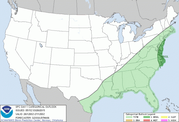
BIG CHANGES AHEAD: We will squeeze out one more mild day; temperatures will reach the mid to upper 70s this afternoon across the great state of Alabama. Clouds will increase during the day, and we could see a few showers this afternoon. The organized band of showers, and possibly a thunderstorm, along the cold front will pass through between 5:00 p.m. and 12:00 midnight. Despite the severe weather event yesterday in Oklahoma and Arkansas, no severe storms are expected in Alabama with marginal instability and weakening dynamics.
COLD AIR RETURNS: Tomorrow’s high will be only in the mid 50s, over 20 degrees colder than today, and well below the average high of 69 degrees for March 27. The sky will be partly sunny, and a north wind of 12-22 mph will make it feel colder.
THE ALABAMA WEEKEND: Temperatures will drop into the 30-35 degree range early Saturday. A freeze is possible, and some frost is likely across North/Central Alabama. Then, the day will be cool with a high in the low to mid 50s. The GFS is now back on the idea of an impulse riding down the back side of the upper trough over the eastern U.S., and suggests a little light rain is possible Saturday afternoon over the northern counties of the state. The airmass will be pretty dry, so rain amounts, if any, will be light and spotty. But I do think we need to insert that risk of a few raindrops.
Sunday morning will be cold with lows in the 30s, but a warm-up begins Sunday afternoon as temperatures rise into the mid 60s along with a good supply of sunshine.
NEXT WEEK: The warming trend continues Monday and Tuesday; we will mention a small risk of a shower Monday, with a better chance of scattered showers Tuesday. Then, a more significant storm system should bring a round of organized showers and storms by Wednesday night. Strong storms are possible, but it remains to seen if this will be a severe weather threat. See the Weather Xtreme video for maps, graphics, and more details.
WEATHER BRAINS: Don’t forget you can listen to our weekly 90 minute netcast anytime on the web, or on iTunes. This is the show all about weather featuring many familiar voices, including our meteorologists here at ABC 33/40.
CONNECT: You can find me on all of the major social networks…
Facebook
Twitter
Google Plus
Instagram
I have weather programs today at Paine Intermediate School in Trussville, and at McGuffey Health Care in Gadsden. Look for the next Weather Xtreme video here by 4:00 this afternoon… enjoy the day!
Category: Alabama's Weather


