

A Chilly Saturday
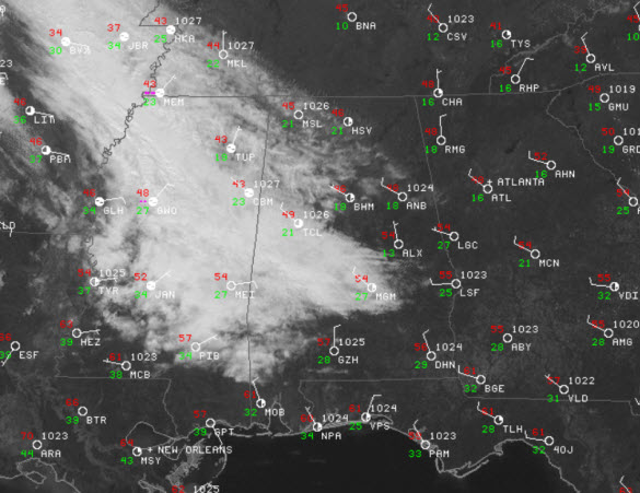
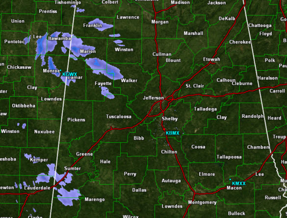
It is a cool day with most locations sitting in the upper 40s and lower 50s this afternoon. Northwesterly flow continues to keep it breezy as well. Most locations have seen plenty of sunshine today, but we are watching an area of clouds moving into and through West Alabama from the northwest. Within the clouds, there are a few very light showers, and some of these are showing up on the radar this afternoon over some of our northwestern counties and these showers should stay west of Interstate 65.
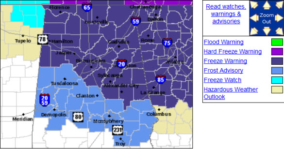
This feature will exit the region later tonight and we should see our sky clear once again. Much like last night, tonight it is going to be very cold for spring. Temperatures will fall below the freezing mark overnight. The NWS has issued a freeze warning for much of North-Central Alabama. This warning includes areas along and north of line from Sulligent, Fayette, Birmingham, Alabaster, Rockford, Alexander City, and LaFayette. South of this area, a frost advisory has been issued for areas around Demopolis, Tuscaloosa, Clanton, Montgomery, Troy, and Auburn. Take any precautions need to protect sensitive vegetation as temps are forecast to be in the 28-32F range by tomorrow morning.
Category: Alabama's Weather
About the Author (Author Profile)
Macon, Georgia Television Chief Meteorologist, Birmingham native, and long time Contributor on AlabamaWX. Stormchaser. I did not choose Weather, it chose Me. College Football Fanatic. @Ryan_StinnetSubscribe
If you enjoyed this article, subscribe to receive more just like it.


