

Early Afternoon Update
SEVERE WEATHER THREAT: The SPC maintains an “enhanced” risk for severe weather for much of Northwestern Alabama today roughly along and line from Reform to Cullman to Scottsboro. South of that, a “slight” risk extends just south of the Intestate 59 corridor from Livingston, Brent, Hoover, and Gadsden, with a “marginal” risk as far south as the Montgomery area.
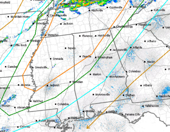
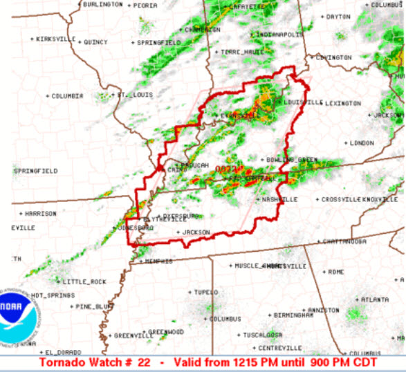
SET-UP: A very warm, moist, and unstable air mass is in place across the state today. A cold front across the Mississippi and Ohio Valleys is sinking towards the south and it is providing the needed uplift for storms. The main low pressure center with this system is well to the north in Canada. This is good news, because that means the best dynamics are displaced from the instability, however, there is still enough to allow for strong and severe storms. Early this afternoon, a tornado watch has already been issued for portions of Kentucky and Tennessee. We are expecting to see additional watches issued and that does include into Alabama the next several hours.
THREATS: The front will be arriving into the state later this evening, and we will have the uplift and instability to produce severe storms. Shear values are not overly impressive, so for us in Alabama, there is a very low tornado threat, but it is still not zero. The line of storms will move into the state, and we are expecting the threat of damaging winds as well as the possibility of large hail. The farther north you go, the greater the threat for severe weather, and the storms will be stronger over the Tennessee Valley of the state. Expect frequent lightning and very heavy rainfall with these storms that develop today.
TIMING: A quick look at the radar this afternoon shows the main area of storms remains well to the north of Alabama. However, we are expecting to see additional convection develop along the Mississippi River and begin to head towards the south and east. We could see a few storms develop out ahead of the main line, and these will have to be watched carefully. We are expecting the line of storms to enter northwestern portions of the state around 5PM. The storms will continue to work their way towards the southeast during the early evening hours and should be approaching the Interstate 59 corridor closer to 9PM. The main action will arrive after the sunsets, so make sure you stay weather aware this evening, to about midnight. As the storms continue to move towards the southeast, they will be slowly weakening and the threat for severe storms will be diminishing the farther south you head.
Category: Alabama's Weather, Severe Weather
About the Author (Author Profile)
Macon, Georgia Television Chief Meteorologist, Birmingham native, and long time Contributor on AlabamaWX. Stormchaser. I did not choose Weather, it chose Me. College Football Fanatic. @Ryan_StinnetSubscribe
If you enjoyed this article, subscribe to receive more just like it.


