

Severe Thunderstorm Warning for Marion County
Click to enlarge image
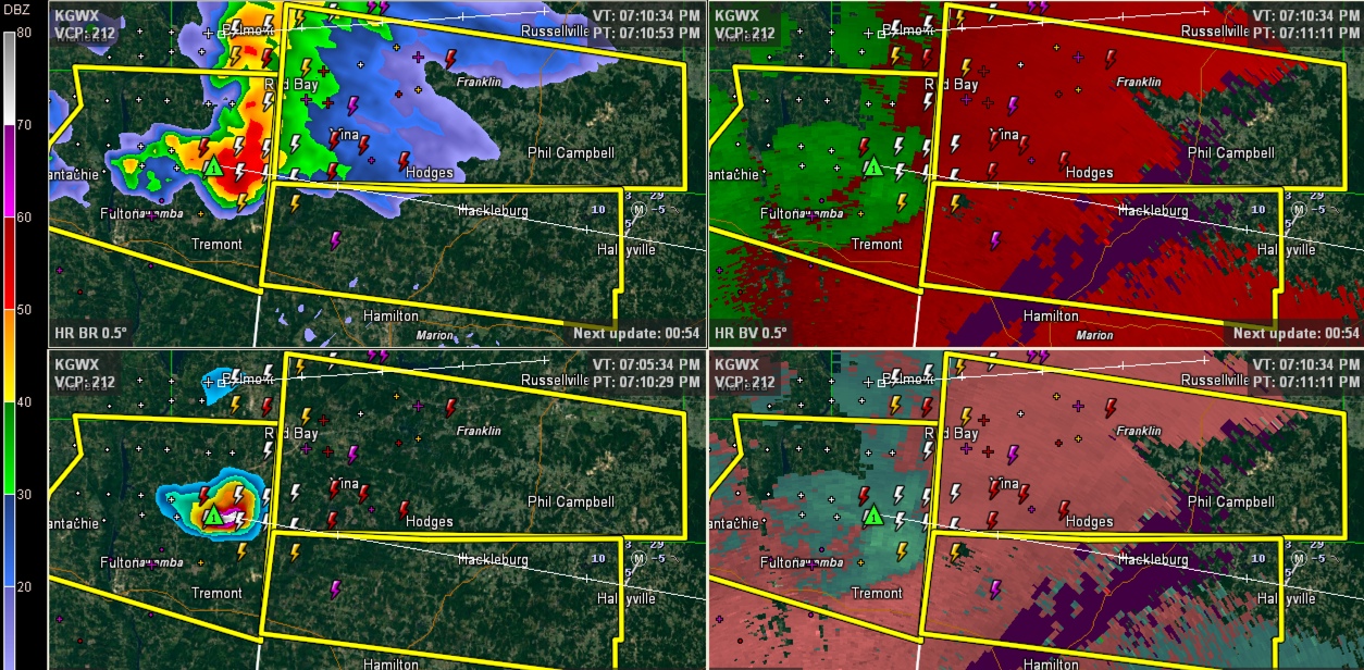
This four panel radar image from the Columbus radar shows the intense storm in NE Mississippi that will be moving into Franklin and Marion Counties shortly.
A hail core with the potential to produce one inch hail will move generally along the Franklin/Marion County line in the general direction of Hackleburg.
There is a small amount of low level helicity (<150 m2/s2), so we can’t rule out a tornado, but the main threat will be damaging winds.
THE NATIONAL WEATHER SERVICE IN BIRMINGHAM HAS ISSUED A
* SEVERE THUNDERSTORM WARNING FOR…
NORTHERN MARION COUNTY IN NORTHWESTERN ALABAMA…
* UNTIL 815 PM CDT
* AT 710 PM CDT…A SEVERE THUNDERSTORM WAS LOCATED NEAR TREMONT…OR
9 MILES SOUTHWEST OF RED BAY…MOVING EAST AT 50 MPH.
HAZARD…60 MPH WIND GUSTS AND QUARTER SIZE HAIL.
SOURCE…RADAR INDICATED.
IMPACT…HAIL DAMAGE TO VEHICLES IS EXPECTED. EXPECT WIND DAMAGE
TO ROOFS…SIDING AND TREES.
* LOCATIONS IMPACTED INCLUDE…
HALEYVILLE…HACKLEBURG…BRINN…BEAR CREEK…PIGEYE…BEXAR…
UPPER BEAR CREEK RESERVOIR…TESSNER AND SHOTTSVILLE.
Category: Alabama's Weather
About the Author (Author Profile)
Subscribe
If you enjoyed this article, subscribe to receive more just like it.


