

Storms Perhaps a Little Weaker
Strong thunderstorms continue across North and West Central Alabama tonight ahead of a cold front.
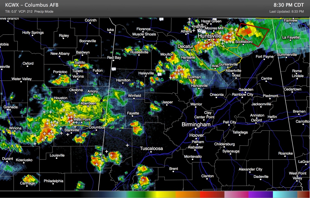
There are severe thunderstorm warnings across the Tennessee Valley of North Alabama across eastern Madison and Jackson Counties. One strong cell with a possible hook echo is near Hytop, the radar site northeast of Huntsville. The NWS Huntsville just issued a tornado warning for parts of Jackson County.
Strong, but not severe storms are over eastern Winston and western Cullman Counties.
Scattered storms are across Marion, the rest of Winston, Fayette, Walker, Tuscaloosa, Lamar and Pickens Counties.
In eastern Mississippi, severe thunderstorm warnings are in effect around West Point. This storm will pass near Columbus on its way toward Pickens and Lamar Counties.
The better shear is now lifting out to the northeast, but there is still sufficient shear and instability (500-1,000 j/kg) ahead of the storms for them to hold together, but hopefully a slow weakening trend will continue. There is the chance some of them will still become severe though, with damaging winds the main threat.
Category: Alabama's Weather, Severe Weather
About the Author (Author Profile)
Bill Murray is the President of The Weather Factory. He is the site's official weather historian and a weekend forecaster. He also anchors the site's severe weather coverage. Bill Murray is the proud holder of National Weather Association Digital Seal #0001 @wxhistorianSubscribe
If you enjoyed this article, subscribe to receive more just like it.


