

Warm Afternoons; Only Isolated Showers
An all new edition of the ABC 33/40 Weather Xtreme video is available in the player on the right sidebar of the blog. You can subscribe to the Weather Xtreme video on iTunes by clicking here.
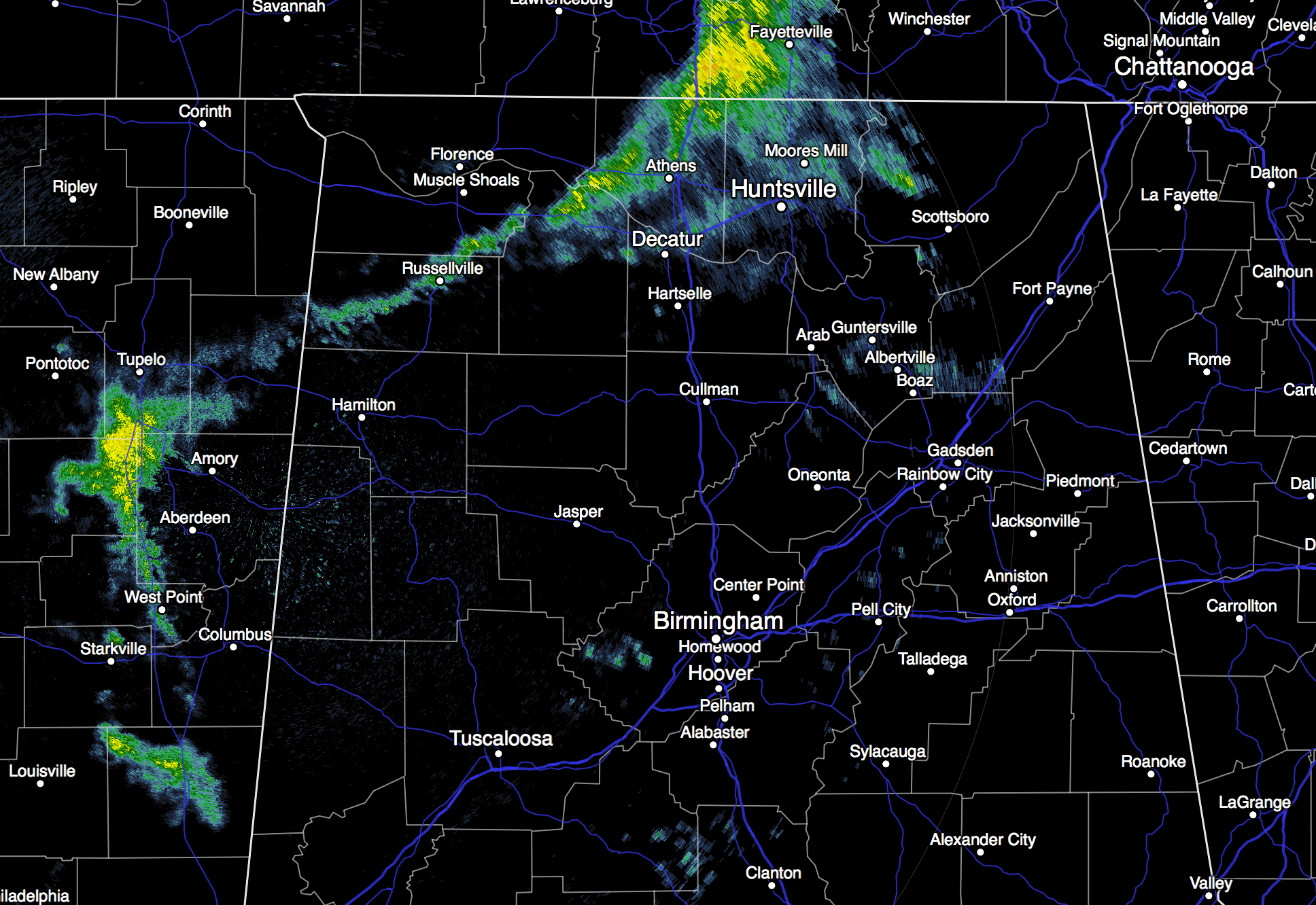
RADAR CHECK: As expected the weather is pretty quiet across the great state of Alabama this afternoon… only a few isolated showers are on radar up over the Tennessee Valley; most of the state is dry. Temperatures are in the 77 to 81 degree range.
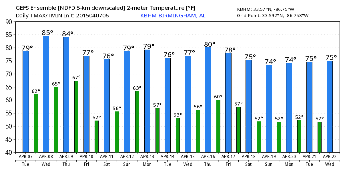
TOMORROW/THURSDAY: Not much overall change on these two days; we project highs between 81 and 84 degrees both days with a mix of sun and clouds; the chance of rain is not zero, but most communities will stay dry. Chance of any one community getting wet tomorrow is 10 percent, and 20 percent Thursday afternoon, and any showers or storms will come during the afternoon and evening hours, when the air is most unstable.
TO THE NORTHWEST: The guys at SPC has “enhanced” severe weather risks defined tomorrow and Thursday for a broad zone from Oklahoma to Illinois; a deepening surface low will run from the plains of Colorado to the Great Lakes with good support from an upper trough to the west. A few tornadoes will be possible in this region, along with storms producing hail and damaging straight line winds.
COLD FRONT MOVES IN FRIDAY: Showers and storms will increase statewide Friday as a cold front pushes into the state. The main dynamic support will pass well north of Alabama, and with marginal instability, weak wind fields, and very little bulk shear we don’t expect any severe weather issues. Rain amounts of around 1/2 inch are likely.
THE ALABAMA WEEKEND: Getting better model agreement on the resting place of the surface front… it will stop a little south of U.S. 80 (south of a line from Demopolis to Selma to Montgomery to Opelika). This means the northern half of Alabama should be dry Saturday with a bit of filtered sunshine with a high in the mid to upper 70s. Showers will remain possible Saturday over the southern third of Alabama.
Then, on Sunday, the front lifts northward, and we will mention a chance of showers statewide. The 12Z run of the GFS suggests rain Sunday won’t be especially heavy or widespread, but no doubt it could rain a few times during the day, with a high in the 77-80 degree range.
NEXT WEEK: Showers and storms remain possible Monday, and there seems to be a setup for severe weather west of Alabama around the Ark-La-Tex region. But, dynamic support weakens as the wave lifts northeast, and for now the severe weather risk here looks low, although showers and thunderstorms could linger into Tuesday. See the Weather Xtreme video for maps, graphics, and more details.
WEATHER BRAINS: Don’t forget you can listen to our weekly 90 minute netcast anytime on the web, or on iTunes. This is the show all about weather featuring many familiar voices, including our meteorologists here at ABC 33/40.
CONNECT: You can find me on all of the major social networks…
Facebook
Twitter
Google Plus
Instagram
I enjoyed seeing the kindergarten kids today at Alberta Elementary in Tuscaloosa… and their new school building looks fantastic. Be looking for them on the Pepsi KIDCAM today at 5:00 on ABC 33/40 News! The next Weather Xtreme video will be posted here by 7:00 a.m. tomorrow…
Category: Alabama's Weather
About the Author (Author Profile)
James Spann is one of the most recognized and trusted television meteorologists in the industry. He holds the AMS CCM designation and television seals from the AMS and NWA. He is a past winner of the Broadcast Meteorologist of the Year from both professional organizations.Subscribe
If you enjoyed this article, subscribe to receive more just like it.


