

Watching Developments To The Northwest
A major tornado moved through Rochelle, IL this evening… part of a wide area of strong to severe storms from the Great Lakes to Texas…
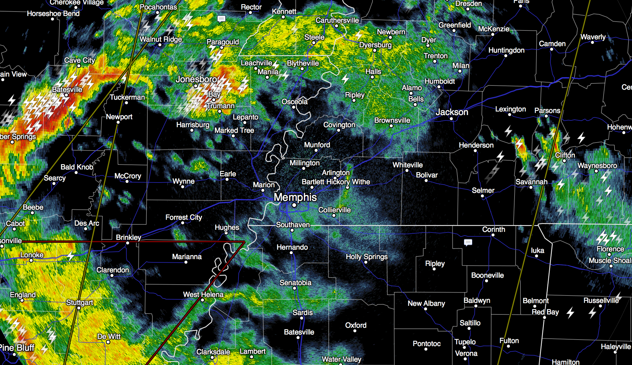
Strong storms are over Arkansas and West Tennessee… and those are moving in our direction…
A severe thunderstorm watch is up for much of North Mississippi, but no watches are in effect for any part of Alabama at this point. The high resolution HRRR model shows the storms moving into the northwest corner of Alabama between 1:00 and 2:00 a.m.
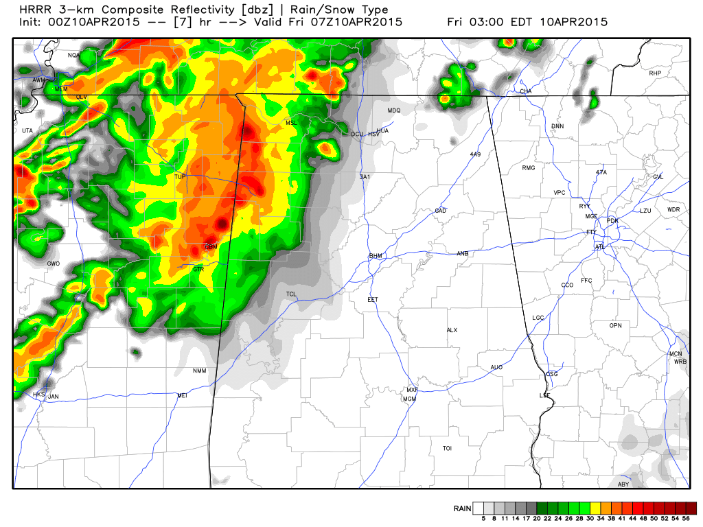
The storms will be strong as they move into the northwest corner of Alabama, with potential for some hail and strong gusty winds. But, with the main dynamics lifting our to the northeast, and weakening wind fields, the storms should weaken as they move south during the pre-dawn hours, and the severe weather threat is low for places like Birmingham, Tuscaloosa, Anniston, and Gadsden.
Storms could intensify again tomorrow afternoon over South Alabama, but the tornado threat looks very low… main issues could be from hail and gusty winds. Drier air rolls into the state tomorrow night, and the weekend will be dry and pleasant. We will watch radar trends closely overnight as the storms get closer.
Category: Alabama's Weather
About the Author (Author Profile)
James Spann is one of the most recognized and trusted television meteorologists in the industry. He holds the AMS CCM designation and television seals from the AMS and NWA. He is a past winner of the Broadcast Meteorologist of the Year from both professional organizations.Subscribe
If you enjoyed this article, subscribe to receive more just like it.


