Rain Dead Ahead
An active southern branch of the jetstream will bring heavy rainfall to Central Alabama over the next ten days. In fact, some model data indicates that we may deal with as much as 5-10 inches of rain during the period.
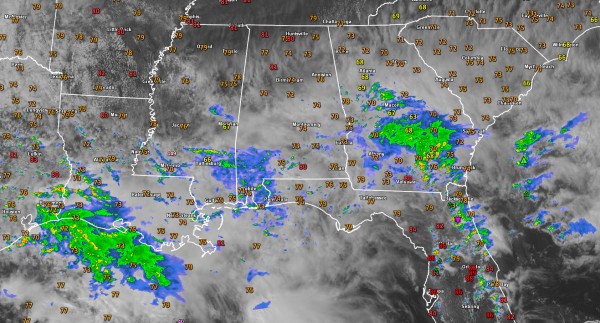
That rain will begin later this afternoon across Central Alabama as scattered light showers and increase in coverage and intensity overnight. There could be a few embedded thunderstorms as well.
This afternoon, high clouds are overspreading the southeastern two thirds of the area, associated with a moist upper flow out of the southwest.
Where there are clouds, temperatures are in the lower and middle 70s.
Over Northwest Alabama, where more sunshine is prevalent, temperatures are in the upper 70s to near 80F.
A few light showers are drifting northward across eastern Mississippi and East Central Alabama. We will see those increasing in coming hours.
Further south and southwest, more widespread showers are moving across southeastern Mississippi and Southwest Alabama. Even heavier and more widespread ones are spreading northeast into Louisiana.
Category: Alabama's Weather


