

Wet Is The Word
An all new edition of the ABC 33/40 Weather Xtreme video is available in the player on the right sidebar of the blog. You can subscribe to the Weather Xtreme video on iTunes by clicking here.
RADAR CHECK: Rain is falling this morning across much of North/Central Alabama, and we expect rain to continue at times through tonight. While a thunderstorm is possible, severe weather is not expected, and the high should be in the mid 70s this afternoon.
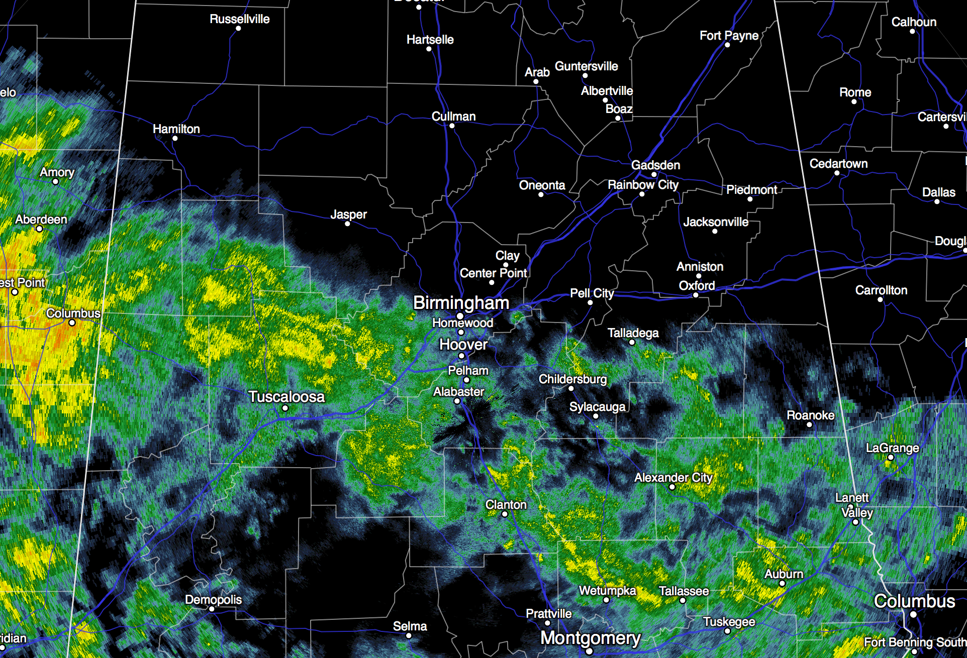
We should mention a flash flood watch is in effect for the Gulf Coast today, including places like New Orleans, Mobile, Gulf Shores, Pensacola, and Panama City. One report was received this morning of 9.47″ during the past 24 hours in Mobile just off Girby Road.
TOMORROW: The latest high resolution NAM model (06Z) is actually suggesting that a decent part of the day tomorrow could be dry, but we will still mention the risk of a few showers during the day with a cloudy sky; rain will then increase tomorrow night with the next wave approaching from the west.
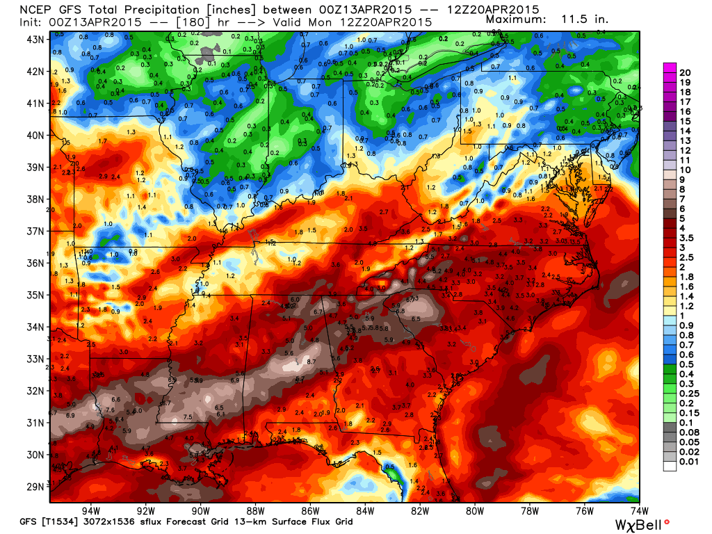
WEDNESDAY THROUGH FRIDAY: The wet pattern continues. There will be some decent breaks in the rain along the way, but rain could come at any hour of the day or night. And, while thunderstorms remain possible, severe storms are not expected. Rain totals between now and Friday are expected to be in the 3 to 5 inch range for most of Alabama, and we could be dealing with some flash flooding issues later this week with the ground becoming saturated.
THE ALABAMA WEEKEND: Still cloudy and wet at times. Seems like the wettest day will be Saturday, with showers thinning out a bit Sunday as a surface low moves northeast of Alabama. Afternoon highs will remain in the 70s, right at seasonal averages for mid-April.
Interesting to note the GFS model is suggesting parts of Central Alabama could see over 8 inches of rain over the next seven days…
NEXT WEEK: A large upper trough is forecast to form over the eastern half of the U.S… this should keep temperatures below average for a decent part of the week meaning no severe weather issues. A few showers are possible early in the week, but next week won’t be as wet as this week. See the Weather Xtreme video for maps, graphics, and more details.

WEATHER BRAINS: Don’t forget you can listen to our weekly 90 minute netcast anytime on the web, or on iTunes. This is the show all about weather featuring many familiar voices, including our meteorologists here at ABC 33/40. We will produce this week’s show tonight at 8:30 CT… you can watch it on “James Spann 24/7” on cable systems around the state, or on the web here.
CONNECT: You can find me on all of the major social networks…
Facebook
Twitter
Google Plus
Instagram
I have weather programs today at Coldwater Elementary in Calhoun County… and Oliver Elementary in Birmingham. Look for the next Weather Xtreme video here by 4:00 this afternoon… enjoy the day!
Category: Alabama's Weather
About the Author (Author Profile)
James Spann is one of the most recognized and trusted television meteorologists in the industry. He holds the AMS CCM designation and television seals from the AMS and NWA. He is a past winner of the Broadcast Meteorologist of the Year from both professional organizations.Subscribe
If you enjoyed this article, subscribe to receive more just like it.


