

A Blanket Of Moist Air Over Alabama
An all new edition of the ABC 33/40 Weather Xtreme video is available in the player on the right sidebar of the blog. You can subscribe to the Weather Xtreme video on iTunes by clicking here.
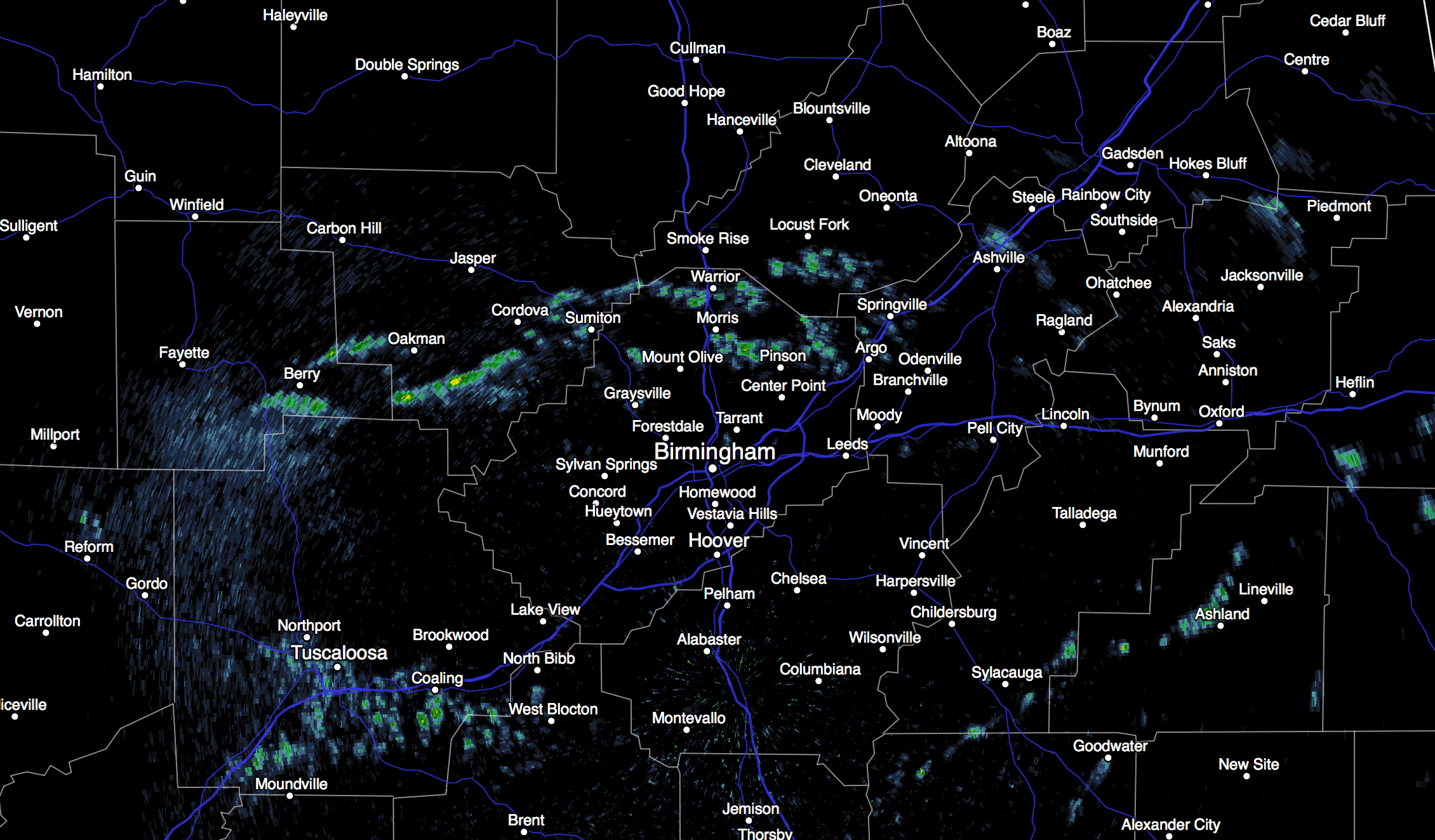
RADAR CHECK: We have a few patches of light rain on radar early this morning just north of Birmingham; the rest of the state is dry.
The sky is cloudy, and temperatures are in the 60s. Today will be another mostly cloudy day, but I really don’t expect too much rain over the next 5-8 hours. Showers are possible, but they should be fairly widely spaced… temperatures reach the mid to upper 70s this afternoon.
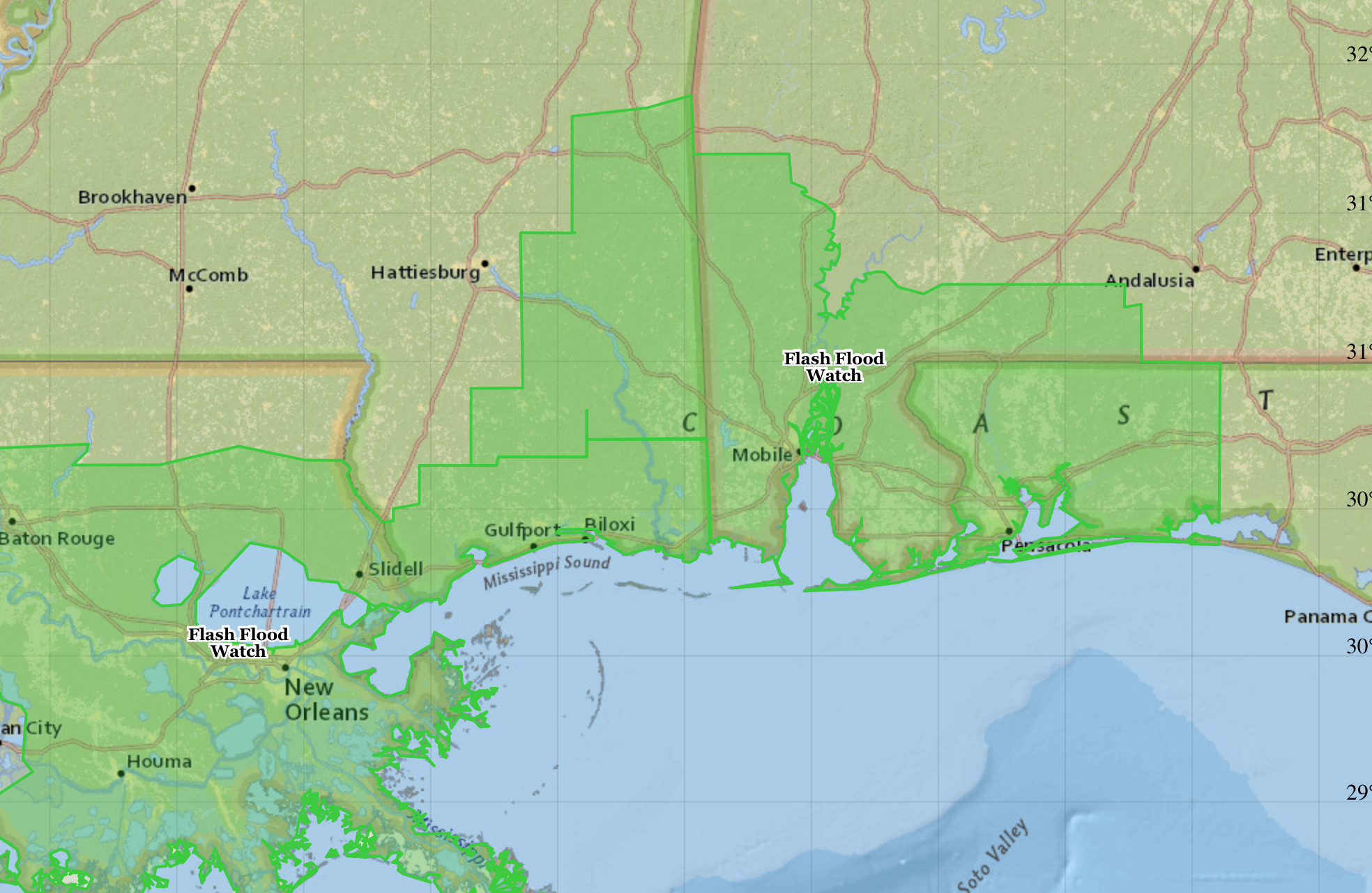
But, rain and storms will increase tonight with short wave energy moving in from the west. SPC has a “marginal” severe weather risk in place for the southern half of Alabama since a few storms could produce small hail and gusty winds, but the main threat for South Alabama continue to be from flooding; a flash flood watch remains in effect for places like New Orleans, Mobile, Gulf Shores, Pensacola, and Fort Walton Beach.
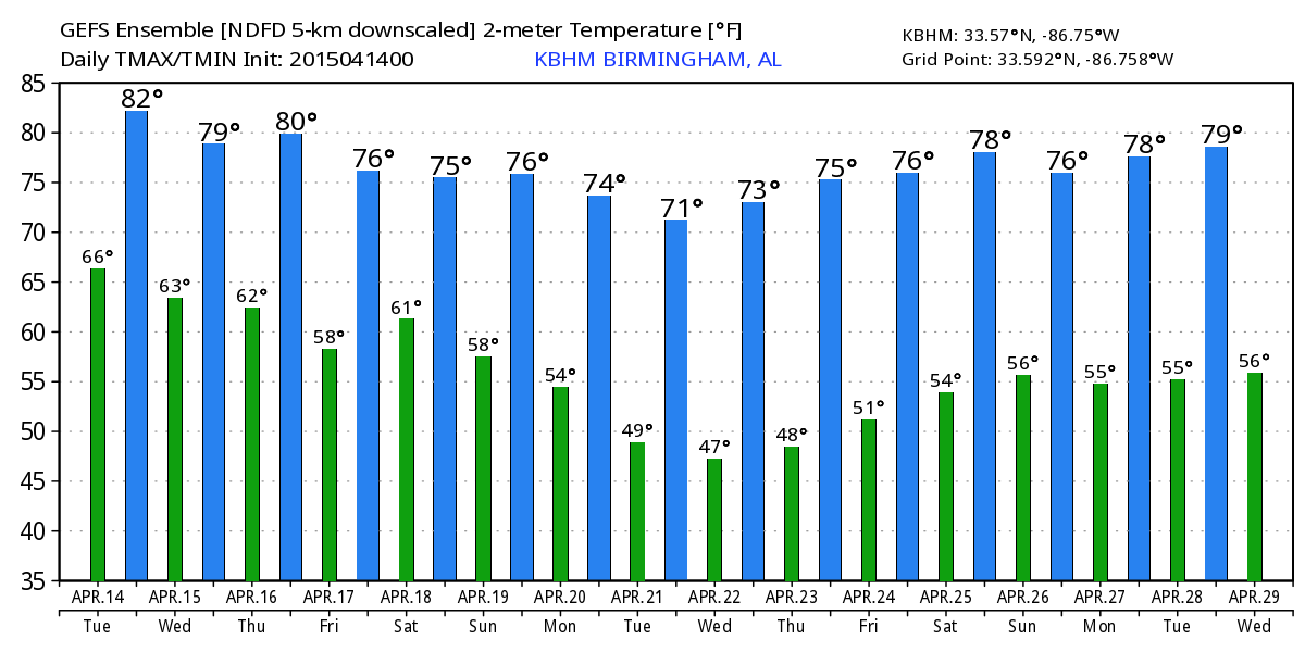
TOMORROW THROUGH FRIDAY: A wet pattern continues. Understand it won’t rain every minute of every day, but on all three days expect periods of rain and a few thunderstorms. The rain could come at any hour of the day and night, but on the positive side severe weather is not expected to be an issue. A cold air damming (CAD) pattern could send cooler air into East Alabama Thursday and Friday… on these days highs in places like Cedar Bluff, Heflin, and Wedowee could drop into the low to mid 60s, while West Alabama sees a high in the upper 70s.
THE ALABAMA WEEKEND: Not much change on Saturday. A vertically stacked low is expected to be near Oklahoma City, and an axis of higher moisture remains over Alabama. We project occasional showers and thunderstorms, and a few strong storms are certainly possible with this kind of setup with a decent amount of instability forecast (surface based CAPE values around 2,000 j/kg). But, bulk shear values look low and for now the overall severe weather threat isn’t too impressive.
The low lifts northeast Sunday and begins to fill, but we will need to hang on to the risk of a few passing showers or storms. Again, a few strong storms will be possible as the low moves northwest of the state; we will keep an eye on parameters. Highs over the weekend will be in the 77-80 degree range.
Additional five day rain totals for the northern half of Alabama are projected to be in the 3-4″ range… we will need to watch for flash flooding issues later this week and over the weekend.
NEXT WEEK: The weather trends drier with cooler nights as an upper trough sets up over the eastern half of the nation. Early morning lows will drop into the 40s by Tuesday and Wednesday morning, with highs around 70 degrees. For now it looks like a decent part of the week will be rain-free, giving us a needed chance to dry out. See the Weather Xtreme video for maps, graphics, and more details.
WEATHER BRAINS: Don’t forget you can listen to our weekly 90 minute netcast anytime on the web, or on iTunes. This is the show all about weather featuring many familiar voices, including our meteorologists here at ABC 33/40. Scroll down for the show notes on the new episode we recorded last night.
CONNECT: You can find me on all of the major social networks…
Facebook
Twitter
Google Plus
Instagram
I have a weather program this morning at Alexandria Elementary School in Calhoun County… look for the next Weather Xtreme video here by 4:00 this afternoon. Enjoy the day!
Category: Alabama's Weather
About the Author (Author Profile)
James Spann is one of the most recognized and trusted television meteorologists in the industry. He holds the AMS CCM designation and television seals from the AMS and NWA. He is a past winner of the Broadcast Meteorologist of the Year from both professional organizations.Subscribe
If you enjoyed this article, subscribe to receive more just like it.


