

Scattered Showers/Storms Today
An all new edition of the ABC 33/40 Weather Xtreme video is available in the player on the right sidebar of the blog. You can subscribe to the Weather Xtreme video on iTunes by clicking here.
AT DAYBREAK: Scattered showers are in progress early this morning primarily east of I-65, but clouds cover the entire state with temperatures in the 60s.
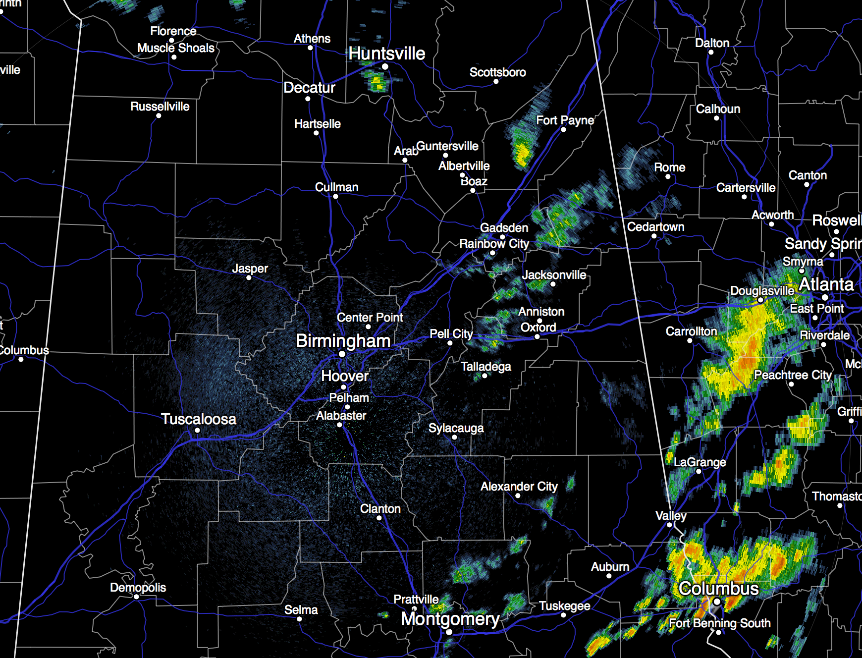
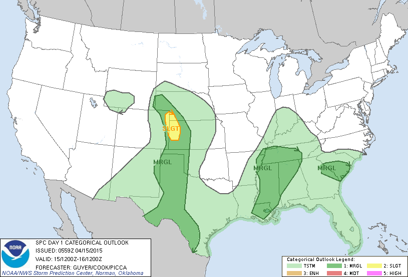
The blanket of moist air goes nowhere, but the dynamic forcing is somewhat limited today, meaning showers and storms are certainly possible, but they will be more scattered in nature, and mostly during the afternoon and evening hours. The chance of any one spot getting wet today is in the 50 percent category, and a few strong storms could pop up. We note SPC has a pretty good part of North and West Alabama in a “marginal” severe weather risk… if temperatures can rise into the 77-80 degree range this afternoon the stronger storms will be capable of producing small hail and gusty winds. But, a decent part of today will be dry if you need to get something done outdoors.
TOMORROW/FRIDAY: Occasional showers and storms remain likely both days. Tomorrow will be cooler over East Alabama thanks to a cold air damming (CAD) setup; communities east of Birmingham won’t get out of the 60s. We stress the rain won’t be continuous, and you might see a brief glimpse of the sun at times. And, no threat of severe weather or tornadoes. Just a wet, unsettled weather pattern.
THE ALABAMA WEEKEND: It would be nice to forecast a sunny pair of days, but that won’t happen as the moist air hangs over Alabama. Saturday and Sunday will be mostly cloudy with a few passing showers and thunderstorms both days. As an upper trough approaches, we could see a few strong storms Sunday with potential for hail and gusty winds, but the overall severe weather threat looks limited.
Impossible to give you specific start/stop times of the rain in a pattern like this for any one given location, but just understand the rain could come at any hour of the day or night. Highs over the weekend will remain in the 70s.
Additional rain amounts of 2 to 3 inches are likely between now and Sunday, but flash flooding is not expected across the northern half of the state. We do note that Mobile, Baldwin, Escambia, and Washington counties in far Southwest Alabama remain under a flash flood watch today.
NEXT WEEK: Global models are trending slower with the progression of the upper trough, and it looks like we will need to hang on to a chance of showers and thunderstorms Monday, but finally we get into a nice dry continental airmass Tuesday and Wednesday with a good supply of sunshine both days along with cooler mornings and lower humidity. See the Weather Xtreme video for maps, graphics, and more details.
WEATHER BRAINS: Don’t forget you can listen to our weekly 90 minute netcast anytime on the web, or on iTunes. This is the show all about weather featuring many familiar voices, including our meteorologists here at ABC 33/40.
CONNECT: You can find me on all of the major social networks…
Facebook
Twitter
Google Plus
Instagram
I have a weather program today at Hueytown Elementary School… be looking for the next Weather Xtreme video here by 4:00 this afternoon. Enjoy the day!
Category: Alabama's Weather
About the Author (Author Profile)
James Spann is one of the most recognized and trusted television meteorologists in the industry. He holds the AMS CCM designation and television seals from the AMS and NWA. He is a past winner of the Broadcast Meteorologist of the Year from both professional organizations.Subscribe
If you enjoyed this article, subscribe to receive more just like it.


