

Severe Thunderstorm Watch Issued for Alabama
BULLETIN – IMMEDIATE BROADCAST REQUESTED
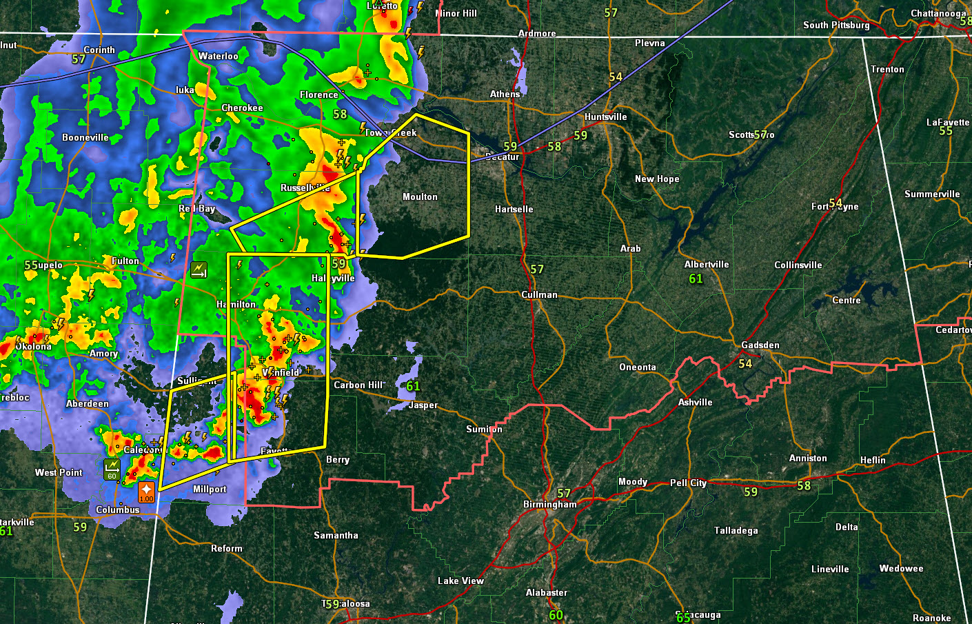
SEVERE THUNDERSTORM WATCH OUTLINE UPDATE FOR WS 85
NWS STORM PREDICTION CENTER NORMAN OK
110 AM CDT MON APR 20 2015
SEVERE THUNDERSTORM WATCH 85 IS IN EFFECT UNTIL 700 AM CDT
FOR THE FOLLOWING LOCATIONS
. ALABAMA COUNTIES INCLUDED ARE
BLOUNT CHEROKEE COLBERT
CULLMAN DEKALB ETOWAH
FAYETTE FRANKLIN JACKSON
LAUDERDALE LAWRENCE LIMESTONE
MADISON MARION MARSHALL
MORGAN WALKER WINSTON https://www.jamesspann.com/wordpress/wp-admin/media-upload.php?post_id=90623&type=image&TB_iframe=1
Category: Alabama's Weather, Severe Weather
About the Author (Author Profile)
Bill Murray is the President of The Weather Factory. He is the site's official weather historian and a weekend forecaster. He also anchors the site's severe weather coverage. Bill Murray is the proud holder of National Weather Association Digital Seal #0001 @wxhistorianSubscribe
If you enjoyed this article, subscribe to receive more just like it.


