

Calmer Weather For Alabama Today
STORMS ARE OUT OF HERE: The batch of noisy, pre-dawn thunderstorms that moved through North Alabama is over into Northeast Georgia, and moving away from us. Thankfully there were very few reports of wind damage early this morning in our state, and the day ahead will be much calmer than the past 48 hours.
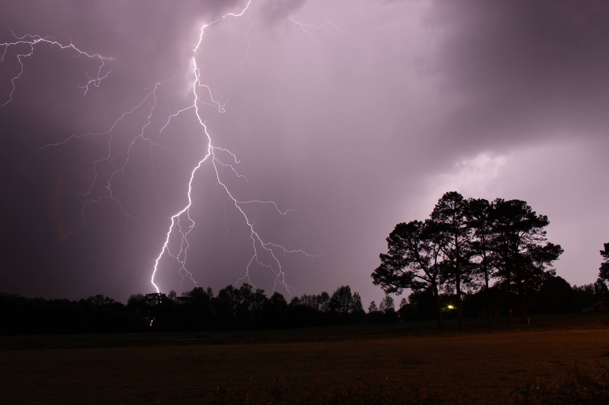
This lightning photo from early this morning was taken at Snead, in Blount County, by Jake King…
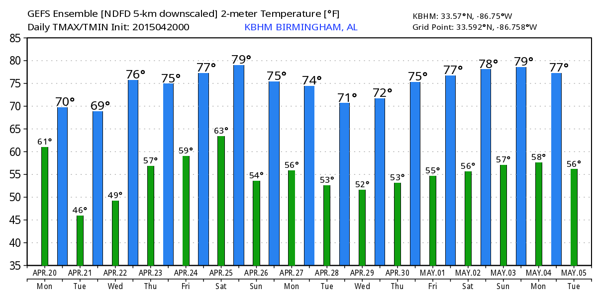
We expect a mix of sun and clouds today, and this afternoon we will mention just the risk of isolated showers as the upper trough axis passes overhead. Most of the moisture is gone, so any rain will be light and spotty, and many communities will be dry today. The high will be in the low to mid 70s this afternoon.
Tomorrow promises to be a beautiful day with low humidity and a cool morning. We begin with an early morning low in the mid 40s, then we climb into the low 70s with sunshine in full supply.
MOISTURE RETURNS WEDNESDAY: Wednesday looks like a partly sunny day, and we will mention the risk of a few afternoon showers as moisture begins to return. Showers and storms become more likely Thursday and Friday ahead of another upper trough lifting out of the Southwest U.S. Highs will remain in the 70s.
STRONG STORMS? A surface low is forecast to be northwest of Alabama by Friday night, and the GFS is hinting that strong, possibly severe storms could be an issue Friday night into Saturday morning with decent upper support. Really too early to define the specific risk.
THE WEEKEND: The forecast for Saturday is low confidence due to model madness. The GFS hints the rain will be gone by midday Saturday, but the European model (ECMWF) keeps a chance of showers and storms through the day. We should have better clarity in coming days, but for now we will lean toward the wetter ECMWF solution and keep rain in the forecast. But, Sunday looks very nice with ample sunshine and lower humidity levels. Saturday’s high will be in the 77-80 degree range, but back in the low 70s Sunday.
RAIN UPDATE: Birmingham’s rain total for the year is 20.41″, and the surplus is 2.98″. The total so far for the month of April is 7.48″. FYI… this is not close to a record… our wettest April on record was in 1979 when we recorded 13.79″ for the month.
WEATHER BRAINS: Don’t forget you can listen to our weekly 90 minute netcast anytime on the web, or on iTunes. This is the show all about weather featuring many familiar voices, including our meteorologists here at ABC 33/40. We will produce this week’s episode tonight at 8:30 CT… you can watch it on “James Spann 24/7” on cable systems around the state, or on the web here.
CONNECT: You can find me on all of the major social networks…
Facebook
Twitter
Google Plus
Instagram
I have a weather program this morning at St. Clair County High School in Odenville… be looking for the next Weather Xtreme video here by 4:00 this afternoon. Enjoy the day!
Category: Alabama's Weather
About the Author (Author Profile)
James Spann is one of the most recognized and trusted television meteorologists in the industry. He holds the AMS CCM designation and television seals from the AMS and NWA. He is a past winner of the Broadcast Meteorologist of the Year from both professional organizations.Subscribe
If you enjoyed this article, subscribe to receive more just like it.


