

Severe Storms Possible Saturday
THIS AFTERNOON: Lingering patches of light rain across Central Alabama will end soon, and the sky becomes mostly fair late tonight. As expected, temperatures are noticeably cooler across the northern half of the state today; in fact some spots are barely out of the 50s at mid-afternoon.
TOMORROW: Most of the day tomorrow will be dry; with a mix of sun and clouds we project a high in the mid 70s… just a small risk of afternoon shower. Then, tomorrow night, rain and storms will increase from the south as a warm front lifts northward. The latest high resolution NAM is now suggesting the best chance of rain holds off until after midnight tomorrow night, so while we sure can’t make any promises, you might get a baseball or softball game in tomorrow evening before the big rain comes.
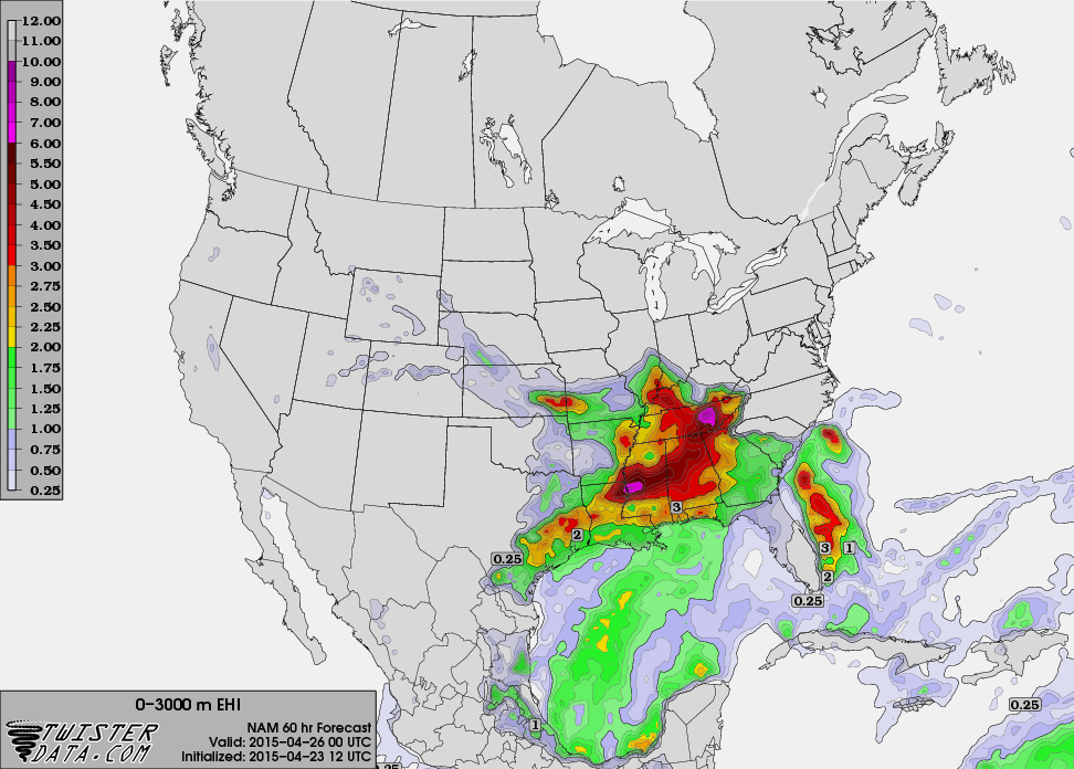
SEVERE WEATHER POTENTIAL SATURDAY: A deep surface low will be over Missouri Saturday, supported by an upper trough lifting out of the Southwest U.S. Surface based instability values are now projected to rise to near 3,000 j/kg over West Alabama late Saturday afternoon, the most unstable values we have seen so far in 2015. The low level jet (around 5,000 feet) is expected to be in the 40 knot range, and there is a significant amount of speed and directional shear.
The NAM is suggesting EHI (Energy Helicity Index) values in the 3-5 unit range late Saturday afternoon over the northern third of Alabama.
Some thoughts on the day:
*Storms could be in progress early Saturday morning, but only a marginal severe weather risk with those.
*There is a good chance we will have several hours of rain-free conditions Saturday, and the sun should be out at times pushing afternoon temperatures up into the low 80s (maybe even mid 80s over West Alabama).
*Storms should begin to develop during the peak of the daytime heating process Saturday afternoon, and those will be the ones with the highest severe weather potential.
*All modes of severe weather will be possible, including hail, damaging straight line winds, and a few tornadoes.
*The severe weather threat will end around midnight Saturday night as drier air begins to push in from the west.
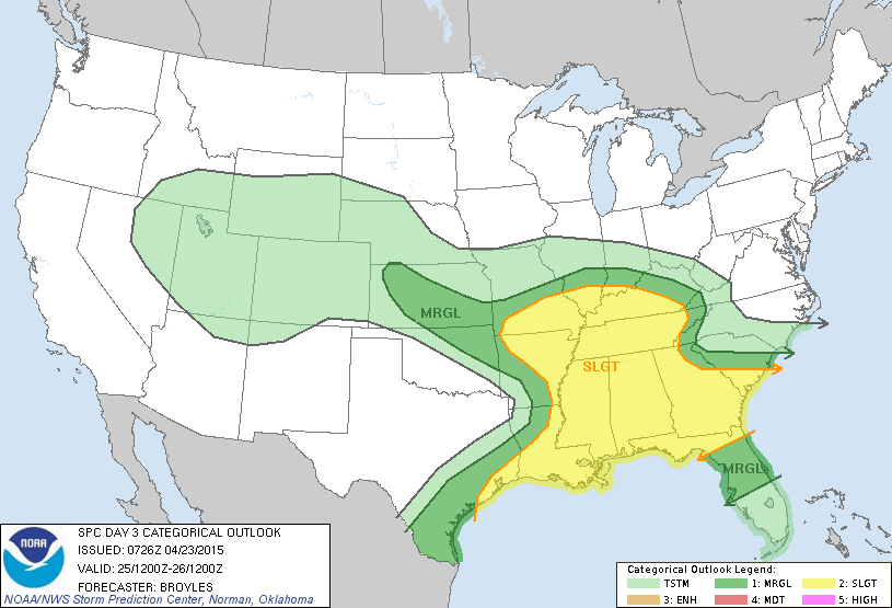
The Storm Prediction Center has all of Alabama in the standard “slight” risk of severe weather for Saturday.
SUNDAY/MONDAY: These two days will be dry and pleasant, with a high in the 77-82 degree range and a partly sunny sky both days.
TUESDAY/WEDNESDAY: The good news is that we are getting good model consistency in the idea of a surface low passing through South Alabama, meaning little if any severe weather issues for the northern half of the state on these two days. But, periods of rain and a few thunderstorms are likely, and the rain could be heavy at times. The high Tuesday will be in the 70s, but will drop into the 60s Wednesday.
See the Weather Xtreme video for maps, graphics, and more details.
WEATHER BRAINS: Don’t forget you can listen to our weekly 90 minute netcast anytime on the web, or on iTunes. This is the show all about weather featuring many familiar voices, including our meteorologists here at ABC 33/40.
CONNECT: You can find me on all of the major social networks…
Facebook
Twitter
Google Plus
Instagram
I had a great time today visiting with the students at Whitesboro Elementary School in Etowah County… be looking for them on the Pepsi KIDCAM today at 5:00 on ABC 33/40 News! The next Weather Xtreme video will be posted here by 7:00 a.m. tomorrow…
Category: Alabama's Weather
About the Author (Author Profile)
James Spann is one of the most recognized and trusted television meteorologists in the industry. He holds the AMS CCM designation and television seals from the AMS and NWA. He is a past winner of the Broadcast Meteorologist of the Year from both professional organizations.Subscribe
If you enjoyed this article, subscribe to receive more just like it.


