

Strong Thunderstorms Across Central Alabama
Click image to enlarge
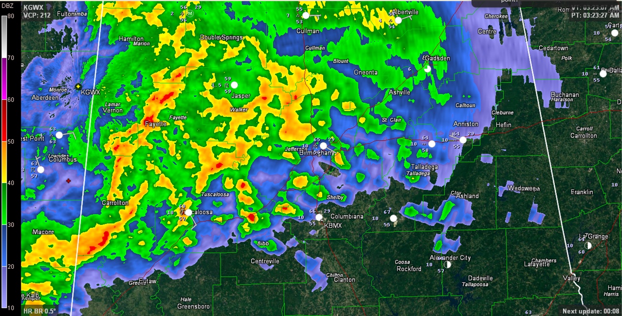
Strong thunderstorms cover much of North Central Alabama this morning along and north of I-20.
The strongest storm is moving into Pickens County at this time, with some signs of rotation on radar, but no warning at this time.
The storm that will move into Sumter County soon had a tornado warning on it until 3:30 a.m. for radar indicated rotation. It is weaker at this time, so the NWS will go with a severe thunderstorm warning shortly.
The lightning is fierce all across the area and there is lots of heavy rain.
A tornado watch remains in effect for the western counties of Fayette, Greene, Lamar, Pickens, Sumter and Tuscaloosa.
Category: Alabama's Weather, Severe Weather
About the Author (Author Profile)
Bill Murray is the President of The Weather Factory. He is the site's official weather historian and a weekend forecaster. He also anchors the site's severe weather coverage. Bill Murray is the proud holder of National Weather Association Digital Seal #0001 @wxhistorianSubscribe
If you enjoyed this article, subscribe to receive more just like it.


