

Be Alert for More Severe Weather This Afternoon
Our first round of severe weather for today is winding down and we have been lucky so far in Central Alabama.
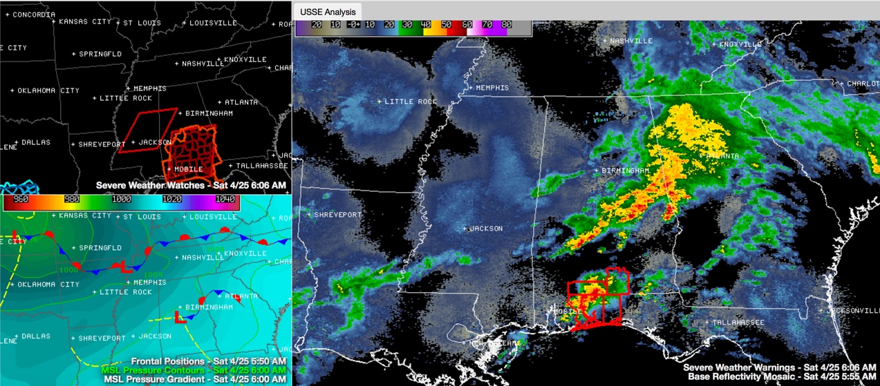
Click image to enlarge.
You can see the line of storms on radar at 6:15 a.m. looking about like what we expected it to.
A tornado watch remains in effect until noon for Autauga, Barbour, Bullock, Elmore, Lowndes, Macon, Montgomery, Pike and Russell Counties in the NWS Birmingham Warning Area. Other counties are included in South Alabama and NW Florida. Dallas County is technically in the watch until 8 a.m. but the threat has ended for there and the NWS just has to get around to canceling the watch for our friends there.
There are tornadoes warnings now for parts of Covington County Alabama as well as Escambia, Santa Rosa and Oklaoosa Counties in Florida.
The severe weather threat will end as the line of storms pass southeast.
But a second, more dangerous round of severe weather is possible later today across the area. Scroll down for more information on this potentially hazardous severe weather threat and Brian Peters will have a new morning map discussion video shortly.
Category: Alabama's Weather, Severe Weather
About the Author (Author Profile)
Bill Murray is the President of The Weather Factory. He is the site's official weather historian and a weekend forecaster. He also anchors the site's severe weather coverage. Bill Murray is the proud holder of National Weather Association Digital Seal #0001 @wxhistorianSubscribe
If you enjoyed this article, subscribe to receive more just like it.


