

Stay Weather Aware: More Severe Storms Possible This Afternoon
The final counties in Central Alabama have been cleared from Tornado Watch 108 but more severe weather is possible this afternoon.
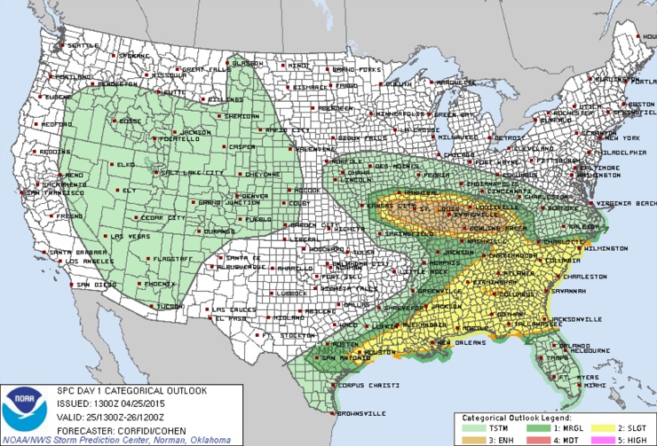
the area remains under a slight risk severe weather outlook from the Storm Prediction Center for the threat of additional severe weather this afternoon and evening.
Scattered storms will form this afternoon and the environment will be conducive for severe weather with moderately high instability. The best window for storm development will be between 1-9 p.m. today. Most of the storms will form after 3 p.m. The SPC has areas south of a line from Vernon to Double Springs to Falkville to Scottsboro outlooked for severe weather through the day and into tonight.
Here is the 4km NAM’s depiction of what the radar might look like at 7 p.m. when CAPE values are still running over 3,000 j/kg over North Central Alabama:
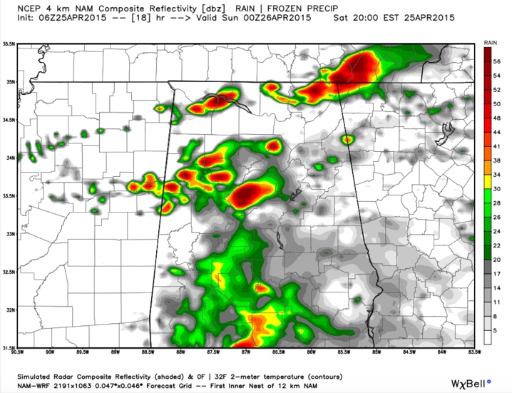
A caveat: the HRRR model is not as robust with the instability environment or the storms, so this forecast is heavily laden with uncertainty. We will just have to keep a close eye on mesoscale trends through the afternoon. One key factor will be cloud cover and how much the lower atmosphere can heat up. Temperatures this afternoon are forecast to reach the upper 70s to near 80F.
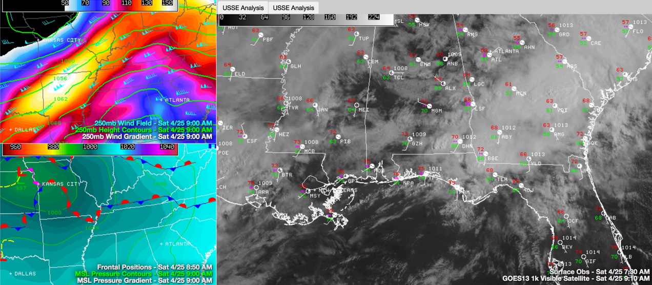
Skies are clearing partially in a southwest to northeast swath that you can see on visible satellite this morning. Temperatures are cool, in the 60s and there is no instability north of US-80 for now but as breaks in the clouds allow things to heat up, the airmass will become unstable. There is plenty of moisture. We will be in the favorable right rear quadrant of a strong upper level wind maximum, which is favorable for diffluence aloft to support thunderstorm updrafts. There will be plenty of speed shear, or difference in wind speed with height, so the storms will be able to stay organized. There will be sufficient low level shear to produce the threat of tornadoes as well.
So, while the storms may not be widespread, the ones that do form will have the potential to produce damaging winds, hail and tornadoes.
Category: Alabama's Weather, Severe Weather
About the Author (Author Profile)
Bill Murray is the President of The Weather Factory. He is the site's official weather historian and a weekend forecaster. He also anchors the site's severe weather coverage. Bill Murray is the proud holder of National Weather Association Digital Seal #0001 @wxhistorianSubscribe
If you enjoyed this article, subscribe to receive more just like it.


