

Severe Thunderstorm Watch Still For East Central Alabama
UPDATED MAP 6:12 PM
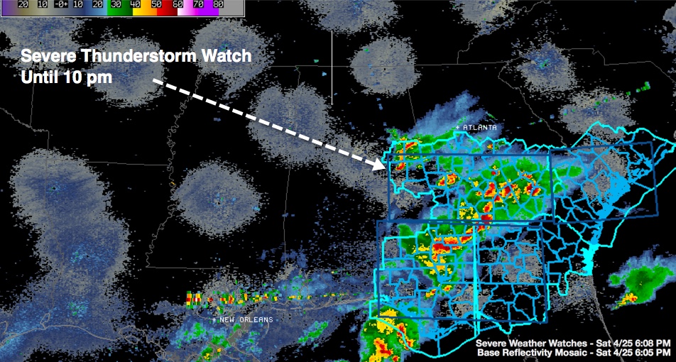
UPDATE 6:02 PM
Barbour, Pike, Bullock, Macon and Russell Counties have been dropped from the Severe Thunderstorm Watch. The watch continues for Chambers, Clay, Lee, Randolph and Tallapoosa Counties until 10:00 PM CDT
ORIGINAL POST
The NWS has extended the Severe Thunderstorm Watch over South Alabama northward to include part of East Central Alabama.
THE NATIONAL WEATHER SERVICE HAS ISSUED SEVERE THUNDERSTORM WATCH
115 IN EFFECT UNTIL 10 PM CDT THIS EVENING FOR THE FOLLOWING
AREAS
IN ALABAMA THIS WATCH INCLUDES 8 COUNTIES
IN EAST CENTRAL ALABAMA
CHAMBERS CLAY LEE
MACON RANDOLPH RUSSELL
TALLAPOOSA
IN SOUTHEAST ALABAMA
BULLOCK
THIS INCLUDES THE CITIES OF…ALEXANDER CITY…ASHLAND…AUBURN…
LANETT…LINEVILLE…OPELIKA…PHENIX CITY…ROANOKE…TUSKEGEE…
UNION SPRINGS AND VALLEY.
=
Category: Alabama's Weather, Severe Weather
About the Author (Author Profile)
Bill Murray is the President of The Weather Factory. He is the site's official weather historian and a weekend forecaster. He also anchors the site's severe weather coverage. Bill Murray is the proud holder of National Weather Association Digital Seal #0001 @wxhistorianSubscribe
If you enjoyed this article, subscribe to receive more just like it.


